Show Me The Water
Workshop Badajoz (ES) - Workshop Site 2
PARTICIPANTS:
Jorge García Anta (ES), Fernando Eiroa (ES), Winner in Warszawa (PL) with "River Gate"
Diana Levin (AT), Runner-up in Goussainville (FR) with "Des racines et des ailes"
Benoît Barnoud (FR), Clara Loukkal (Fr), Winner in Moulins (FR) with "La théorie de l'évolution"
Philip Grosch (IT) Winner in St-Pölten (AT) with "Ju(mp) in the Water Kiss That Frog" & Runner-up in Azenha do Mar (PT) with "Second Lines"
Fanny Chenu (FR), Runner-up in Metz (FR) with "Cycles, Sol, Air"
Boris Vapné (Fr), Special Mention in Marne-la-Vallée (FR) with "Relational Landscape"
Coach: Bernd Vlay (AT)
SITE 2 - CITY & NATURE
Which Limit Between City & Countryside?
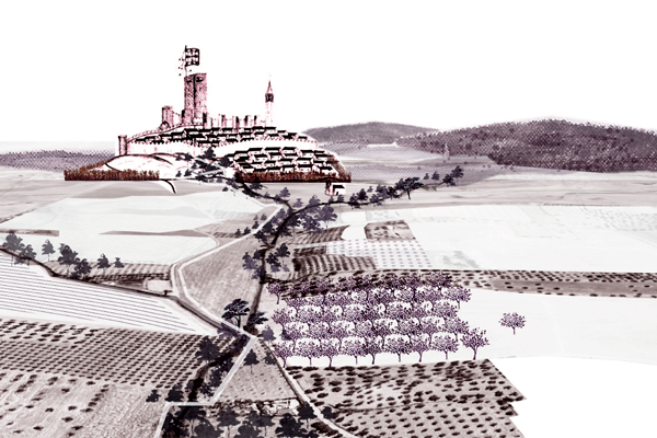
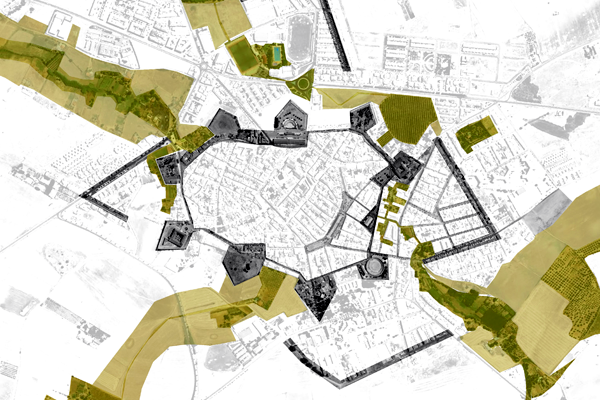
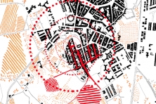
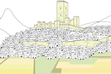
The site South of Olivenza includes the extensions of peripheral housing districts in direct contact with the nearby agricultural fields. The landscape looks like a flat land with green scars and is made of valleys running towards Lisbon, linking the waters of Olivenza to the Atlantic sea; hills and towers act as high points “controlling” the territory until the limit of the horizon, while large “enclaves” –cloisters & arenas– are embedded in the historical limits of the bastion elements, inducing a (non) dialogue between the open agricultural land and the mostly residential outer edge of the city.
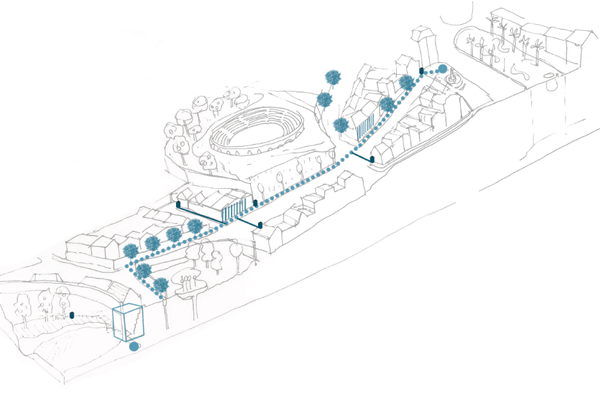
The group had to develop scenarios to create an interface between build town & agriculture, without preventing the residential extension but including it into the agricultural natural landscape. Three topics rose from the reflections and subsequent questioning: the complicity of topography and water, or how to bring back the element of water as an identifying element to Olivenza?; the Limit as an objet trouvé, or how to turn the accidental city/walls relation into an added value for the city and the countryside?; and "100% Coexistence and 0% Interaction", or how to re-establish the power of the limit as a connecting medium? Through a rereading of the past the three “obsessions” discovered a wonderful “already there” to offer new pathways to Olivenza’s future.
Show Me The Water
Download the PDF here
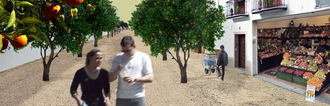
“Geography is used, first, to make war.” Using the historical power of Olivenza’s geography, yet turning it from a war project to a strategy of comprehensive reconciliation: the system of water, topography, texture, and land cultivation are mapped by their relation to sky, wind, sun, underground and soil. This cartography of relationships demonstrates an impressive richness of the “already there”, which is activated through cross-programming of leisure and agriculture activities. Thus a productive city/countryside link is established on the scale of the town and the territory: specific transversal connections trace existing water systems and the town’s porosity. They provide agriculture leisure programs with infrastructures, as well as they improve the quality of public space for the locals – a detective geography, reintroducing the existing as the new.
Download the PDF here
Rural landscape textures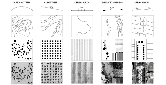
See other projects on the same site:
See the other sites:
- Olivenza 1 – Acupuncture
- Valencia de Alcántara – Uses & Rhythms