Nyköping Skavsta (SE)
Les Dossiers synthétiques et d'enjeux sont disponibles gratuitement.
Merci de vous inscrire et vous connecter pour accéder au Dossier complet de site.
- Dossier synthétique EN
- Dossier d’enjeux EN
- Le site sur Google Maps
- Retour à la carte
Données synthétiques
NYKOPING SKAVSTA (SE)
Scales XL/L
Team representative Architect, urban planner and landscape architect
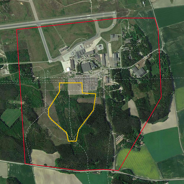
Location Skavsta Airport, Nyköping - Sörmland
Population 58 000 inhabitants
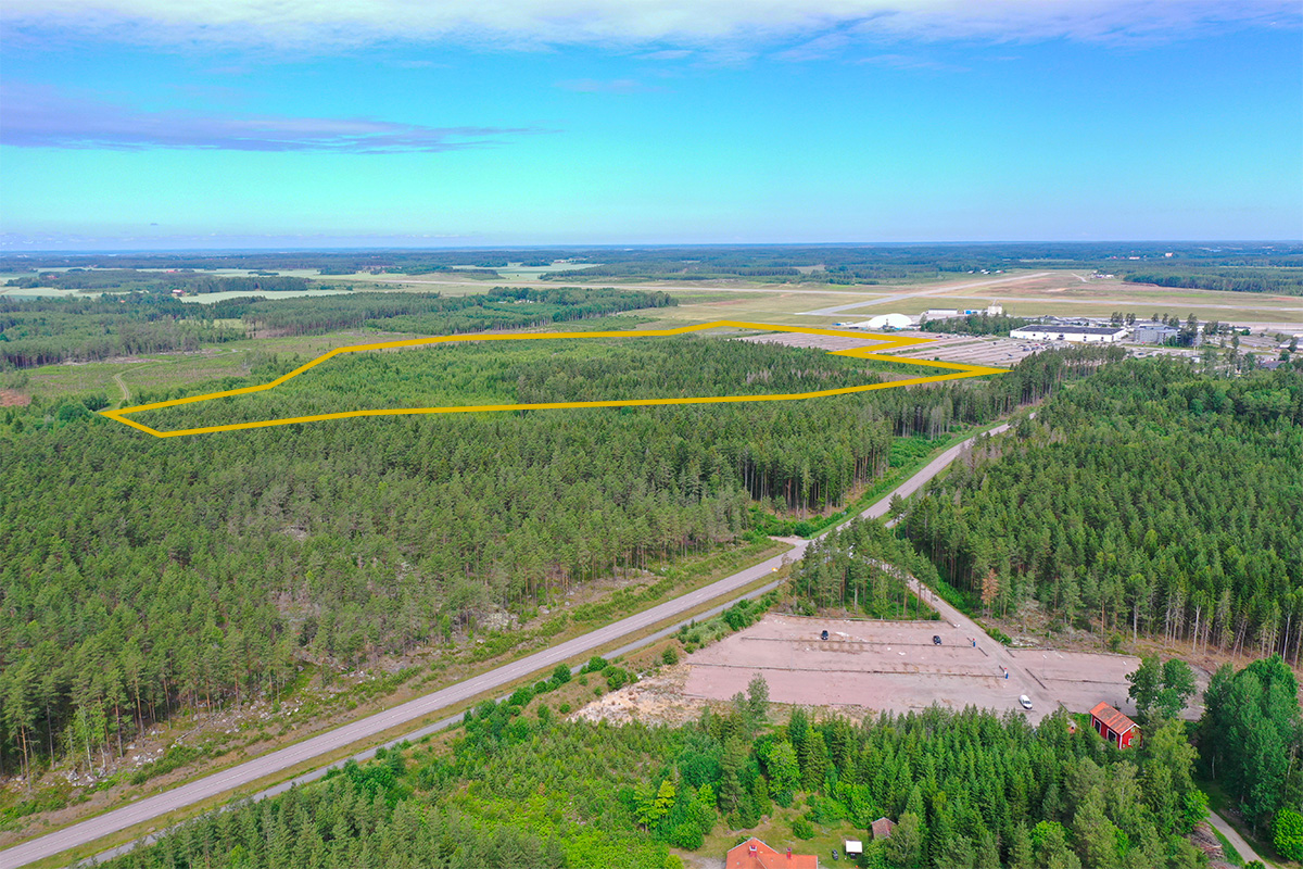
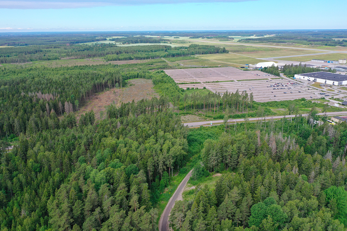
Reflection site 324 ha - Project site 28 ha
Site proposed by Nyköping Municipality
Actors involved Explore Skavsta, Nyköping Municipality, Region Sörmland
Owner(s) of the site Explore Skavsta, Nyköping Municipality
Commission after competition The prize winning team(s) will continue the work with the competition assignment in a workshop with the municipality, with an option for further work towards an implementation of the proposal, including workshops, various planning documents, illustrations, drawings and citizen dialogues.
Information complémentaire
Inhabited milieu's challenges
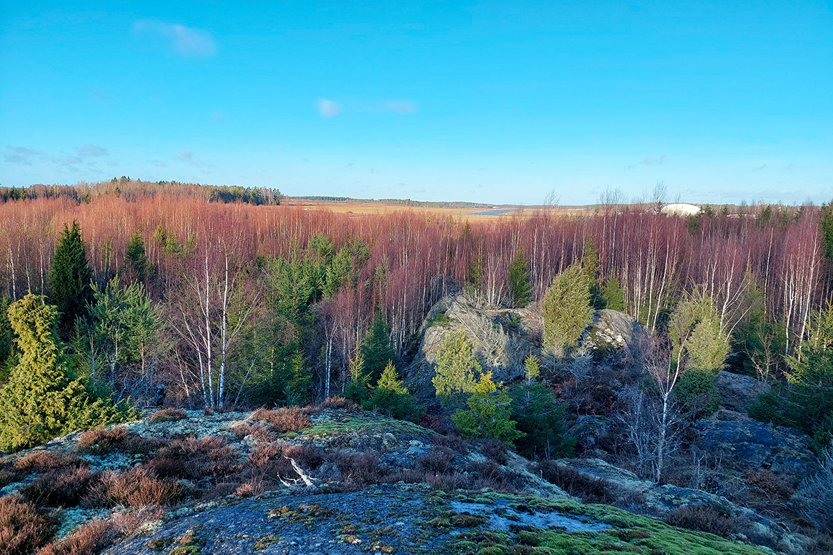
Skavsta – today known for its international airport – is located in a strategic position, seven km from Nyköping and about 100 km south of the City of Stockholm city, approximately 1/3 of Sweden’s population can be reached within 100 km.
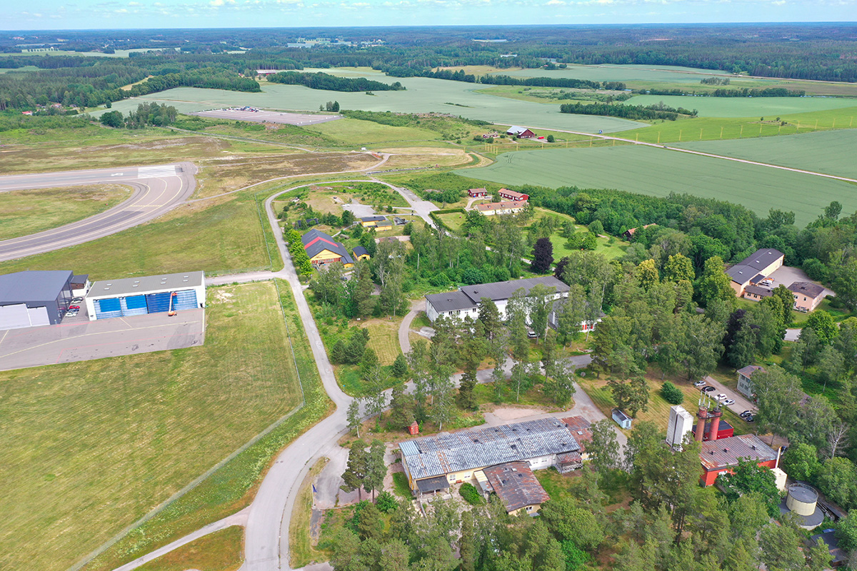
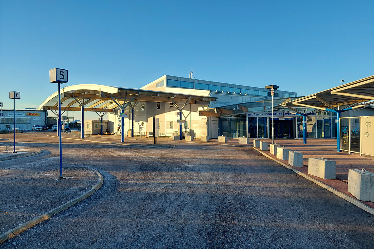
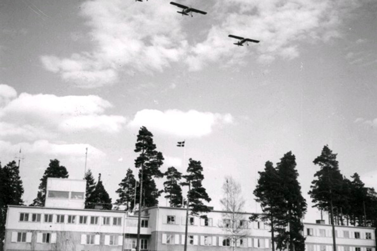
Stockholm Skavsta Airport was historically an important military airbase, F11. Of local interest are also the ancient bronze settlements along the nearby protected cultural landscape of Nyköpingsån.The site is today mostly surface car parking and unbuilt land.
The construction of the East Link, a new national railway line, with a station planned next to the airport will make Skavsta a unique intermodal node in Sweden.This gives the opportunity for the area to be developed, to create a resilient and self-sufficient area where working, commuting, travelling, services and recreation are interwoven through solutions that encourage creativity and innovation.
Due to the noise levels from the airport, permanent housing is not suitable at Skavsta. Skavsta can however provide space for the establishment and growth of new companies. One of the biggest challenges is that the separation between the working and housing functions, the focus on efficiency, flows and costs optimization in the design of the buildings often results in business areas being experienced as dead. Transportation hubs have a high requirement for design, with a focus on efficiency, flows and capacity.
An initial structural plan has been approved by the municipality, pinpointing the strategic elements that will organize the new area. Skavsta Square, the link to the transport hub, Skavsta Boulevard, the area’s main street, and the Park. The new physical structure needs to accommodate blocks that allow the clustering of companies in different scales and the flexibility to be developed in different stages, as well as innovative logistic business.
Questions to the competitors
With the vision of “Innovative Skavsta a unique, resilient and self-sufficient area for a clustering of companies” the goal is to forecast a development for the next 20 years.
Some factors are key for it to happen successfully:
A carefully modulated space for commuters/travellers, a common and uninterrupted space which can support a smooth everyday travel experience. How can that space meet both the needs of the people commuting and the travellers arriving at the airport? How can such a living environment be created with urban planning and architecture as tools? Which structures bring people closer together? How can the central public square be reinvented for this context?
When it comes to the physical structure for future companies and industries in the area, how can the familiar concepts be challenged to support innovation in a multitude of ways? What does innovation mean for the physical structure? When it comes to energy, the area has the reachable goal to become self-sufficient. It also implies new ways of promoting social and ecological aspects in the living environment. How can a unique, resilient, and self-sufficient structure be reinvented? How can it support the clustering of future companies in such way that new synergies are created between them?
Old ideas about how all the strategic elements that will organize the development are designed should be challenged to create something unique. The proposal should explore the spatial and functional qualities of the public square. How can the components of the transportation hub be interwoven into a whole living environment? How do we find co-use and all-day use of the area as opposed to a large and empty space? How can the views and needs of children be considered in transportation hubs, where the efficiency of the transport is often the focus? How can the green structure be integrated into the square? What impact can people’s behaviours and lifestyles have on the physical environment? How can greenery, recreation and stormwater management be integrated into the public space in a new way?
Questions à propos du site
DWG and DXF files do not include information on z axis, which means that all altitude lines are not placed in their actual height ( all altitude lines are placed on +1m). Could you complete the site folder with a cad model including the site altitudes?
In the DXF file called SE-Nykoping-PS-M2, the contour lines are placed in the right height. The coordinate z can be found under the property "elevation"
Concerning the Skavsta airport, what is the future placement of the existing parking (the one that is part od the projekt site) in relation to a mobility study
- The existing parking on the project site is mostly serving the airport. This parking will essentially be located to the north of the future railway – see the pdf document now available on the Complete site folder in the folder "0-New-Documents-After-Launch"
- For a mobility study the priority order (walking, biking, public transport, car traffic) is important. In the red marked roads – see the pdf document now available on the Complete site folder in the folder "0-New-Documents-After-Launch" – for main car traffic access gives a hint for the location of future car parking (common parking garages included).
Concerning the expansion plan of the airport, is a future plan to reach maximum capacity? Today the airport capacity is up to 3 million passengers/year whereas the permit is for 6 million passenger/year.
The main purpose is not to prevent the future development of the airport. Explore Skavsta wants to increase the air traffic and, in the long run, possibly reach the maximum capacity.
During the visit the forest land being a cultivated forest industry land was discussed. That was also obvious by observing the heights and the regular distances of the trees. In the brief it is stated that this land is natural forest. What does natural mean in that case? Who is the owner of this property? How old are the trees and are they suitable for wood construction?
- “Natural forest” is not a precise term in the brief. In this case it also includes “cultivated forest industry land”, as you rightly have observed.
- The land owner of the project site is foremost Explore Skavsta. As they are partners for this competition, we see no need for taking exact ownership into account on this stage.
- The age of the trees on the project site differs. We can assume that they are suitable for wood construction.
Concerning F11 area, is it possible to share with us some material for the future development of the F11 area to get an idea of the direction of future Skavsta?
- The plans for the F11 area are still in progress. We only have the planning program as an overarching document for this area. It assumes a different kind of development compared to the other parts of future Skavsta. We can assume a small scale development with the exception of the area next to the railway, where a larger scale development is possible. Possible activities according to the planning program are: education, high school, conference, temporary accommodation, innovation business, etc. In the area connected to the airport related businesses might develop, including spaces for authorities. Explore Skavsta as land owner has some current actions for this area, but the outcome is not yet official.
- The F11 area will be connected to the greater Skavsta despite the railway barrier.
Is it possible to get sections through the future train station, in order to understand the relation with the public square that is going to be designed close by?
A digital model of the platform building (station) is not available for us. We only have preliminary renderings of the concept design given in the brief. The brief also gives the ground level of the entrance to the platform building (+47 meter), which is essential for the relation to the public square and surrounding areas.
In order to give some further information from the concept design:
- ground level of the bridge over the platforms: ca +52 meter
- ground level of the platforms (by the railway): ca +45 meter
- In order to make a basic model of the platform building see the PDFs: “platform building plan 1-500” and “platform building section 1-100”, now available on the Complete site folder in the folder "0-New-Documents-After-Launch". In the same folder you can find two new pictures to better understand the concept design.
General heights of the train line crossing Skavsta are also relevant for the proposal to be integrated strategically (taking into account the need of noise control caused by train). Can we get some more information about that?
- The height of the railway line will be corresponding to the ground level of the platforms (by the railway): +45 meter.
- General noise protection will be part of the East Link Project. The difference in ground level will help the protection.
Le site est lié au thème suivant
PENSEZ TABULA NON-RASA! À travers le monde, certaines réserves naturelles sont des déserts - chauds ou froids ; elles abritent cependant toutes sortes d'animaux et de micro-organismes cachés dans les fissures, dans les crevasses et sous les rochers. Certains sites semblent vides, inoccupés ; ils ne le sont pourtant pas. Ils sont pleins de vie, cachée dans le sol ou dans l'air. Ils font partie d'un équilibre plus large de forces et de processus naturels. Sur ces sites, un grand nombre de nouveaux programmes est nécessaire. Il faut voir ces sites comme une chance de multiplier les formes de vie. Voir la demande de construction de nouveaux habitats comme une chance de concevoir un environnement global. Il faut penser tabula non-rasa !
Concevoir de nouveaux habitats comme milieu global
Documents spécifiques

Questions à propos du site
Pour pouvoir poser une question, vous devez être connecté (et, par conséquent, inscrit au concours).
Ve. 16 mai 2025
Date limite de soumission des questions
Ve. 30 mai 2025
Date limite de réponses aux questions
Avant de soumettre votre question, assurez-vous qu'elle n'apparaît pas déjà dans la FAQ.
Merci de poser vos questions sur les sites dans le menu Sites.
Merci de poser vos questions sur le règlement dans le menu Règlement.
Si votre question ne reçoit pas de réponse dans les 10 jours, merci de vérifier qu'elle ne figure pas dans la FAQ sous un autre intitulé ; sinon, contactez le secrétariat concerné par email (secrétariats nationaux pour les sites, secrétariat européen pour le règlement.)