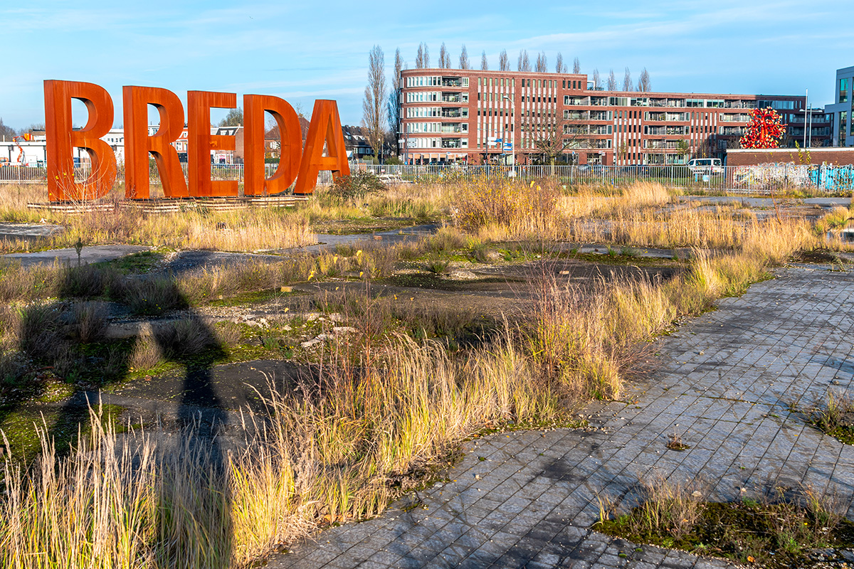
'T Zoet (NL)
Les Dossiers synthétiques et d'enjeux sont disponibles gratuitement.
Merci de vous inscrire et vous connecter pour accéder au Dossier complet de site.
- Dossier synthétique EN
- Dossier d’enjeux EN
- Le site sur Google Maps
- Retour à la carte
Données synthétiques
'T ZOET (NL)
Scales L/S
Team representative Architect, urbanist, landscaper
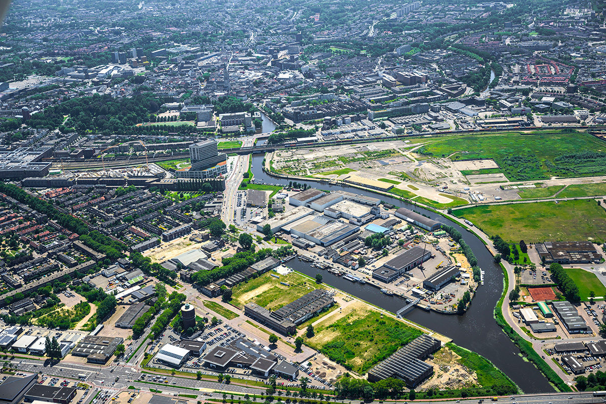
Location Etten-‘t Zoet, Breda
Population City 184 000 inhabitants
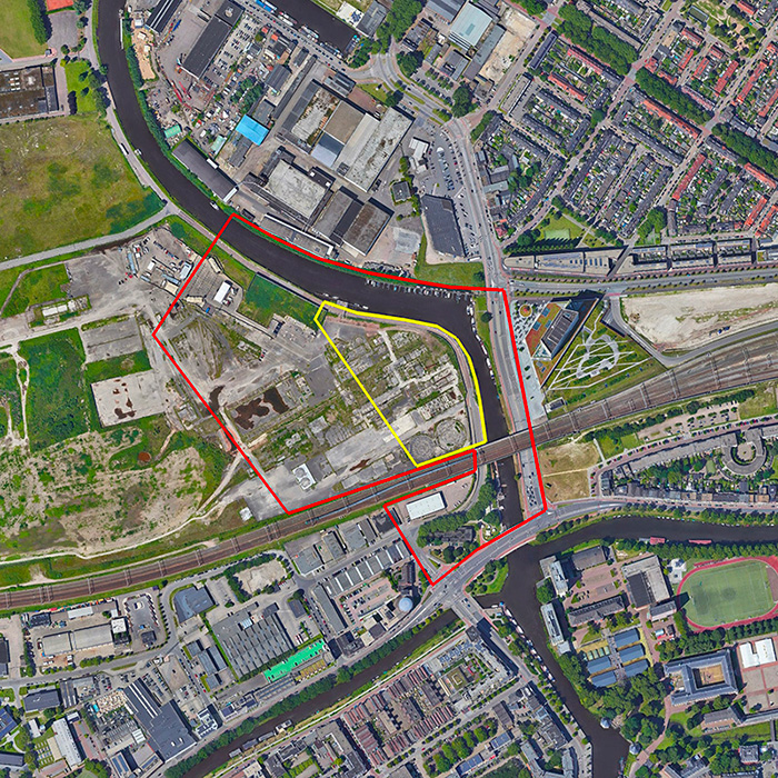
Reflection site 13,7 ha - Project site 2,65 ha
Site proposed by Municipality Breda
Actors involved Municipality Breda
Owner(s) of the site Municipality Breda
Commission after competition Follow up design (or research by design) assignment on implementation at the pro- ject site (or a site with similar challenges) commissioned by the municipality of Breda and/or private partners. All Dutch locations are situated in the urban region called SRBT. The SRBT is an urban regional network of 1 million inhabitants. Each sites represents prototypical design challenges within this region.
Information complémentaire
Inhabited milieu's challenges
Breda is growing from a center where in 2020, 21,250 people lived and 25,500 people worked, to in 2040, 43,000 people will live and 32,500 people will work.
‘t Zoet is designated to become be a complementary, inclusive, energy-neutral and international living and working environment as part of Crossmark and elaborated in conjunction with the water, nature and climate ambitions of Zoete Delta and the mobility challenges associated with ‘t Zoet and Breda.
‘t Zoet is the largest inner-city development in Breda, in the immediate vicinity of Station and the historic city center. Here we can build between 4,000 and 6,000 homes. By building homes in this vibrant area, we significantly contribute to solving the housing shortage in Breda and the region. We expect that in ‘t Zoet, multi-family, multi-generational homes, flexible living, and new forms of collective living will be built. The connection with sustainability and proximity is essential. It involves energy-neutral living, growing your food, and relaxing in your own environment.
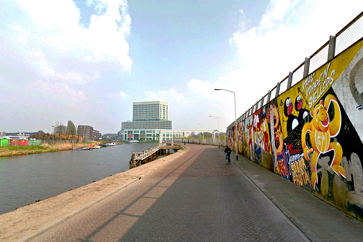
The Suikerplein will be an iconic area on the Mark with space for hospitality, culture and leisure. The cultural quater will be designed with a chain of urban facilities, connecting the city with the surrounding landscape through a high-quality green boulevard and a strong relationship with the river Mark, with the possibility of special water-related, social and public-oriented facilities. The urban program has a focus on culture and entertainment with (inter)national allure; e.g. hotel,museum, music venue, library, e-game arena etc.
Questions to the competitors
Consider what combinations of programs, and what types of programs, could come together on the site (± 12.500 m2 at the Suikerplein) - 20% of which could be new innovative housing.
Propose an urban/architectural strategy for transformation that includes big, bold ideas for buildings, pro- grams and waterfront public spaces connected to the location and its history – the new ‘working cathedral’ on the Suikerplein.
Create a dynamic public space, ecological landscape design that incorporates the city’s current vision on connecting city and nature.
Consider how the existing waterfront can be re-thought taking advantage of the changing water levels.
Consider more broadly the role, form and position of the bridge(s) over the river Mark. How might the bridge(s) act as the public space and be inviting as an urban stage?
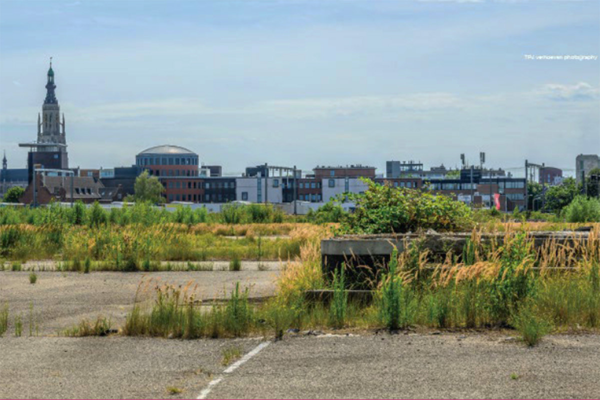
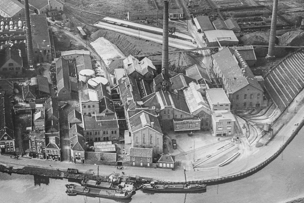
Do you see opportunities to re-use existing foundations of the demolished factory present on the site?

Questions à propos du site
In page 54 of the brief there are outlines of the strategic and site scopes. In the project & site maps NL-breda-t Zoet-PS-M2 there is another outline of the project & reflection site. Which reference can we use as a correct guideline for the scope of our site? Can we receive the dxf version of the project & reflection scope lines placed in site?
Yes, the new file can be found in the '0-New_Docs_after_Launch' folder. In addition you can also find a sketchup model of breda!
The site and masterplan include a streetgrid infrastructure with a bicycle route to the waterfront. Should we consider this streetgrid as a given constraint of our context?
The grid is an important base for making connections between the development as total with the existing city and is not part of a reconsideration.
In the diagram in page 50 the plots of the reflection site M3-M7 (diagram page 54) cross over between Linkeroever, Grienden Stedelijk and Spoorzone. Can we assume our reflection site relates to subarea Linkeroever only?
The site belongs to the subarea Linkeroever, Yellow line. However the site will be influenced by the other developments according to the red line
On page 44 of the brief there is a 3d schematic massing model. May we receive it in cad format as a context model?
No, We use it as study model of density, there is nothing final about shapes and forms about it. It purely represents the amount of volumes to be planned.
The maps in folder PS-c_maps-1-2000_1-5000 annotate foundation points and paved area outlines. These are further elaborated with numbers. Do these numbers signify as foundation height related to the +NAP?
The red numbers in the drawing NL-Breda- T Zoet-PS-M1.pdf contains the right measured height.
What is the condition of the foundations? Do they require further inspection or can we assume they are functional for light/heavy construction loads?
The big round foundation of the old silo’s can be reused without any problem. The other foundations need further inspection.
In the tekst of the Toekomst Perspectief we note that the site will undergo remediation post demolition. Would you like us to consider remediation strategies as part of our strategy, or is it a given that the site is remediated?
Consider remediation strategies for the site, especially off the consisting foundations and cellars is very interesting and possible the base off a new Urban and architectural language.
Parts of the total development could be remediated butt we are investigated the need at this moment.
In site plan NL-breda-t Zoet-PS-M4 we see ground information without a legend. Could we clarify what the blue and red lines signify?
The red lines visualize were the different parts of the former sugerfabric were located
The blue lines are not important but contains were the utilities like pipes were.
The brief calls for 20% of our program set up to be new innovative housing. How should we relate the housing capacity on site in relation to the overall ambition of 4000-6000 houses for all of 't Zoet?
The site is a important place at the river The Mark, in direct connection with the Station and the old city center. The ‘public’ value is very high so housing is a minor value on the site. However housing is important for the growth of the city as total. The question should not be a absolute amount off housing for the site but more like a question of bringing an new sort off living quality in balans with the public value’s off the site.
We see the HOV bus line within our reflection area with a station destined at the silos (page 41 of the Toekomstperspectief paper, as well as in the maps). Should our proposal takes this bus line in consideration?
Yes the busline is very important for the development in total and will be one of the first elements to make.
Le site est lié au thème suivant
PENSEZ TABULA NON-RASA! À travers le monde, certaines réserves naturelles sont des déserts - chauds ou froids ; elles abritent cependant toutes sortes d'animaux et de micro-organismes cachés dans les fissures, dans les crevasses et sous les rochers. Certains sites semblent vides, inoccupés ; ils ne le sont pourtant pas. Ils sont pleins de vie, cachée dans le sol ou dans l'air. Ils font partie d'un équilibre plus large de forces et de processus naturels. Sur ces sites, un grand nombre de nouveaux programmes est nécessaire. Il faut voir ces sites comme une chance de multiplier les formes de vie. Voir la demande de construction de nouveaux habitats comme une chance de concevoir un environnement global. Il faut penser tabula non-rasa !
Concevoir de nouveaux habitats comme milieu global
Documents spécifiques
Questions à propos du site
Pour pouvoir poser une question, vous devez être connecté (et, par conséquent, inscrit au concours).
Ve. 16 mai 2025
Date limite de soumission des questions
Ve. 30 mai 2025
Date limite de réponses aux questions
Avant de soumettre votre question, assurez-vous qu'elle n'apparaît pas déjà dans la FAQ.
Merci de poser vos questions sur les sites dans le menu Sites.
Merci de poser vos questions sur le règlement dans le menu Règlement.
Si votre question ne reçoit pas de réponse dans les 10 jours, merci de vérifier qu'elle ne figure pas dans la FAQ sous un autre intitulé ; sinon, contactez le secrétariat concerné par email (secrétariats nationaux pour les sites, secrétariat européen pour le règlement.)