Zagreb (HR)
Les Dossiers synthétiques et d'enjeux sont disponibles gratuitement.
Merci de vous inscrire et vous connecter pour accéder au Dossier complet de site.
- Dossier synthétique EN
- Dossier d’enjeux EN | EN
- Le site sur Google Maps
- Retour à la carte
Données synthétiques
Zagreb (HR)
Échelle L/S
Composition d’équipe Architect obligatoire
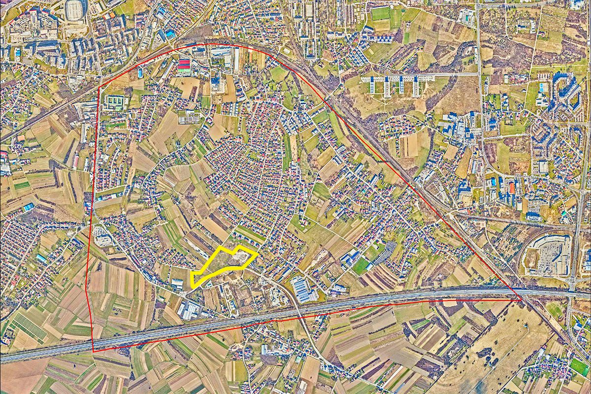
Localisation Zagreb, Croatia
Population Novi Zagreb 119,815 habitants, Zagreb 767,131 habitants
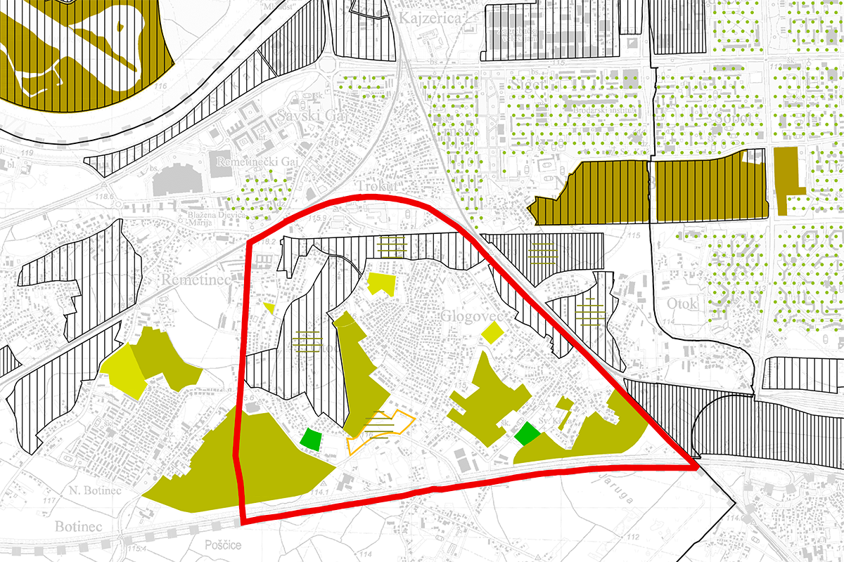
Site de réflexion 410 ha - Site de projet 4,62 ha
Site proposé par City of Zagreb
Acteurs impliqués City of Zagreb
Propriétaire(s) du site City of Zagreb
Phase post-concours is an URBAN DEVELOPMENT PLAN.
Information complémentaire
SITE / CONTEXTE
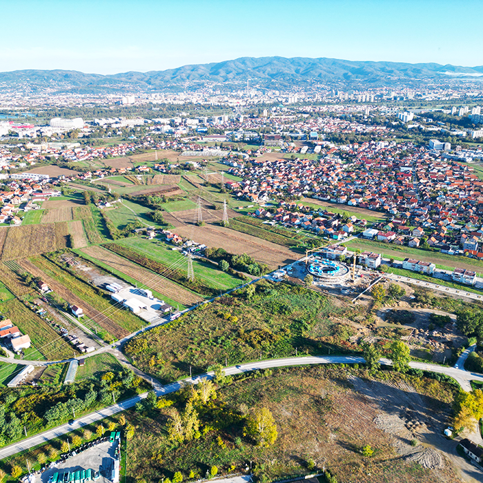
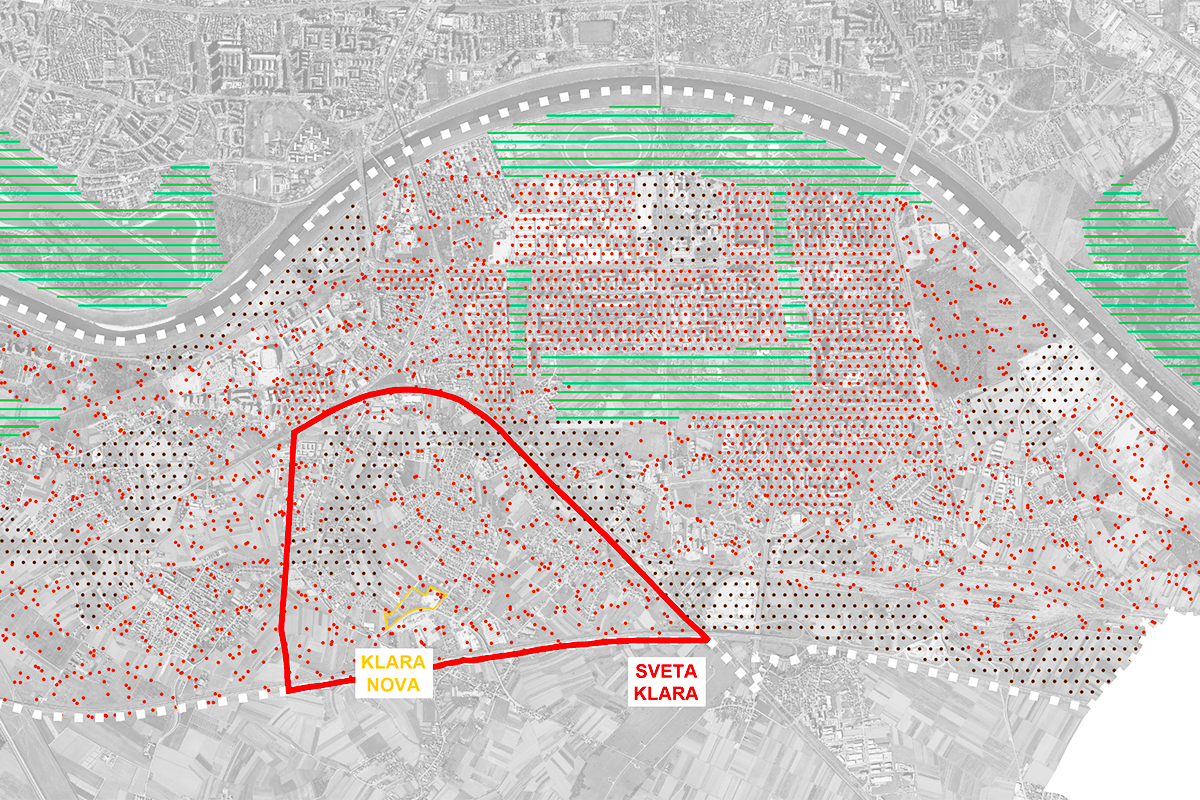
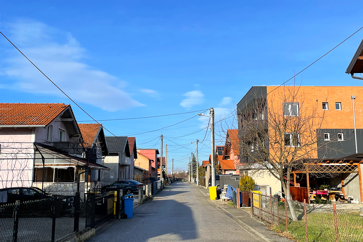
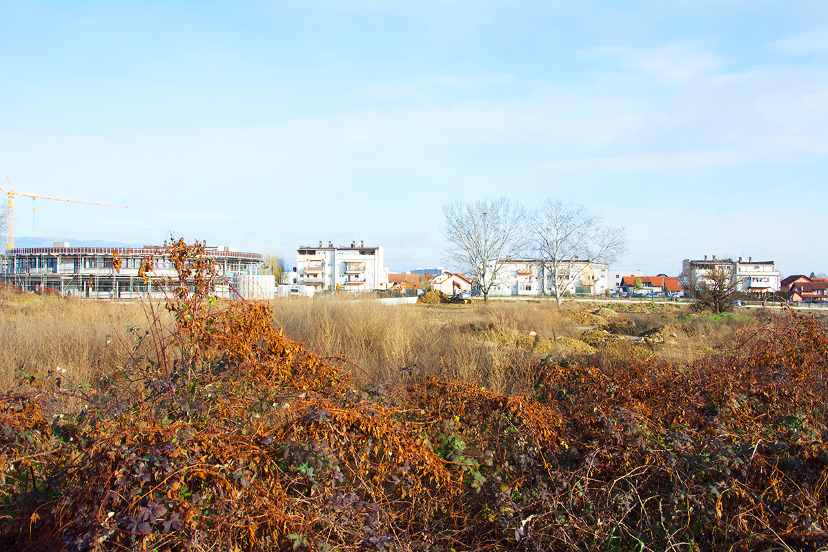
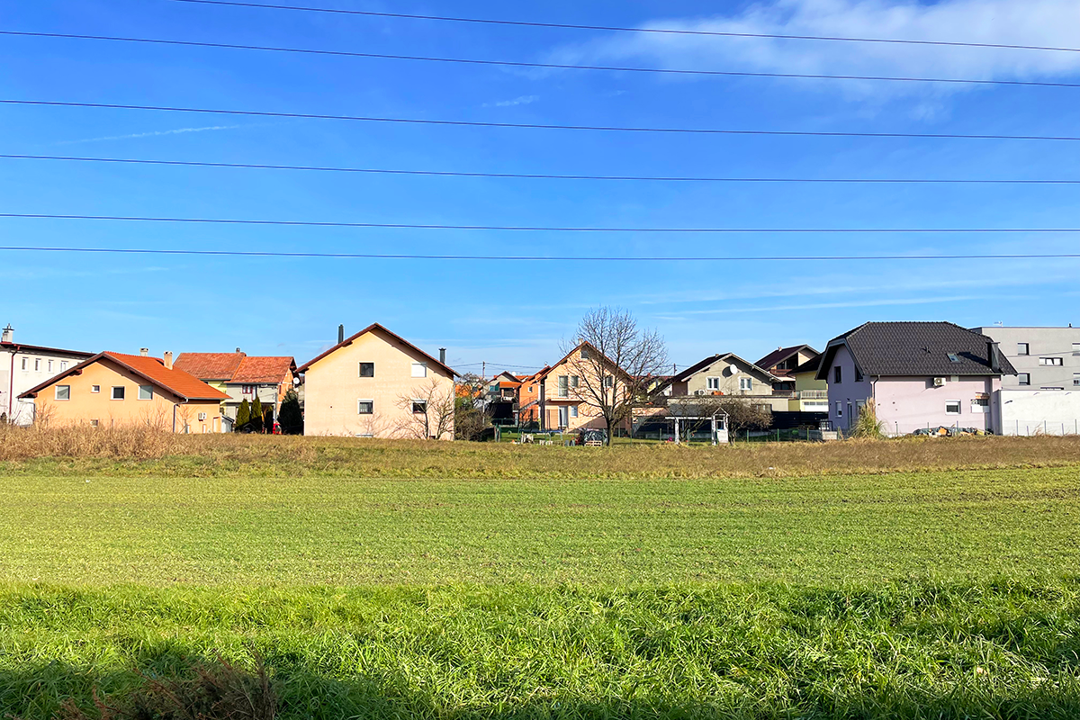
Klara Nova est située à la limite sud de Novi Zagreb. Sa typologie et son niveau de consolidation la définissent comme une périphérie suburbaine de Zagreb. Elle est développée sur une matrice de morcellement agricole rural, séparée de son contexte plus large par des corridors d'infrastructures, qui marquent clairement la frontière entre les quartiers modernistes planifiés de Novi Zagreb et ses périphéries rurales.
L'expansion de la ville au-delà de la Save a commencé au milieu du XXe siècle avec la construction de la foire de Zagreb et du pont le long de l'axe urbain central. Dans le système socialiste, de nouveaux lotissements ont été développés sur la base des principes de la Charte d'Athènes et du concept de ville fonctionnaliste. Ces lotissements ont suivi une matrice orthogonale, comprenant des immeubles multi-appartements indépendants entourés de grands espaces verts.
Simultanément au développement planifié des quartiers résidentiels, des zones d'habitation auto-construites non planifiées ont émergé autour des centres-villages historiques et le long des routes et des sentiers. Les villages traditionnels se sont transformés en banlieues peu peuplées, une périphérie urbaine de qualité inférieure dépourvue d'infrastructures sociales et communautaires adéquates.
Avec la transition vers une économie de marché, la priorité donnée à la propriété privée et à l'investissement a déplacé l'accent de la planification urbaine du développement spatial intégré vers la planification parcellaire individuelle. La réduction des investissements et de la capacité organisationnelle de la ville a conduit à ce que l'on appelle la « planification de microlocalisation ». Cela s'est traduit par une augmentation significative de la construction résidentielle et commerciale privée, parallèlement à une diminution des équipements publics et sociaux, des parcs, des zones de loisirs et des réseaux d'infrastructures, en particulier par rapport aux plans urbains modernistes.
La tendance persistante à des logements chers et inabordables a été aggravée par une offre limitée de logements sociaux, l'augmentation des locations à court terme et le tremblement de terre de 2020 qui a temporairement rendu une partie substantielle du parc immobilier inutilisable.
La mise en œuvre des politiques municipales et des documents d'aménagement du territoire envisage le développement de logements publics abordables sur ce site en friche. Ce projet vise à inclure des équipements publics, sociaux et sportifs-récréatifs, ainsi que des espaces verts, créant un modèle de communautés résidentielles organisées et contemporaines grâce à un développement de logements planifié.
QUESTIONS AUX CONCURRENTS
Au niveau du site de réflexion, conformément au thème de re-ressourcement, il est nécessaire de proposer des scénarios de revitalisation de la communauté au sens large, où le nouveau quartier deviendra un facteur d'intégration pour tous les niveaux indéfinis d'urbanité, principalement par la régénération urbaine et l'augmentation des normes urbaines.
Comment de nouveaux modèles spatiaux peuvent-ils être développés pour coexister avec ceux existants, afin de renforcer le quartier de Sveta Klara en tant que lieu d'interaction et de participation pour ses résidents et ses utilisateurs ? Comment peut-on encourager l'utilisation de modes de transport durables dans les zones suburbaines tout en réduisant la dépendance aux véhicules personnels ?
Au niveau du site du projet, il est nécessaire de proposer une conception urbaine pour un quartier résidentiel inclusif et résilient au climat pour une vie et un travail abordables, avec un aménagement paysager complet. En outre, la tâche comprend le développement d'un design conceptuel pour des bâtiments avec une disposition modulaire et des plans d'étage offrant différents niveaux d'intimité/espaces communs.
Comment pouvons-nous créer des communautés résidentielles périurbaines en réinterprétant la tradition de coexistence et de coopération entre les humains et leur environnement ?
Comment organiser les équipements d’une nouvelle communauté et repenser un spectre d’espaces privés et collectifs divers et dispersés, à l’échelle du quartier et à l’échelle des bâtiments individuels ?
Questions à propos du site
The project brief (p29) outlines a land use diagram with zones Z1, M1, and R2 assigned within the site.Could you please confirm whether these zones must remain in their indicated positions,or if they can be repositioned within the project boundaries, provided their functions/proportions (M1 60%, R2 25%, Z1 15%), and overall program are maintained?
Yes, it is necessary to maintain the specified land use diagram.
According to the project brief, zone M1 allows for the planning of detached and/or semi-detached buildings. We would like to ask whether proposing additional housing typologies within M1—while still meeting the intended programmatic and spatial goals—would be acceptable, or could such an approach be considered grounds for disqualification?
The proposed housing typologies in the competition brief are determined in accordance with the General Urban Plan of the City of Zagreb, and since the competition is being conducted for the purpose of implementation, it is important that the competition entries comply with spatial planning documents.
The brief states that 5 commercial units and a socio-cultural center must be planned in the residential zone. Does this mean a total of 6 distinct non-residential units (5 commercial + 1 center)? Is it suggested that the 5 commercial units must be integrated within residential buildings, while the cultural center may be located on a separate plot?
This is correct, the commercial units and socio cultural center must be planned as stated in the question.
Regarding the socio-cultural center: the brief states that its area cannot exceed 30% of the gross construction area of a building on the plot, which would be approximately 150 m². If the center is located on a separate plot, does the same 30% limitation apply, or can the total floor area of the socio-cultural center be larger in that case?
In accordance with Chapter 5.2.5 of the competition program as well as Chapter 5.2.2, the socio-cultural center planned on a separate plot may be a maximum of 40% of the plot's floor plan area.
Is the proposed zoning of residential and recreational areas in the ideogram (page 29) mandatory, or can we adapt the zoning to our solution?
The zoning proposed in the competition brief is mandatory.
Is it necessary to follow the proposed cadastral parceling?
The existing cadastral parceling is not mandatory, as stated in the Competition brief.
Is it possible to form zones (residential, recreational, green) in a way that they are not formed as unified areas, as they are shown in the ideogram on page 29? In other words, is it possible to concieve the zones of different uses as divided in a number of smaller areas distributed on the site?
It is necessary to propose a solution in accordance with the zoning from the Competition brief.
On page 30, it is stated that 5 commercial units may be planned. Can they be standalone buildings, or must they be part of residential buildings?
The primary goal is for 5 commercial units to be dispersed throughout the neighborhood.
”Direct access from public traffic areas to parking/garage spaces on the plot is not allowed;” “Each plot must be accessible from a public traffic area, existing or newly planned;” These two sentences are a direct contradiction to each other. Please confirm that the first quoted statement can be ignored?
The above mentioned is not in contradiction, as it refers to the formation of one (common) entrance or exit to an individual plot, given the need to ensure multiple parking and garage spaces for each purpose planned on the plot, according to the norms given in the Competition brief.
Is it permissible to propose scenarios that deviate from the current GUP regulations (e.g., housing typologies, gross construction areas, max. building heights) if these deviations are conceptually justified and contribute to the overall quality of the proposal?
Since the competition is being conducted with the aim of implementation, it is important that the competition entries comply with spatial planning provisions based on the General Urban Plan of the City of Zagreb, in all respects as stated in the Competition brief.
Is it acceptable to propose a collective parking solution—such as a shared garage serving multiple housing units—instead of providing one parking space per unit, if this approach supports a more urban and integrated design?
The General Urban Plan of the City of Zagreb sets out the parameters for stationary traffic in the manner given in the Competition brief. Since the competition is being conducted for the purpose of implementation, it is important that the competition entries comply with spatial planning documents.
Of the 300 new tenants, what percentage or number are young families, large families, and singles? How can we plan the percentage of the apartments by size?
In Chapter 5.2.3. Housing Program of the Competition brief, the structure of housing units is defined as follows:
studios 0-5% of the total number of housing units
one-room apartments 15-30% of the total number of housing units
two-room apartments 35-50% of the total number of housing units
three-room apartments 25-40% of the total number of housing units
four-room apartments and/or apartments for housing communities 0-10% of the total number of housing units
The number of housing units by size are determined according to data on applicants for the allocation of city rental apartments
Is there a way to get existing demographic data on the population in that part of Zagreb (demographic polygon) so that we can have an overview of the population structure today (age, gender, etc.)?
Data from the 2021 population census is available at the link:
https://zagreb.hr/popis-stanovnistva-kucanstava-i-stanova/1043
The data has been processed by city districts – for the competition site, see Novi Zagreb – West, and in the table
https://www.zagreb.hr/userdocsimages/arhiva/statistika/popis 2021 kona%C4%8Dni rezultati/Stanovni%C5%A1tvo prema starosti i spolu po MO GZ, Popis 2021._web.xlsx
is the part of the data for the Sveta Klara Local Council.
At the link: https://zagreb.maps.arcgis.com/apps/MapSeries/index.html?appid=73e33727fad74298a9df9859a2331cd6 , graphical representations of the population structure by city districts are available – for the competition site, select Novi Zagreb – West.
Are there any health facilities in the area today, and can we propose health-type facilities in the competition area, within the non-residential units?
The competition program stipulates that 5 business units with proposed uses such as a small shop, a small craft business, a dental office, a children's playroom or a veterinary clinic be placed within the residential zone. Within the given number of business units, health-related facilities can be proposed.
Considering that work units are also being proposed - is there any information on what people from the area mainly do?
The requested information does not exist. When considering the topic, it is suggested to focus attention on the proposed solutions for new scenarios of life in a specific peri-urban community, in accordance with chapter 5.3, point 1, of the Competition brief.
In the wider scope of the entire neighborhood of Klara, is it necessary to pay attention only to the traffic solution or to something additional?
Chapter 4.2. of the Competition brief defines the expected solutions at the level of the zone of influence of the neighborhood of Sveta Klara. The requested solution must be designed based on the relevant data presented in Chapter 4.1. Current state and planning guidelines, with the possibility of other proposals according to the author's interpretation of the task and the perspective of the competition area.
Le site est lié au thème suivant
Re-sourcer à partir de la dynamique sociale Une couche d’urbanité manquante s’ajoute sur un territoire aux complexités sous-jacentes. Dans tous ces grands sites, la question est de savoir comment les habiter, comment s’y associer, comment y ajouter un écosystème humain tout en négociant les avantages et les inconvénients de la complexité existante. Il peut s’agir de reconsidérer un développement urbain interrompu, de soigner les blessures laissées ou créées par des infrastructures anciennes ou nouvelles ; de régénérer des logements insalubres ou les dégâts laissés par une friche industrielle, de reconsidérer une rivière ou d’anciens champs agricoles.
Créer de nouvelles relations urbaines
Documents spécifiques
Questions à propos du site
Pour pouvoir poser une question, vous devez être connecté (et, par conséquent, inscrit au concours).
Ve. 16 mai 2025
Date limite de soumission des questions
Ve. 30 mai 2025
Date limite de réponses aux questions
Avant de soumettre votre question, assurez-vous qu'elle n'apparaît pas déjà dans la FAQ.
Merci de poser vos questions sur les sites dans le menu Sites.
Merci de poser vos questions sur le règlement dans le menu Règlement.
Si votre question ne reçoit pas de réponse dans les 10 jours, merci de vérifier qu'elle ne figure pas dans la FAQ sous un autre intitulé ; sinon, contactez le secrétariat concerné par email (secrétariats nationaux pour les sites, secrétariat européen pour le règlement.)