Kassel (DE)
Les Dossiers synthétiques et d'enjeux sont disponibles gratuitement.
Merci de vous inscrire et vous connecter pour accéder au Dossier complet de site.
- Dossier synthétique EN
- Dossier d’enjeux DE | EN
- Le site sur Google Maps
- Retour à la carte
Données synthétiques
KASSEL (DE)
Scales XL/L
Team representative Architect, urbanist and landscape architect
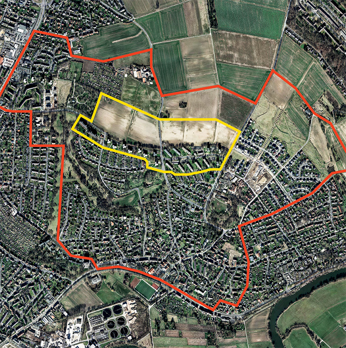
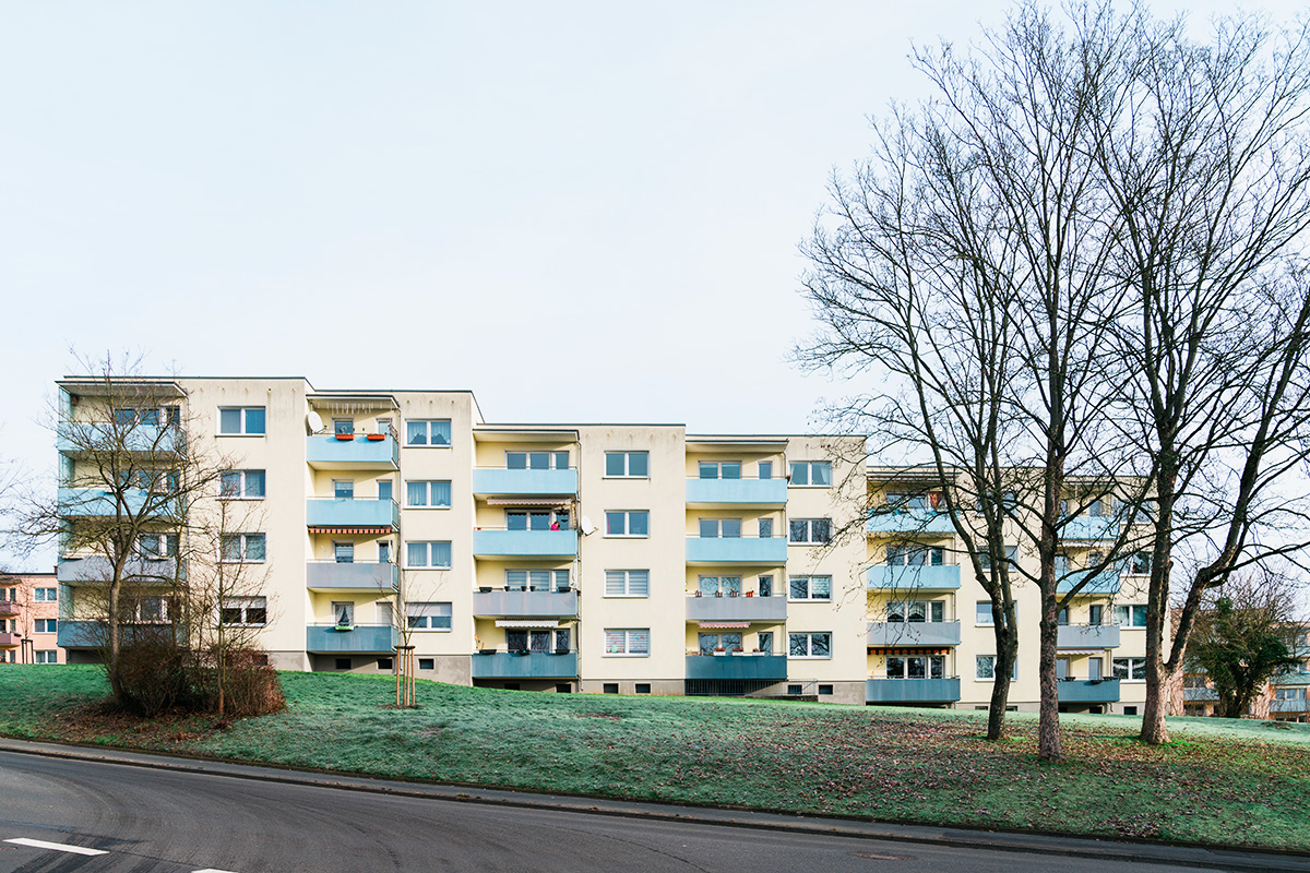
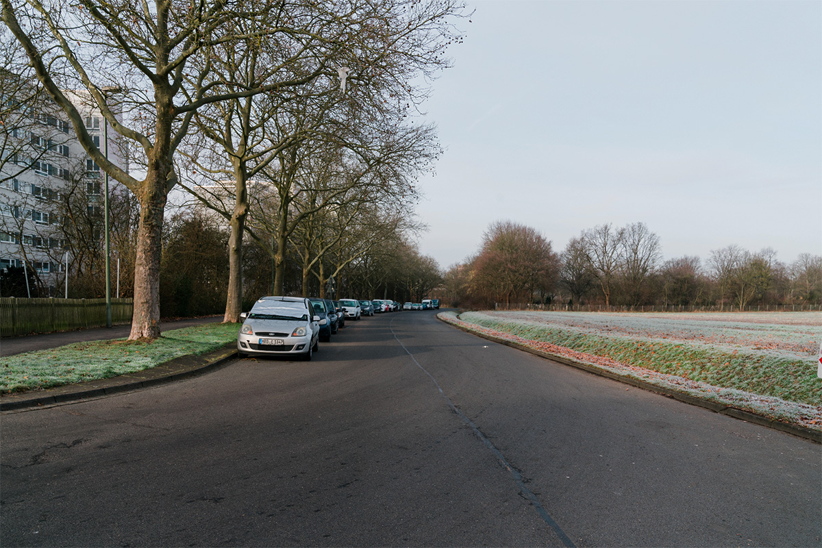
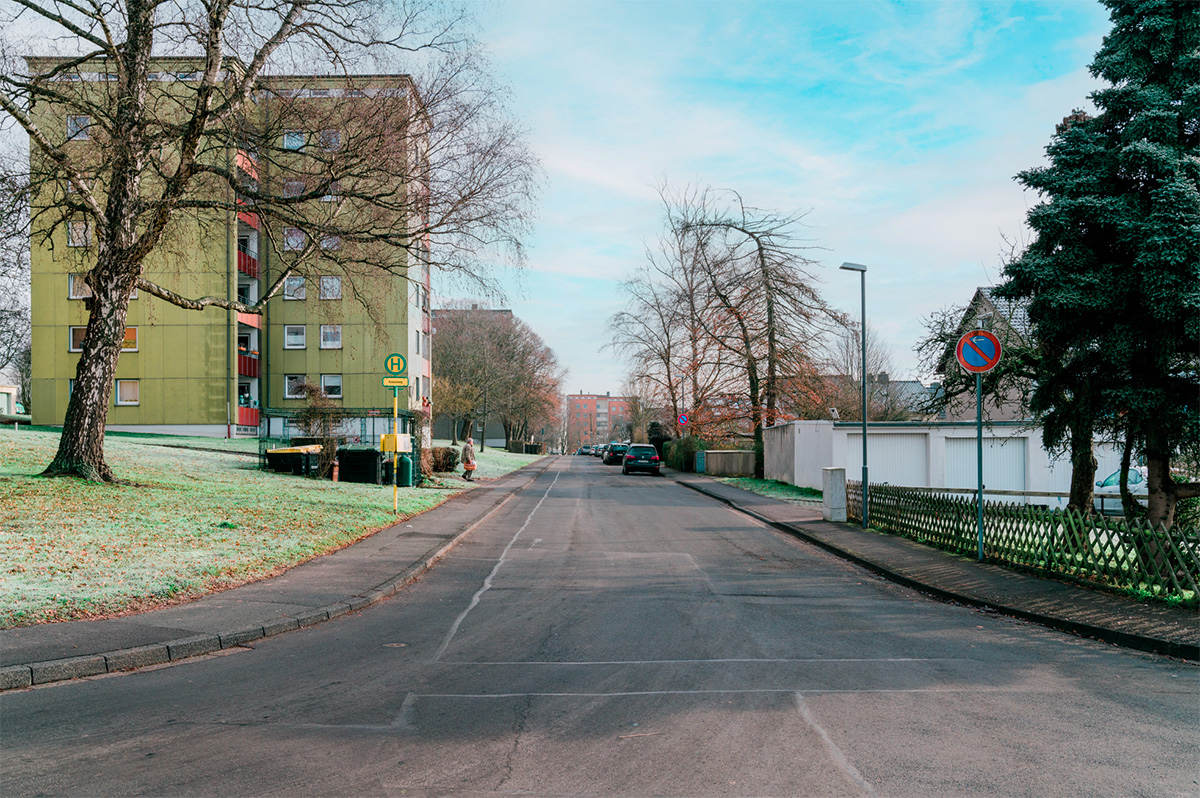
Location Kassel, Wolfsanger Nord
Population 203 479 inhabitants
Reflection site 400 ha - Project site 27 ha
Site proposed by City of Kassel
Actors involved City of Kassel
Owner(s) of the site City of Kassel (undeveloped areas), WOHNSTADT Stadtentwicklungsund Wohnungsbaugesell- schaft Hessen mbH, numerous private owners
Commission after competition The city is open to the idea of working with the competition winners (e. g. mandate for an urban plan) on the upcoming planing steps.
Information complémentaire
Inhabited milieu's challenges
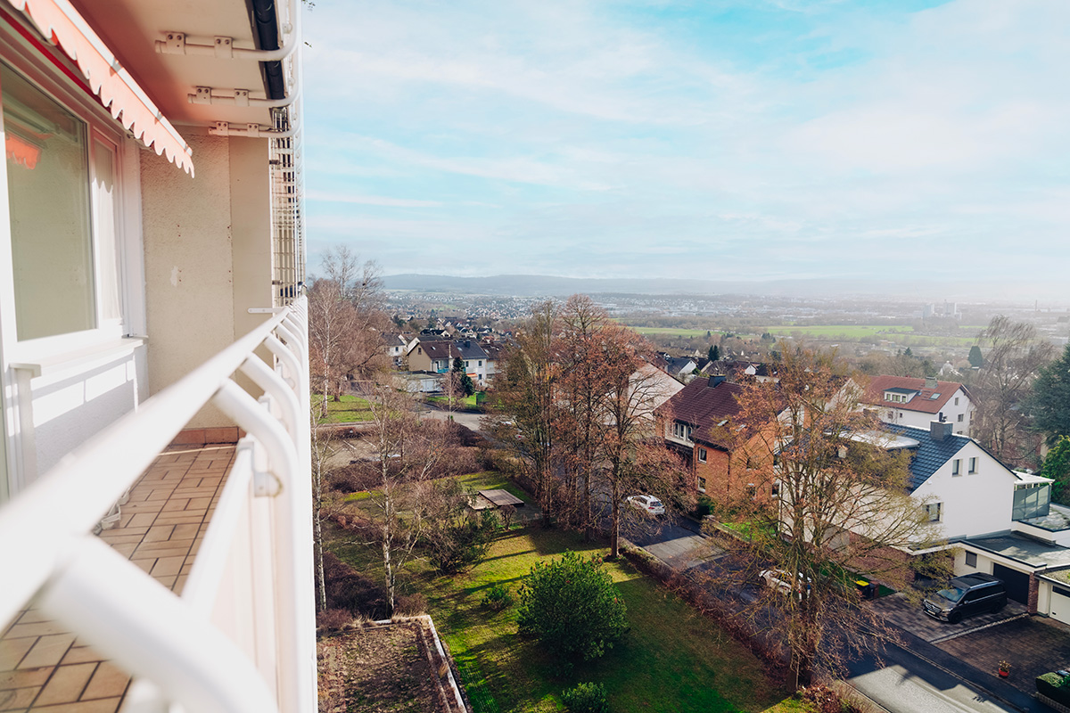
Kassel is located in the geographical center of Germany and with around 200,000 inhabitants is the third-largest city in the state of Hesse. The city has been experiencing dynamic development in recent years, which is reflected both economically and in increasing numbers of inhabitants. The Kassel housing market has been characterized by rising rents and property prices in recent years. The housing supply, especially for households with low incomes, has deteriorated.According to the 2020 housing supply concept, around 8,000 homes would need to be built by 2030 based on population growth forecasts.
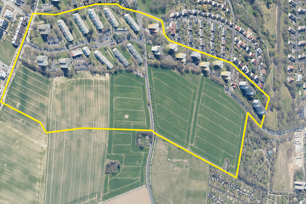
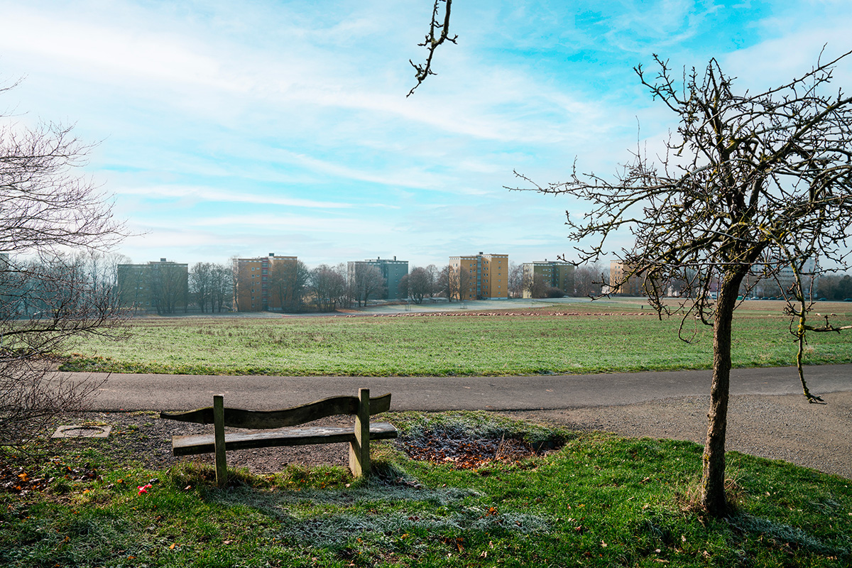
The major challenge for the city of Kassel is to create the necessary housing on the one hand and to achieve the desired climate goals on the other. The previously undeveloped northern outskirts area in the Wolfsanger/Hasenhecke district is of particular importance for settlement development, as the area is one of the few outer reserves for building development. The focus is on the development of the approximately 15-hectare area used for agriculture in the northern part and the approximately 10.5-hectare residential area of the 1960s with high-rise buildings and block buildings that adjoins it from the south.
The special urban and open space planning challenge lies in the balancing act between developing a new residential quarter with a qualified «green» settlement conclusion and integrating it with the existing settlement context and the adjacent landscape. This requires both a sustainably designed and at the same time compact, innovative and experimental housing construction and the use of internal development potential through opportunities for internal densification and improvement of the living environment in the existing neighborhood.
Questions to the competitors
The task is to develop a sustainable, innovative and experimental urban planning model that shows what compact, ecologically and socially sustainable housing development on the outskirts of a city might look like. Climate protection and adaptation, including minimizing land use and soil sealing, sponge city ideas, rainwater management, shading and cooling, and biodiversity, are given particular consideration.
How can a lively neighborhood emerge? What kind of housing does a socially sustainable housing development need that cor- responds to today’s heterogeneous society? What does a socially just, mixed (residential) neighborhood look like? What uses can be combined with living to generate a vibrant neighborhood? What building typologies are necessary for this?
How can communal living forms find a place? How do seniors live? How can a combination of living and care succeed in the neighborhood? What needs do large and small families, single parents, or students have? What might adaptive floor plans look like? How can a climate-friendly, climate-positive neighborhood be realized? What measures for climate protection and adapta- tion do you propose? Can climate protection and adaptation be understood as a design task?
What open spaces does a social, sustainable neighborhood need? How can meeting places be created where the neighborhood can meet? How can retreat spaces be designed? How and where are prominent public areas like small neighborhood squares or multifunctional street spaces where children can play found? What do semi-private open spaces look like? How can the new neighborhood be optimally integrated into the settlement and landscape?
Questions à propos du site
For the site of Kassel we uploaded additonal documents (Plans and Sections from the existing buildings). You can download them from the Folder "0-New-Documents-after-Launch"
For the site of Kassel we uploaded additonal documents (Plans and Sections from the existing buildings). You can download them from the Folder "0-New-Documents-after-Launch"
Can the maps also be provided in an older DWG format?
Yes, we received the document in the 2000 version. You can find this in the folder "New Documents after Launch" on the server.
In the dwg-file provided, there is one part where the topography lines are missing (on the eastern section of the site). is it possible to provide this part or is it incomplete?
Sorry, there are no more specific documents available.
In the dwg-file provided, there is one part where the topography lines are missing (on the eastern section of the site). is it possible to provide this part or is it incomplete?
The city does not have any further information, sorry.
Would it be possible to get a dwg-drawing of the mining area?
There are no more specific documents available.
What is the current vacancy rate in the existing buildings?
No precise figures are available on the current vacancy rate in the existing housing estate. However, vacancies that do occur are usually either due to modernisation or fluctuation. Vacancy due to modernisation only refers to individual flats. The usual fluctuation-related vacancy rate is between 3 % and 5 %.
Are there planning documents from the 1960s for the urban expansion of the neighborhood?
Sorry, no corresponding plan documents from the 1960s can be provided.
Can the planning for the potential tram extension be provided?
The route considered at the time for a possible tramway extension can be taken from the land use plan (cf. competition p. 44). The route is shown as a purple dashed line and leads from Dessenborn Street in the adjacent development area to the east along the current settlement boundary in a westerly direction into Am Felsenkeller Street. The potential tram route was also taken into account in the City of Kassel's development plan No. VI/48 "Auf dem Dessenborn" (legally binding since 31.03.2006), which adjoins to the east (cf. https://www.kassel.de/daten-und-karten/rechtsverbindliche-bebauungsplaene.php / https://geoportal.kassel.de/Dokumente/pdf/bplan/VI_48.pdf).
The former framework illustrated with Fig. 29 (p. 45) indicates a pictogrammatically marked use at the lower end of the eastern of the two green corridors running in a north-south direction. What use was intended for this area in the framework concept and does this continue to play a role for the current competition task?
In the framework concept (cf. competition p. 45) and there at the lower end in the eastern north-south green corridor, a playground sign is shown. The intention of this is that the desired public and interconnected open spaces should also include play facilities for children of different age groups. This also plays a role for the competition task in that one goal is to create diverse open spaces for diverse user groups, i.e. ecological as well as functional diversity.
Le site est lié au thème suivant
PENSEZ TABULA NON-RASA! À travers le monde, certaines réserves naturelles sont des déserts - chauds ou froids ; elles abritent cependant toutes sortes d'animaux et de micro-organismes cachés dans les fissures, dans les crevasses et sous les rochers. Certains sites semblent vides, inoccupés ; ils ne le sont pourtant pas. Ils sont pleins de vie, cachée dans le sol ou dans l'air. Ils font partie d'un équilibre plus large de forces et de processus naturels. Sur ces sites, un grand nombre de nouveaux programmes est nécessaire. Il faut voir ces sites comme une chance de multiplier les formes de vie. Voir la demande de construction de nouveaux habitats comme une chance de concevoir un environnement global. Il faut penser tabula non-rasa !
Concevoir de nouveaux habitats comme milieu global
Documents spécifiques
Questions à propos du site
Pour pouvoir poser une question, vous devez être connecté (et, par conséquent, inscrit au concours).
Ve. 2 Juin 2023
Date limite de soumission des questions
Ve. 16 juin 2023
Date limite de réponses aux questions
Avant de soumettre votre question, assurez-vous qu'elle n'apparaît pas déjà dans la FAQ.
Merci de poser vos questions sur les sites dans le menu Sites.
Merci de poser vos questions sur le règlement dans le menu Règlement.
Si votre question ne reçoit pas de réponse dans les 10 jours, merci de vérifier qu'elle ne figure pas dans la FAQ sous un autre intitulé ; sinon, contactez le secrétariat concerné par email (secrétariats nationaux pour les sites, secrétariat européen pour le règlement.)