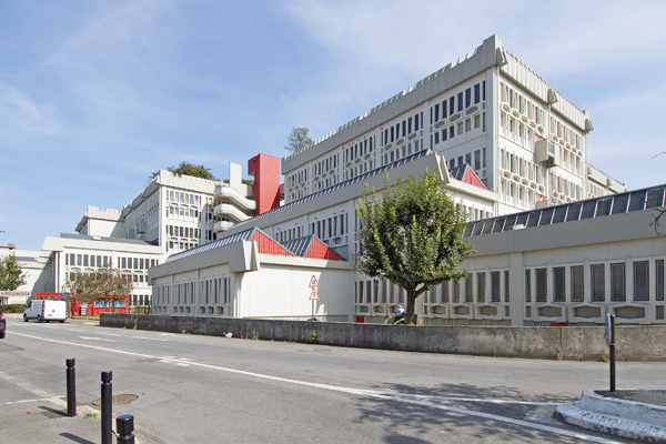
Montreuil
The Synthetic Site Folder and Site Brief are available for free.
Please register and login to access the Complete Site Folder.
- Synthetic site folder EN | FR
- Site on Google Maps
- Back to map
Data
Category urban - environmental - architectural
Location Montreuil (93), Sector Haut Montreuil - Communauté d’agglomération: Est Ensemble Conurbation, Grand Paris Territory
Population City 103,000 inhab. - CA Est Ensemble 400,000 inhab.
Strategic site 140 ha / 20,000 inhab. - Project sites 29 ha on 3 sites: Boissière 1.3 ha / Roches 4.5 ha / Signac 2.4 ha
Site proposed by Montreuil Municipality, Etablissement Public Foncier d’Ile-de-France (EPFif)
Partners CA Est Ensemble, Île-de-France Regional Council, Seine-Saint-Denis Regional Council, RATP (autonomous Paris transport board), STIF (Île-de-France transport Federation), Office public de l’habitat montreuillois (OPHM)
Owner(s) of the site Montreuil Municipality, EPFif
Commision after competition A workshop will be held with the chosen teams, who will be commissioned to carry out a further study leading to urban design contracts (public spaces). One or more architectural project management commissions may be awarded
Team representative architect - urban planner - landscaper
More Information
How can the site contribute to the adaptable city?
The combined arrival of Line 11 of the metro and the T1 tramline in 2020 will bring a transformation in the area, in its popularity, in its economic activities, as well as strong land pressure.
The municipality wishes to anticipate these changes by beginning a project process with the aim of creating a lively and active urban district around the new transport options. While respecting the existing fabric, the introduction of a gradual transition in the plot layout will help to move this area towards new practices, new programs, which combine productive space and places of social life.
Reconciling habitat and business in a sustainable way means questioning the compatibility of uses, innovating with regard to occupancy types (flexibility, modularity…) to manage the link between public and private.
Managing the urban project over time will ensure the survival of the existing activities as they evolve towards greater urban integration. The construction period should be seen as the period of the project. Temporary programs need to be devised.
City strategy
Against the background of the Grand Paris program and the rebalancing between east and west, the prospect of the arrival of new public transport facilities involves Montreuil municipality in a process of transformation that it wishes to pursue without disrupting its residents and the equilibrium of the locality. With the status of Île-de-France Region “New Urban Districts”, Haut de Montreuil is writing a new chapter of its story by organising its development along the structural north-south axes exposed by the links between the T1 and M11. The conversion of a motorway into a landscaped avenue with the T1 tramline brings leftover urban land into play and raises the question of introducing a mix into monofunctional and isolated business sites, soon to be diversified and reconnected to the town. Metro line 11 raises the question of converting Boulevard de la Boissière and its surroundings to new practices, new ways of living and working, new uses.
A land strategy guarantees the economic feasibility of the proposed sites.The Municipality is looking for solutions that will preserve the identity, the social and economic characteristics of the site, with the aim of containing the intensification linked with the arrival of public transport facilities.
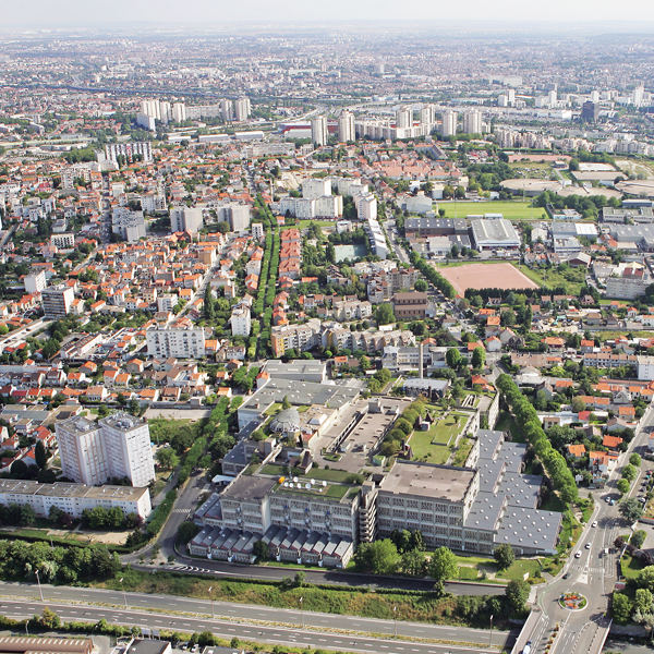
Site definition
The study site is bounded to the north by Boulevard de la Boissière, the former corniche of the forts of Paris, to the south by the A186, to the west and east by the structural arteries linking to Montreuil town centre.
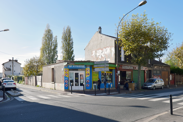
This area on the plateau is characterised by a disparate urban fabric, where traditional post-war detached houses sit side-by-side with small, recent apartment buildings, large social housing estates and business zones. The project site runs along the two north-south axes linking the metro to the tramline, incorporating the warehouse sector to the east. Within this perimeter, work needs to be done on three more operational sectors:
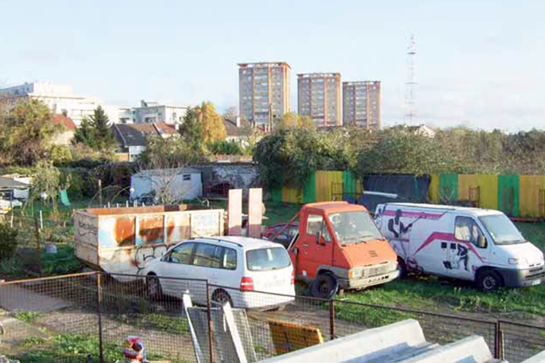
- To the north, the Boissière site situated on the town boundary, along Boulevard de la Boissière, which links the two future metro stations. Innovative programs are needed on areas of brownfield land at the foot of the metro.
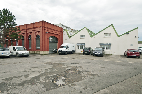
- To the east, the Roches sector, large business and warehouse plots needing to evolve towards a more urban character.
- The Signac site along the A186, which is an interwoven fabric of detached houses and large business and warehouse plots, which need to be reconnected with potential new building land along the tramline.
Future of the site in relation to the site family and Adaptability
The project site combines several problems that the teams will need to tackle together in order to offer innovative programs that develop coherence and pursue new urban forms, rooted both in the history of the place and its practices and in the radical transformation of large business footprints.
What project processes need to be established to prepare for the arrival of mass transit and the profound changes associated with it, without disrupting the social, urban and economic fabric?
How can these new mobilities trigger opportunities for youth employment, integration and vocational training?
How can economic activity and housing be organised around the T1 and the M11, and what process will allow the municipality to exploit these new infrastructures without falling victim to the property speculation that they generate?
What programs and what urban forms will be consonant with the existing fabric and generate an urban life based on sharing, community spirit and sociability, rooted in innovative projects, a community economy, participatory housing, self-build activities…
How can urban planning and its phases be harmonised with gradual shifts in land ownership?
Given the need to protect the area’s economic life, should existing sectors be reinforced or should a new cluster be envisaged?
What can be done to provide safe pedestrian routes to promote walking, cycling and bus travel, and reduce the use and impact of the car?
What can be done to create new landscape links and showcase the site’s exceptional topography (plateau and viewpoint)?
What consultation process will take account of the demands expressed by resident groups, who have come out against dense, free-market real estate operations, and who are now positively involved in the debate on the future of these areas?
Questions on the site
Do we have to respect the PLU (local urban plan) which is available on the city of Montreuil website? In particular regards to alignment and height. Or are we free to set our own town planning regulation, as it is an urban and architectural proposal?
Le PLU will be soon under revision. You are free to do proposal that modify the current regulation.
Could you please comment on the site task: there are three sites for detailed proposal. should we make a proposal for all three? or should it be the one we choose? thank you
You can choose to do make proposals on 1, 2 or all sites.
This site is connected to the following theme
How to use new inputs to change urban space? How to profit from new inputs to transform urban space and disperse the incoming positive dynamics to adjacent areas to create new urbanities? How to manage potential tensions between the local and translocal activities? These inputs are related either to new public transport network connections or to new programmatic developments. The scale of these incoming urban dynamics varies from the urban agglomeration to the whole world.
Specific documents
E13 FR - Launch: Bondy, Montreuil & Vernon
Questions on the site
You have to be connected –and therefore registered– to be able to ask a question.
Fr. 16 May 2025
Deadline for submitting questions
Fr. 30 May 2025
Deadline for answers
Before submitting a question, make sure it does not already appear in the FAQ.
Please ask questions on sites in the Sites section.
Please ask questions on rules in the Rules section.
If your question does not receive any answer in 10 days, check the FAQ to make sure the answer does not appear under another label or email the secretariat concerned by the question (national secretariat for the sites, European secretariat for the rules).