Eivissa (ES)
The Synthetic Site Folder and Site Brief are available for free.
Please register and login to access the Complete Site Folder.
- Synthetic site folder EN | ES
- Site Brief EN | ES
- Site on Google Maps
- Back to map
Data
EIVISSA (ES)
Scales L/S
Team representative Architect/landscape architect
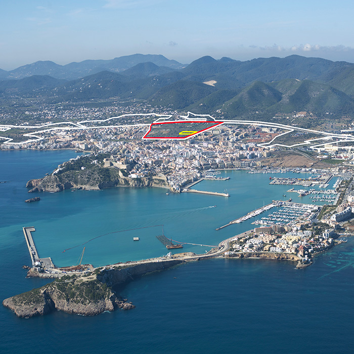
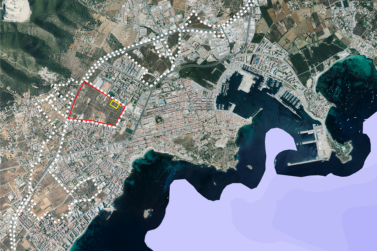
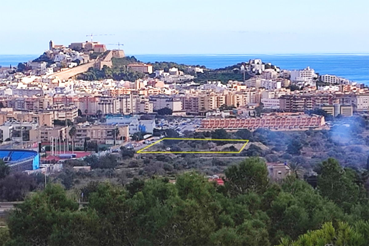
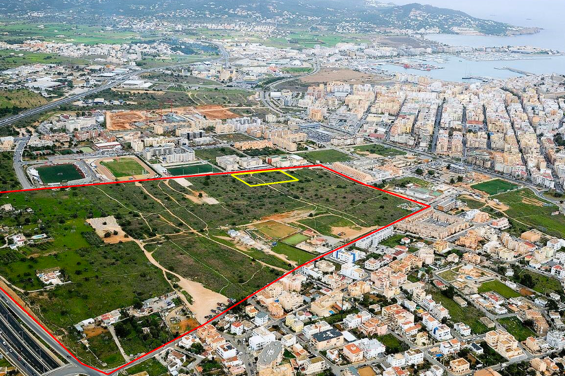
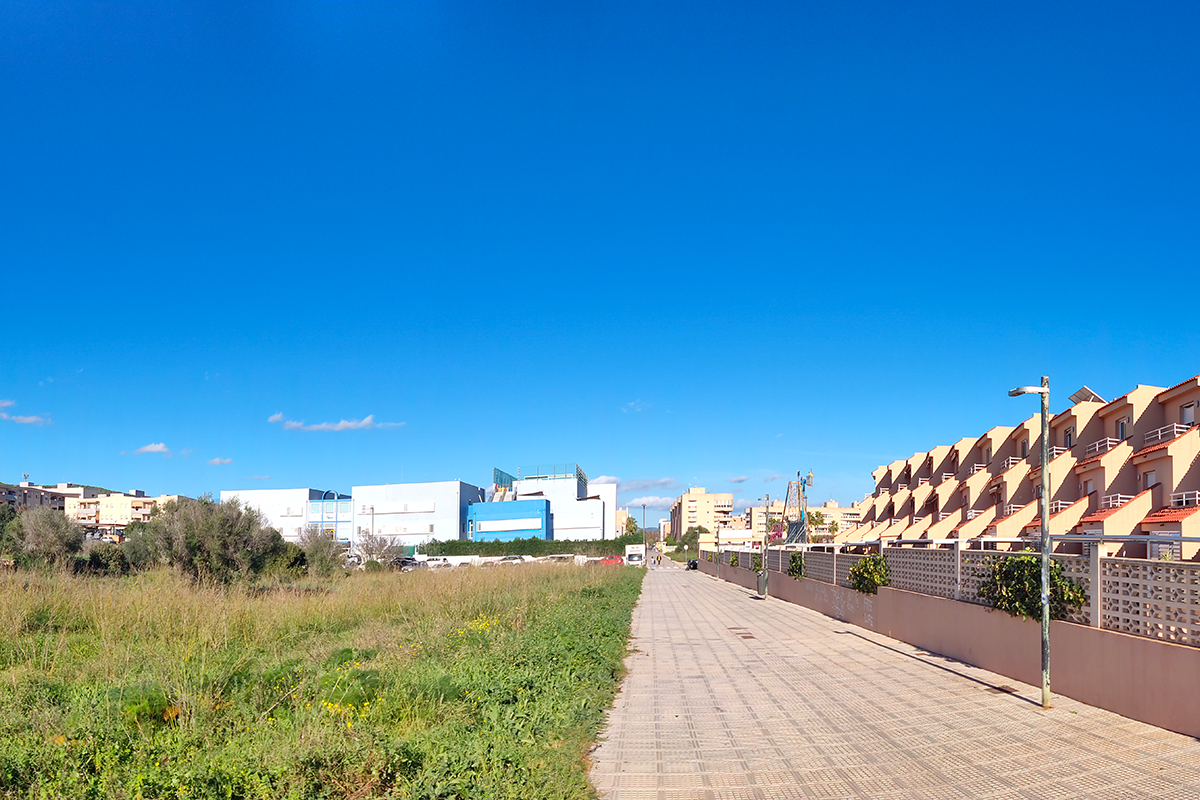
Location Can Escandell, Eivissa
Population 50,643 inhabitants
Reflection site 315,686 m2 - Project site 4,785 m2
Site proposed by General Direction for Housing and Architecture. Regional Government of Balearic Islands (GOIB)
Actors involved Regional Ministry of Mobility and Housing GOIB + Eivissa City Council + SEPES
Owner(s) of the site Eivissa City Council + SEPES
Commission after competition Project for the construction of a public rental housing development of some 68 units with the possibility of extending the pro- ject to 170 units. The same team could also be used for the direction of the corresponding works.
More Information
Inhabited milieu's challenges
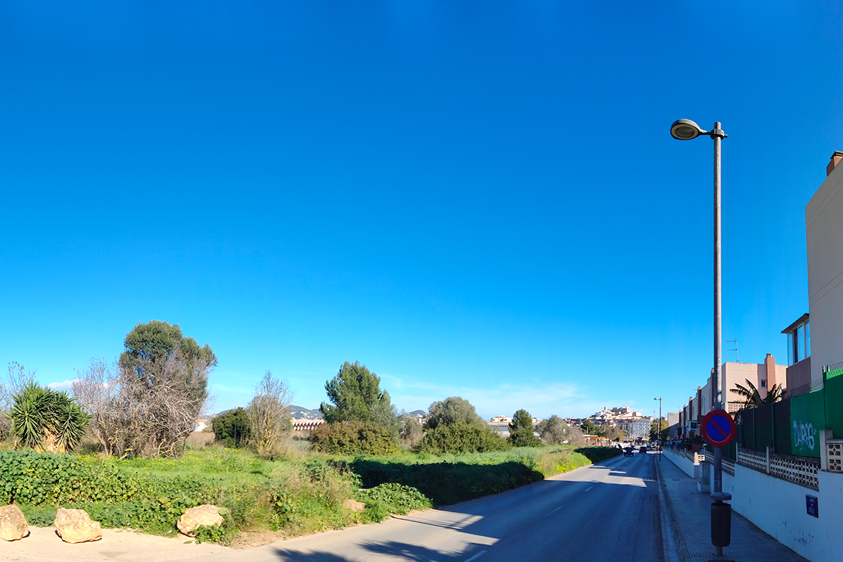
The proposed location invites us to study the interaction of a new centre of more than 1,500 inhabitants with the rest of the city and its connection with the other areas of the municipality. In this area limited by two expressways, it is essential to seek proposals for mobility in its pedestrian and road traffic variants, integrating the new neighbourhood into the urban fabric so that it is not isolated within the city itself. On the other hand, in order to avoid ending up as a dormitory town, it is suggested to take into account the desirable mix of other uses with the main residential use in the area. The projected building should introduce and highlight the value of the human scale in relation to its open space immediate surroundings.
This is a sector of the PGOU of Eivissa for mainly residential use, which is complex due to its location, as it is situated in the peripheral area of the city, in the middle of the two main ring roads that isolate it from both the city and the countryside. A subsector in which educational and sports facilities, public open spaces (including a large park) and the road network are also contemplated is ordered by a Special Plan and a reclassification of land.
The residential area of this Special Plan is destined for housing with some form of public protection; the total number of dwellings is expected to be 476. With regard to public housing de- velopments, one of the blocks (no. 10) is destined for a public rental housing development. This block, with a total buildable surface area of 16,706 m2, ground floor + 4 floors + attic, can ac- commodate a total of 170 dwellings. The other subsector will be the subject of a partial plan for private development in which the continuation of the park and the implementation of a health facility are planned, in addition to residential use.
Questions to the competitors
The intention is to find innovative architectural solutions in the field of public rental housing development. The aim is to explore imaginative housing typologies complemented with common use spaces for users, in order to optimise the use of the available buildable space and contribute to improving the economic and environmental sustainability of the projected buildings. The different profiles of residents, groups and types of families must be taken into account and aspects such as inclusivity, as well as integration and connection with the immediate surroundings and the rest of the city must be valued.
The territorial scale points to a set of transition areas which, together with the study area, are the only unconsolidated land for buildings and are not environmentally protected. The aim is to find proposals at a larg- er scale to integrate the sector into the urban fabric and explore interconnections with the city and the countryside. One of the objectives of the City Council is to achieve good connectivity with the surrounding landscape, especially towards the hills bordering the vacant developable land that are protected as natural spaces. The main problems that should be solved are those derived from its peripheral location in the urban fabric, in what we could call "commissures" and its location between the two ring roads which will generate many movements, predictably many of them by car, given the dispersion of activities on the island of Ibiza and the deficient network of public transport.
While the subsector is already developed and planned, ideas are expected to help connect this area to the city and integrate it into the urban fabric. At the same time, the proposals for the residential building will have to provide an extra element of social, energy and sustainability optimisation.
Questions on the site
We need to ask if the building to be build in the block 10 need a distance from the border of the site. In the file "ES-IBIZA-PS-M1" there is a dotted red line that seems to be the buildable area. Is that it? Thank you
1) there is no need of distance from the border of the site.
2) yes, there is a buildable area but not for ground floor, is just for floors above
We ask about the size of the "S scale" plot. We see in the file "ES-IBIZA-SS-AP1" a dimension of the plot bigger than the dimension of the file "ES-IBIZA-PS-M3_zoningandurban" or "ES-IBIZA-SS-M2". In the last one we see a dimension of 79.90x59.60m. Is this the maximum size of the building or it can be bigger? Thank You
The dimensions will be 79.95 x 59.85 m. from graphic information we have at the current moment.
In the competition brief , there is a link to see the profiles of applicants for pubicly protected housing for rent in the municipality of Ibiza (page 13). This link does not seem to work from the PDF. Would it be possible to share the link again ? Thank you.
Please, see profile of applicants for public housing_Eivissa_Vila_ERB.pdf in "New_Docs_after_Launch"
In the competition brief, it seems to require a minimum of one parking space for each apartment. Is it possible to have a lower parking ratio according to new types of sustainable mobility?
It’ s not allowed according to current regulation
How many floors below ground can be built?
There is no regulation about
The diagram on p. 20 shows two zones of the analysis area: 12-East and 12-West. Does this division affect the expected design proposal? Can we orient on ES-IBIZA-SS-M2.pdf regarding the functions of land use?
East is an already planned area, but not West, where you can still suggest ideas regarding to future planning
p. 15 (table) 'S. floors occupancy': the requirements for this parameter don't clear to us - could you please clarify?
You can occupy 100% maximum just in Groung floor. In floors 1 to 4 you can occupy 16 m. depth from street . Floor 5: from 4 m. to 16 m. depth.
p. 15 (table) 'S. floors occupancy': the requirements for this parameter don't clear to us - could you please clarify? Also, the footnote (a) is not clear to us - could you clarify?
You can occupy 100% maximum just in Groung floor. In floors 1 to 4 you can occupy 16 m. depth from street . Floor 5: from 4 m. to 16 m. depth.
p. 15 'Max. projection over public domain' - does it mean overhang outside of the plot?
Yes
p. 15 footnote (b): - What does 'enclosed' mean in this context? -'façade aligned with the road on each floor' - with balconies, or balconies can step out in front?
Just open balconies.
p. 15 footnote (i) - can you clarify regarding the hight?
It does not apply for housing.
You promised to upload the video on the competition site during the site visit. Can you upload it?
It´s in progress
If we calculate the buildable area using the 16m buildable depth we have 3438 sqm on the intermediate floors and 2386sqm on the top floor, that summed to the ground floor area gives a total buildable area of 20896sqm which is different from the buildable area given in the “urban development conditions” table (16706sqm). Which surface should we use?
16706 is the maximum total surface that you can distribute in different floors wich also have a maximum surface each.
The competition brief says that the groundfloor will prioritize housing, commercial and parking uses, but it doesn´t say anything about the basement. Is it possible to implement a basement level (-1) in the plot for parking and warehouse uses?
yes, it is
We would like to ask about the buildable of the site. In the file "ES-IBIZA-PS-M1", is the red dotted lign just there to show the maximum depth of the buildings (16 meters) or is it the limits of the buildable area ? Is it allowed to have dwellings outside of this red dotted line (as an example in the center of the plot) ?
On floor 1 and above it is not allowed to build outside the red line.
We would like to ask about the maximum exterior space in the summary of regulations governing officially protected housing on page 17. « the 50% exterior must be less than 10% of the useful interior area ». Does that mean that the total of exterior spaces must be under 20% of the total interior area ? Many thanks.
Exactly. (You should consider that now we are in the ideas level, not yet in a definitive building project...)
Could you specify how the allowed square meters in the 'Urban developments conditions' table should be calculated? Does, for example, on an intermediate floor the allowed 2.556 square meters refer to only internal space? Are open or closed balconies or detached open walkways calculated at a percentage or not at all?
Only built volumes internal space and closed balconies. open balconies: 50%. Remember Europan is an ideas competition.
Could you provide a file containing the site's topography? In the site folder under PS-e_maps-topography (0) seems to be no file.
You will find the topography in C-M2.dxf
The brief mentioned that it must be possible to enclose the central park. Does this mean a permanent gated fence around the park?
The park is not a main subject or the competition since it is already planned but you can always give ideas about ar suggest changes to improve current situatio
How should be measure the maximum height of the building on a plot with a slope? Should we measure at the centre line of the plot on each elevation?
Yes
Could you please clarify: p.10 - '... it is suggested that it is desirable for it to have a mix of uses other than residential.' - can we propose other additional functions besides housing within the project site? If yes, should we calculate these functions as a part of the overall floor area pointed out in the table on p. 15?
All floor area counts. Those other uses in the ground floor are also part of the overall floor area.
Could you please clarify: p.17 - 'max. car park area - 25 m2 space', below there is '30 m2' - which one is correct?
30 m2 is maximum admitted and 25m2 is recommended
Could you let us know if the first phase of the development with 68 units be as separate housing buildings within the project site?
You can distribute the volume inside the plot as you consider according to the rules. That includes finding a solution in separate bulidings.
Could you please confirm that the type of expected housing on the project site is social housing?
Yes, it is
We have examined the planning framework and regulations applicable to the site and detected the standard of 1 parking space per dwelling or per 100 sqm of residential. Is it necessary to provide 1 space per unit or can we apply the second option, which is also reflected in the planning regulations?
It is required to provide 1 parking space per dwelling
Given the space required for the building planimetry and the potential inputs for XL and L scales, can the 3 Computer Generated Images/photomontages be submitted out of the required 3no. A1 panels?
The submission must follow Europan rules, so all images should be included in the panels.
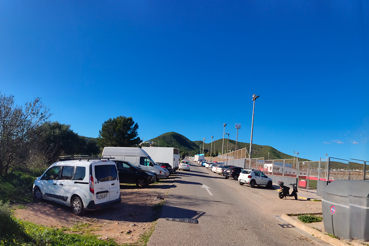
Could you confirm the ownership of the adjacent sport facilities and the relevant actors/agents responsible for their management? Could you also confirm the ownership of the proximate plot used as an informal parking?
Most of this land is municipal property and management.
Considering the sector as already developed and planned, do we have to follow strictly to this design or can we propose alternative solutions for the development of the park and all the new residential areas of the sector?
At the level of ideas you can always propose what you consider best but, probably the plot where the housing will be finnally built, will be the plot 10 as planned.
This site is connected to the following theme
THINK TABULA NON-RASA! Some nature reserves around the world are deserts –hot or cold–, but they host all kinds of animals and microorganisms hiding in the cracks and crevices, under the rocks. Some of our sites look empty, vacant, but they are not. They are full of life: in the soil, in the air, in the breeze. They are part of a larger balance of natural forces and processes. On these sites, substantial new volumes of programme are required. Think of these sites as the opportunity to multiply the number of life forms, think of the request to build new habitats as an opportunity to design a holistic environment. Think tabula non-rasa!
Designing new habitats as a holistic environment
Specific documents
Questions on the site
You have to be connected –and therefore registered– to be able to ask a question.
Fr. 16 May 2025
Deadline for submitting questions
Fr. 30 May 2025
Deadline for answers
Before submitting a question, make sure it does not already appear in the FAQ.
Please ask questions on sites in the Sites section.
Please ask questions on rules in the Rules section.
If your question does not receive any answer in 10 days, check the FAQ to make sure the answer does not appear under another label or email the secretariat concerned by the question (national secretariat for the sites, European secretariat for the rules).