Graz (AT)
The Synthetic Site Folder and Site Brief are available for free.
Please register and login to access the Complete Site Folder.
- Synthetic site folder EN
- Site Brief EN
- Site on Google Maps
- Back to map
Data
GRAZ (AT)
Scales XL/L
Team representative Architect, urbanist and landscape architect
Location Graz, Styria
Population 291 000 inhabitants
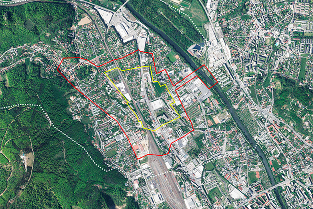
Reflection site 112 ha - Project site 32 ha
Site proposed by City of Graz
Actors involved City of Graz, Federal Province of Styria Department for Mobility
Owner(s) of the site City of Graz, private owners, Federal Province of Styria, Austrian Railway company ÖBB
Commission after competition There is a definite intention to involve the nominated team in the strategic processes and master planning.
More Information
Inhabited milieu's challenges
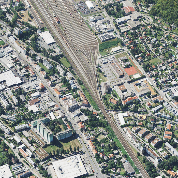
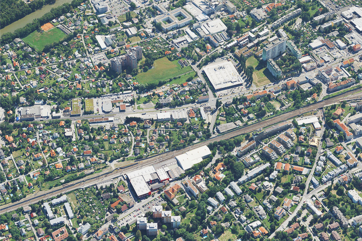
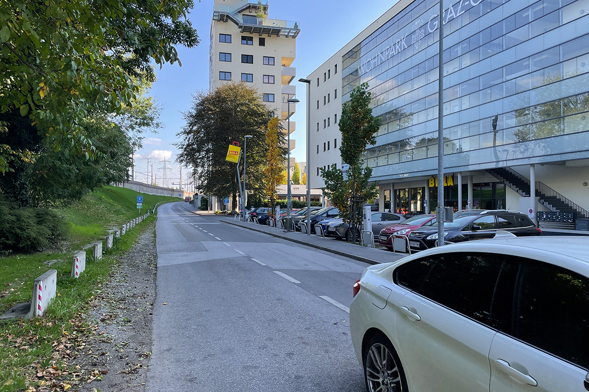
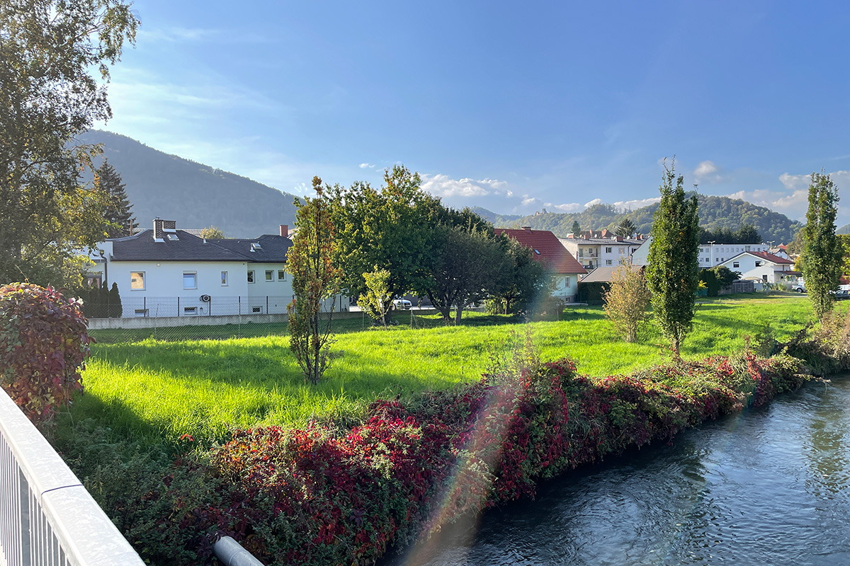
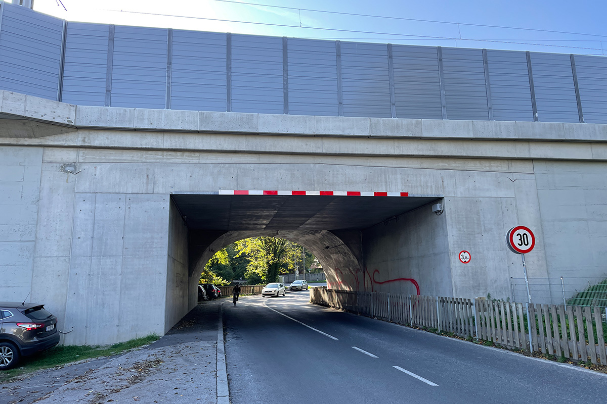
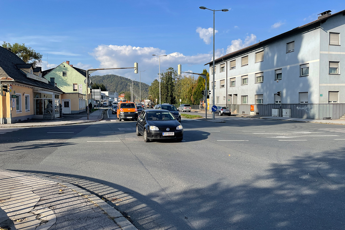
Wiener Straße is the main artery when entering Graz from the north. Coming from the motorway, cars speed along a four-lane road towards the city centre. Gösting is the first district they encounter. Junctions and traffic lights slow the speed, and the 3-4 storey houses along the road become increasingly dense. However, the large supermarkets or car dealerships in between break the continuity.
Gösting has a castle on the hill that no one on Wr. Straße would ever notice.Turn left or right at one of the intersections and you’ll find a heterogeneous, patchy urban fabric with lots of greenery and even small streams.
Another obstacle that cuts through Gösting is the railway line. In the near future, a mobility hub will be created with a regional train station and a tram loop with frequent services. This is a great opportunity to rethink the objective of the four-lane road, reduce private car traffic by shifting commuters to public transport, and to make the area more liveable and human-scaled again.
Questions to the competitors
The task on this site is to look at the urban fabric, both its existing and its new potential as a result of infrastructure development. Accessibility to public infrastructure must be combined with a relaxed living environment and good community relations.To show how the future of this four-lane road and the transformation of this place between infrastructure and physical barriers can become a valuable place to live and a place of identity is the task of this site.
How to negotiate an infrastructural transition and how to face the challenges? How to strengthen the urban fabric around a new mobility hub? A mobility hub is by definition a place of movement and passage; how to create a quality of place that invites people to stay? How to integrate the barriers of the train and devise a mobility transition of the road? How to adapt the area to the new velocity? The surrounding fabric will benefit from better accessibility, liveability and less motorised individual traffic; how can this currently heterogeneous area regain its identity? What kind of urbanity can be established within the peri-urban? Can its core values be linked to nature, as there are several green areas and two streams? Water could be a fascinating medium to work with.The whole area is prone to flooding; how can the peculiarities of nature be incorporated into a scenario that respects or even encourages the various expansions and developments of nature?
Questions on the site
Can we deviate from the proposed tram route and propose a new route?
According to the brief - variations of the tram route are possible.
Please note: The city of Graz has already carried out studies on the tram route some time ago. In these studies, the tram route was chosen according to criteria such as the highest number of passengers to be picked up. This route is based on the current state of development or density distribution of the population and has already been positively tested in terms of traffic.
If a new concept, a different distribution of buildings and public spaces, would make it possible to vary the route within the necessary (technical) conditions, without changing the area of the terminal station, this possibility is not excluded.
Are the proposed deliverables by Europan Austria (site brief page 55) compulsory, or can we use it as a guideline and deviate from it?
The public space strategy, as well as the 1:2000 site plan and the 1:1000 lenses are compulsory. Other proposed deliverables can vary, but we would highly recommend to depict the proposed deliverables.
Can you clarify what type of drawing is expected for the deliverable '1:1000 lenses' (page 55 of the site brief)?
The drawing can be a typological axonometric or isometric, as well as a ground plan. We would suggest axonometrics as a prototype for this milieu in order to be able to show phasing.
This site is connected to the following theme
IMAGINE A SECOND LIFE! A Second Life! is a metamorphosis of a situation. The challenge is to regenerate and to support spaces in need of transformation from a new perspective towards the pre-existences and the hidden treasures that are already there. A new revalorization of all kind of resources – natural, heritage, energy, flows, economy, social… It means to reconsider uses and new proximities linking ecological and social dynamics. How to be attentive and welcoming to differences and vulnerabilities nourished by inhabited milieus facing climate change?
Transforming neighbourhoods and buildings towards an inclusive milieu
Specific documents
Questions on the site
You have to be connected –and therefore registered– to be able to ask a question.
Fr. 16 May 2025
Deadline for submitting questions
Fr. 30 May 2025
Deadline for answers
Before submitting a question, make sure it does not already appear in the FAQ.
Please ask questions on sites in the Sites section.
Please ask questions on rules in the Rules section.
If your question does not receive any answer in 10 days, check the FAQ to make sure the answer does not appear under another label or email the secretariat concerned by the question (national secretariat for the sites, European secretariat for the rules).