Helsinki (FI)
The Synthetic Site Folder and Site Brief are available for free.
Please register and login to access the Complete Site Folder.
- Synthetic site folder EN
- Site Brief EN
- Back to map
Data
HELSINKI (FI)
Scales XL/S
Team representative Architect, landscape architect
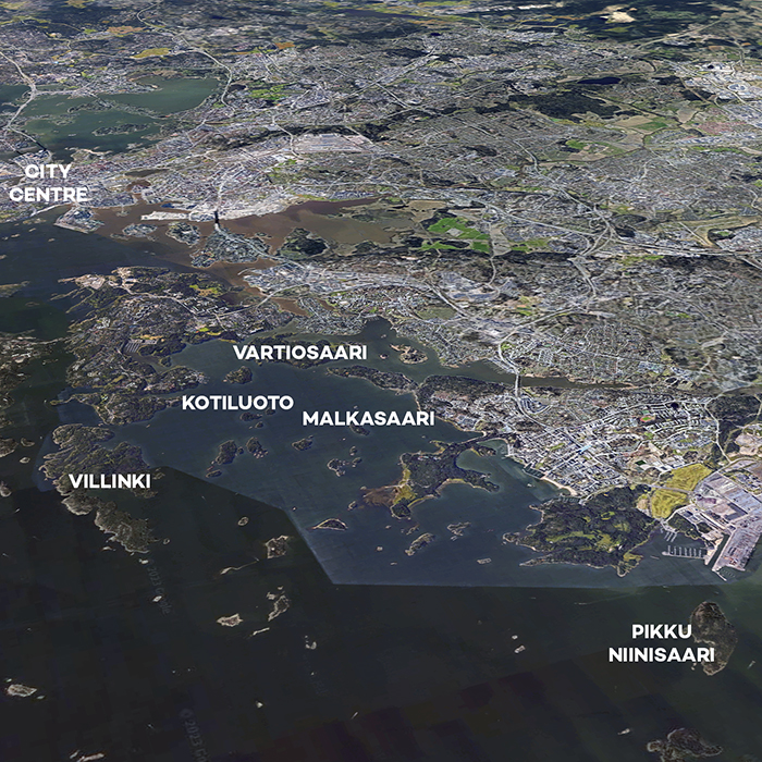
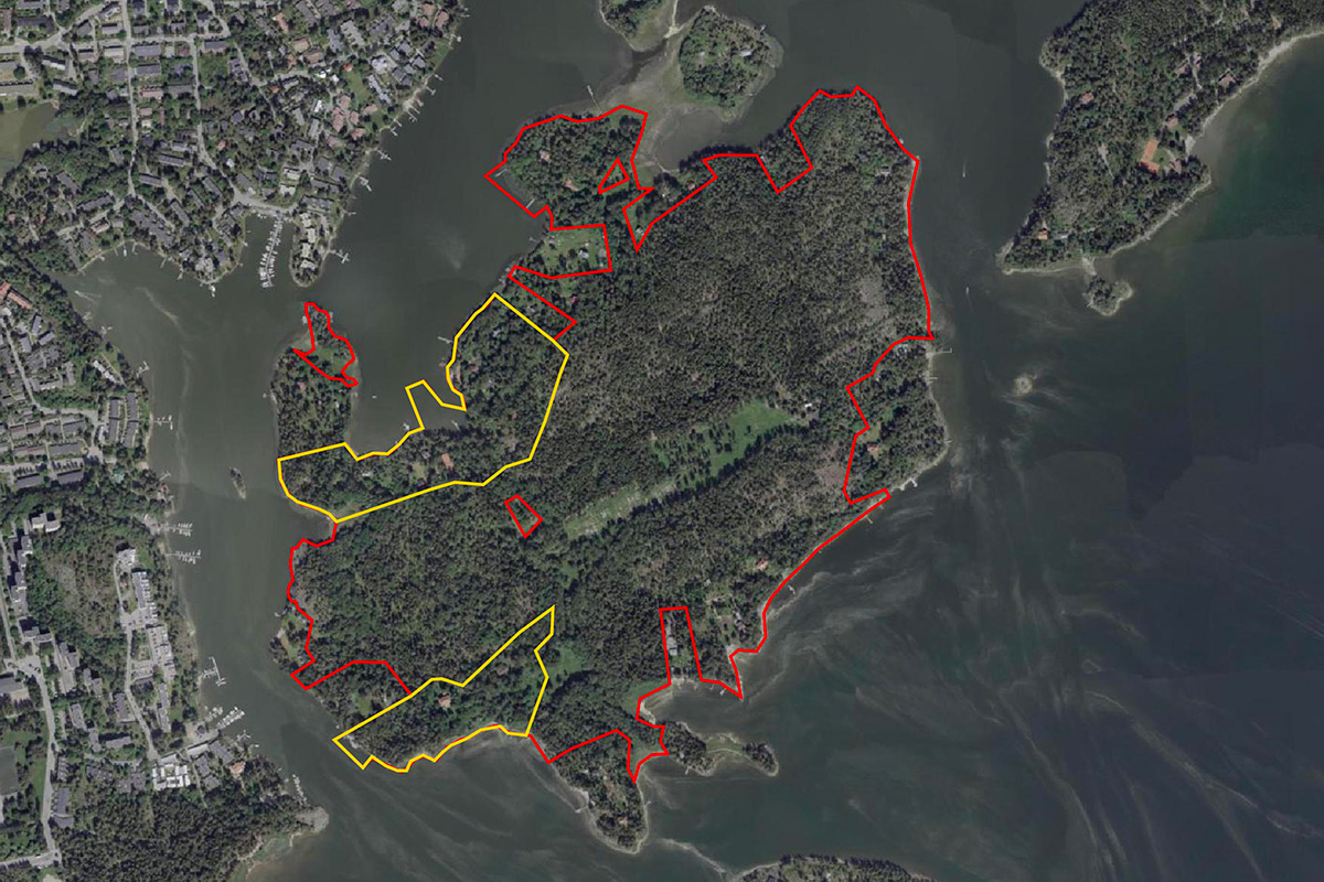
Location Helsinki Eastern Archipelago
Population City 658,864 inhabitants
Greater Helsinki Area of Helsinki 1 320 000 inhabitants
Reflection sites 68 ha + 13 ha + 4 ha + 4 ha + 16 ha
Project sites 8 ha + 7 ha + 2 ha + 1 ha + 6 ha
Site proposed by City of Helsinki
Actors involved City of Helsinki
Owner(s) of the site City of Helsinki
Commission after competition Futher studies on the level of concept and landscape design; goal of implementing a project at one or more of the pilot islands.
More Information
Inhabited milieu's challenges
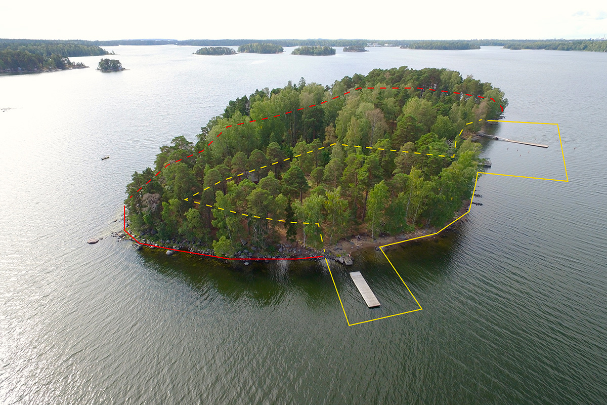
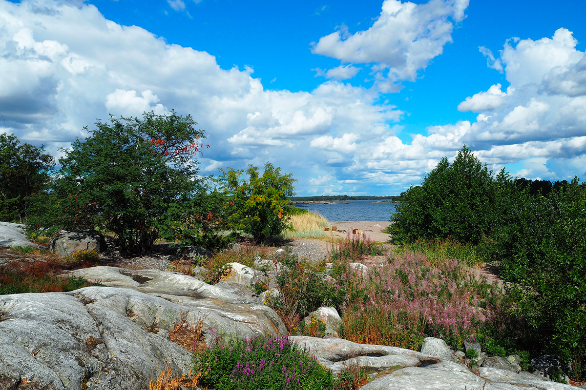
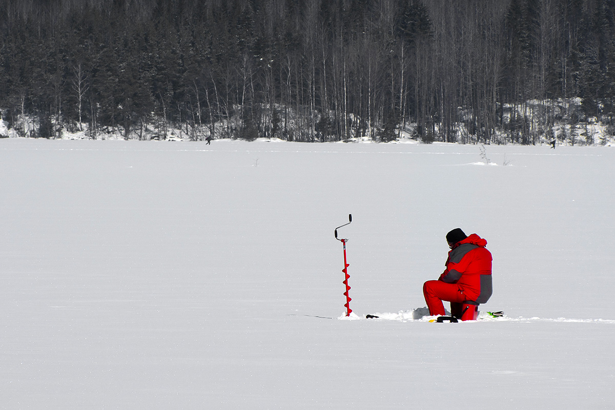
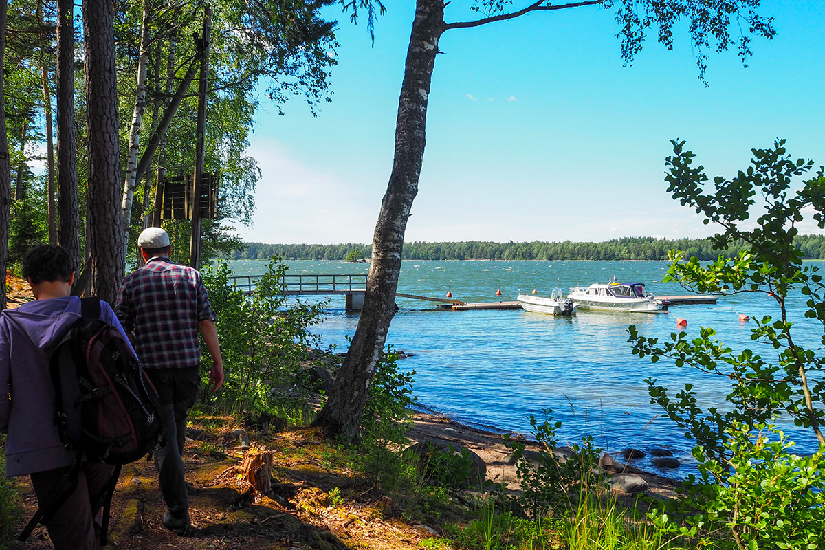
There are more than 700 islands and islets in Helsinki. The presence of an archipelago next to a capital city is a rarity also internationally. Helsinki’s eastern archipelago is a unique maritime milieu with valuable natural and cultural-historical sites and varying landscapes, from the sheltered inner archipelago to the barren and open outer archipelago. The public recreational use of the eastern archipelago has so far been low compared to the number of islands and the extent of the area. Two of the main challenges has been poor accessibility and the lack of services, and the vicious circle formed by them. Private boating or canoeing is often the only way to access the area’s public recreational islands. In addition, there are few public jetties or other places suitable for landing. The changing seasons and weather conditions add challenges for accessibility.
The new landing sites and related structures, constructions and buildings for maritime recreation will be an essential part of promoting the general recreational use of the archipelago and improving its services and accessibility. Five islands that are topical from the point of view of planning and implementation have been chosen as pilot sites. The challenge is to improve the recreational use of the area while repairing the damaged and worn out natural areas and enhancing biodiversity. Landing sites should also be social meeting places where various modes of movement meet and different user groups share the same areas and functions, benefitting from their closeness.
Building on islands and in other coastal areas creates challenges for the proposed structures. They should be easily transported, implemented and standardised. Simultaneously, the proposal should enhance the values and characteristics of different islands while providing a holistic solution for the recreation in the eastern archipelago.
Questions to the competitors
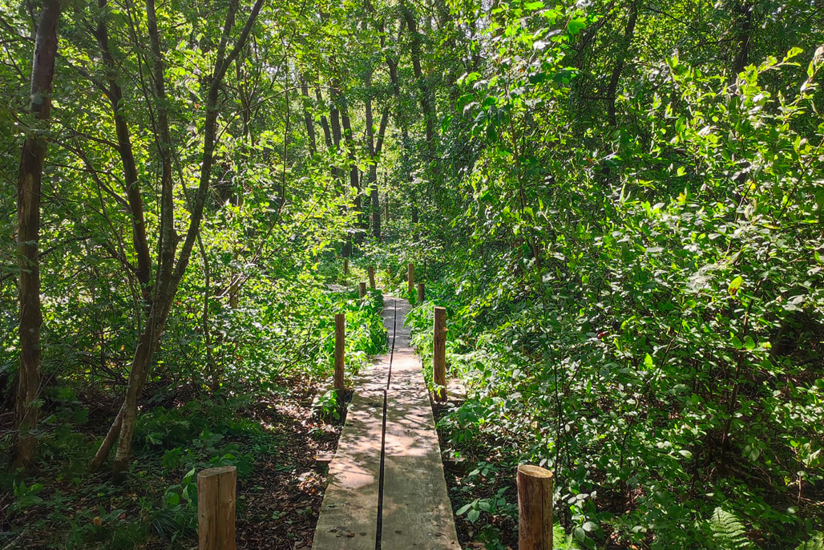
Besides the docks and jetties needed for archipelago boat traffic, small boats, paddlers and rowers, other elements need to be located within the vicinity of the landing sites include: cafes, kiosks, saunas, barbeque shelters, fireplaces and firewood storages, toilets and waste containers, and equipment to routes and trails such as info boards, signs, fences and duckboards. The goal of the competition is to design a modular concept and an architectural system for these diverse elements which can be easily adapted to various sites and situations, and can be tested on seven different kinds of pilot sites. The construction of the elements should be flexible and simple enough in order to be easily expandable and relocatable.
The elements must be of a high-quality architecture, distinctive, and reflect the spirit of the Helsinki archipelago and the islands’ values and special features, bringing the necessary services to those islands that are best suited for it. The keywords are: flexibility, scalability, repeatability and adaptability over time, experimentation and testing, economic and ecological sustainability and cost-effectiveness. Natural, cultural, social, and historical values, as well as other special features of the islands, must be taken into account. Sustainable and low- threshold recreation, accessibility, off-grid solutions for infrastructure, archipelago maintenance and urban metabolism are also to be considered. Summertime is the main season but, for example, barbecue places and saunas could also be used in the wintertime on the islands, which can be reached by pontoon bridge or over the ice. The increasing number of visitors to nature sites requires responsible methods of operation and activities that support sustainable recreational use. How can a vulnerable and sensitive nature and landscape be protected from wear caused by recreational use? How can recreational structures guide visitors of different skill levels to act responsibly on the islands and increase their environmental awareness?
Questions on the site
The brief asks for site plans and axonometric drawings of the proposals for all seven areas. Can we take the approach of concentrating on one site and keeping the rest of the site at a diagrammatic level? Developing in more detail of one site might help to show a realisable vision that could be implemented on the other sites.
The concept of the landing site should be studied in all project areas, as it’s essential to show how the concept of built elements and structures adapt to different places and conditions. Nevertheless, it’s up to the competitors to decide what kind of presentation illustrates their ideas best.
Are the drawings outlined in "submission and required drawings" a requirement or a suggestion? Producing site plans and axonometric drawings for all sites will leave little space to explore the detail and spatial qualities of the proposals.
Hello. On Helsinki site, is it possible to be provided with same maps in .dxf for all 5 island? Now there is an inconsistency in visual and graphical appearance. Maps FI-HELSINKI-SS-M1-5 are missing Villinki Island and maps FI-HELSINKI-SS-M7a-d are missing Vartiosaari Island
Indeed the map FI-HELSINKI-SS-M2.pdf/dxf on Villinki island has been missing from the Complete Site Folder! uploading hasn't been succesful. Now the files in question can be found in Complete Site Folder, in the E17_CSF-FI-Helsinki > 0-New_Docs_after_Launch folder. So sorry for the delay!
The map of a detailed plan of Vartiosaari is missing from the maps FI-HELSINKI-SS-M7/a-d, as there’s no detailed plan made yet. Instead, there’s a map of the draft local masterplan FI-HELSINKI-SS-M6.pdf/dxf.
Hello, Is it possible to get 3D model of competitions islands? it would be very helpful considering how height of a building or a structure can play a key role in design
You can find 3D material on the islands on the Helsinki Maps website https://kartta.hel.fi/?setlanguage=en# > Background Maps > 3D City Models. You can move in the photorealistic 3D City Information model in the web (though you cannot get into the very low / eye level) and / or you can download the city model as triangle mesh model (XML format; import / insert the file(s) to your cad-application).
How should we approach the local plan? The website kaupunkitilaohje.hel.fi provides information about the current use situations and future development for all five islands. Is it necessary to strictly adhere to the plan, or is there flexibility to make adjustments in certain aspects, such as the hiking route or functions around the dock?
The local detailed plan, which was made and accepted just a couple of years ago, should be considered as the basis for future land-use and new development, as it is up-to-date and it is the city's goal to fulfill the plan. However, slight deviations from the plan can be accepted if they are well justified and not threatening the values or other usages of the area.
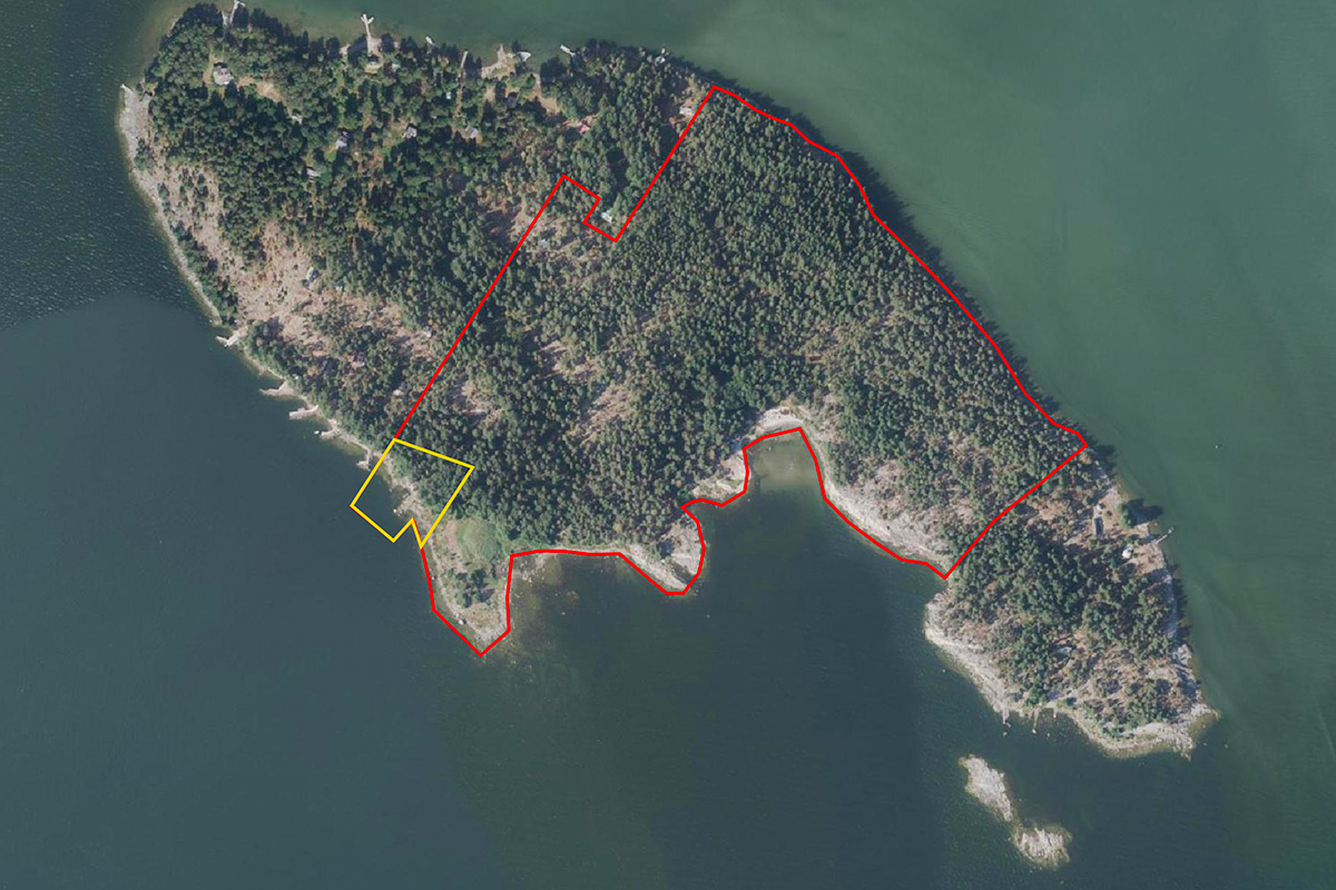
The most important routes and paths needed on the islands are marked as indicatif to the detailed plan - except in Villinki, where the alignment and character of the Saaristopolku-path leading through the island is defined more strictly.
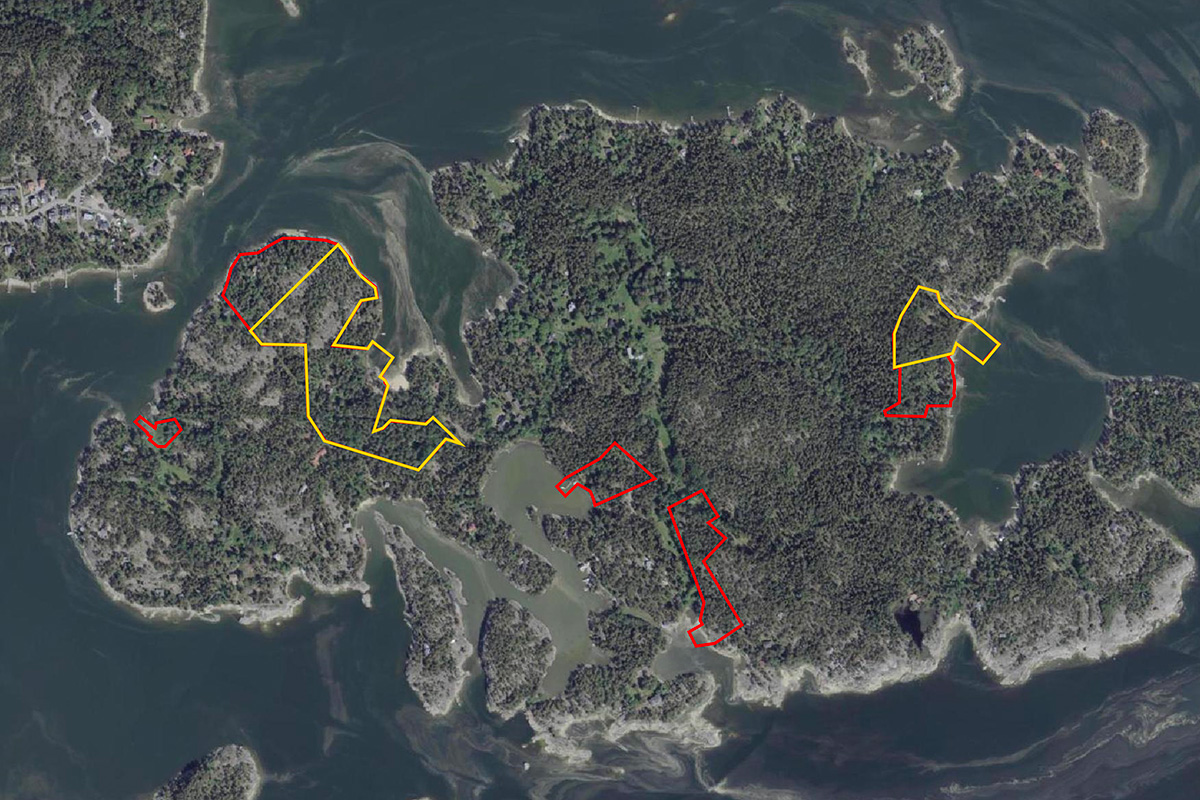
Note that the zoning status is different in Vartiosaari, where there’s no local detailed plan for the island yet, and the local master plan is currently only a draft.
In the brief, the axonometric drawings are required to be embedded into oblique aerial photos. However, limited aerial images are provided. Does this mean all competitors must use the same angle? Is it possible to draw the axonometric drawings on the illustrative base?
Competitors are asked to illustrate their proposals by axonometric drawings _or_ by embedding them into aerial photographs - whichever they consider the best way to convey the concept.
The provided aerial images are significantly larger in scale compared to the project site. This makes it impractical to fully illustrate the architectural ideas within this context. Is it possible to crop and zoom in on the provided aerial images around the project site?
The competitors are free to crop images and illustrate their proposals in a way that they consider the best. Note: oblique aerial photos with embedded proposals are not obligatory, axonometric drawings can do as well.
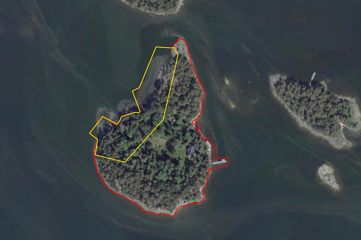
For some abandoned buildings, can we propose to demolish or reconstruct that? For example, the old sauna on Malkasaari.
In the local detailed plan the buildings and structures that have special values, are protected and marked with ”sr”, and they cannot be demolished. The sauna of Malkasaari is among these protected buildings, as it’s also stated in the competition brief (p. 24); it’s also still in use (although waiting for renovation). Instead, the old villa in the eastern part of the island is in a poor condition and can be demolished or reconstructed if necessary.
In addition to the local detailed plan maps mentioned above, the buildings protected by detailed plans can be found in the Helsinki Map Service: https://kartta.hel.fi/?setlanguage=en# > Cultural Environments > Buildings protected by detailed plans. Note: as there’s no local detailed plan in Vartiosaari, the valuable buildings there cannot be shown in the Map Service yet.
Should we use the proposed/exisiting routing in your planning? or There is space to update and design them as well.
The routes and paths, which are most important for the route network, are marked in the detailed plan. Some of the paths marked in the plan are already existing, and have already taken their most natural course and alignment. However, it is possible that for example the new services proposed for the landing sites raise new needs for recreational connections, which is why new complementary paths and other updates to existing path networks can be proposed.
This site is connected to the following theme
LET THE BIRDS SING! Imagine public space as a biodiverse landscape. Imagine public space as the touching ground, the proof that YES, WE CAN –through design– address challenges caused by the crisis due to climate change, in terms of social and environmental issues. Imagine public space as the agent for inclusion of difference both in terms of humans and non-humans, as a mediator between new interdependencies. Imagine soils, water bodies, shores and eco-corridors as the main actors to guide complex transformation processes. On the following sites, public space is seen as the area where the topic of Living Cities is performed.
Reimagining public space as a biodiverse landscape
Specific documents
Questions on the site
You have to be connected –and therefore registered– to be able to ask a question.
Fr. 16 May 2025
Deadline for submitting questions
Fr. 30 May 2025
Deadline for answers
Before submitting a question, make sure it does not already appear in the FAQ.
Please ask questions on sites in the Sites section.
Please ask questions on rules in the Rules section.
If your question does not receive any answer in 10 days, check the FAQ to make sure the answer does not appear under another label or email the secretariat concerned by the question (national secretariat for the sites, European secretariat for the rules).