Marseille (FR)
The Synthetic Site Folder and Site Brief are available for free.
Please register and login to access the Complete Site Folder.
- Synthetic site folder EN | FR
- Site Brief EN | FR
- Site on Google Maps
- Back to map
Data
MARSEILLE (FR)
Scales XL/L
Team representative Architect, urbanist and landscape architect
Location Marseille - Bouches-du-Rhône (13)
Population City 870 321 inhabitants, Métropole Aix-Marseille-Provence 1 898 561 inhabitants
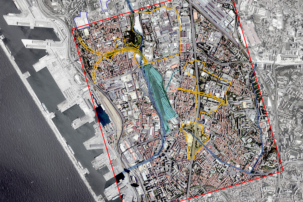
Reflection site 400 ha - Project site 25 ha each
Site proposed by City of Marseille • Métropole Aix-Marseille-Provence • EPA Euroméditerranée
Actors involved City of Marseille • Métropole Aix-Marseille-Provence • EPA Euroméditerranée
Owner(s) of the site Métropole Aix-Marseille-Provence, City of Marseille, French government, private owners
Commission after competition Commissions to further define development strategies • Project site feasibility studies • Project management commissions • Coordinating the start of sites with partners.
More Information
Inhabited milieu's challenges
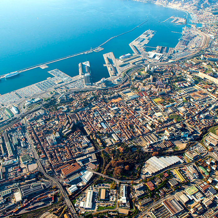
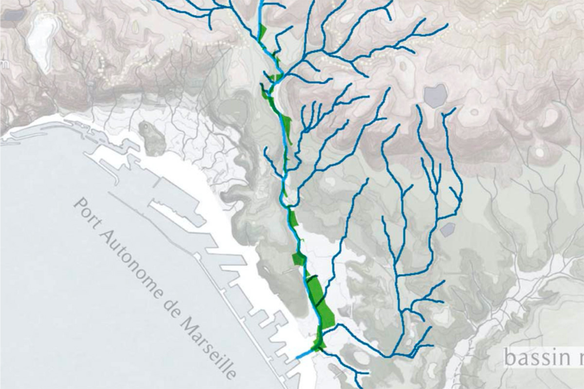
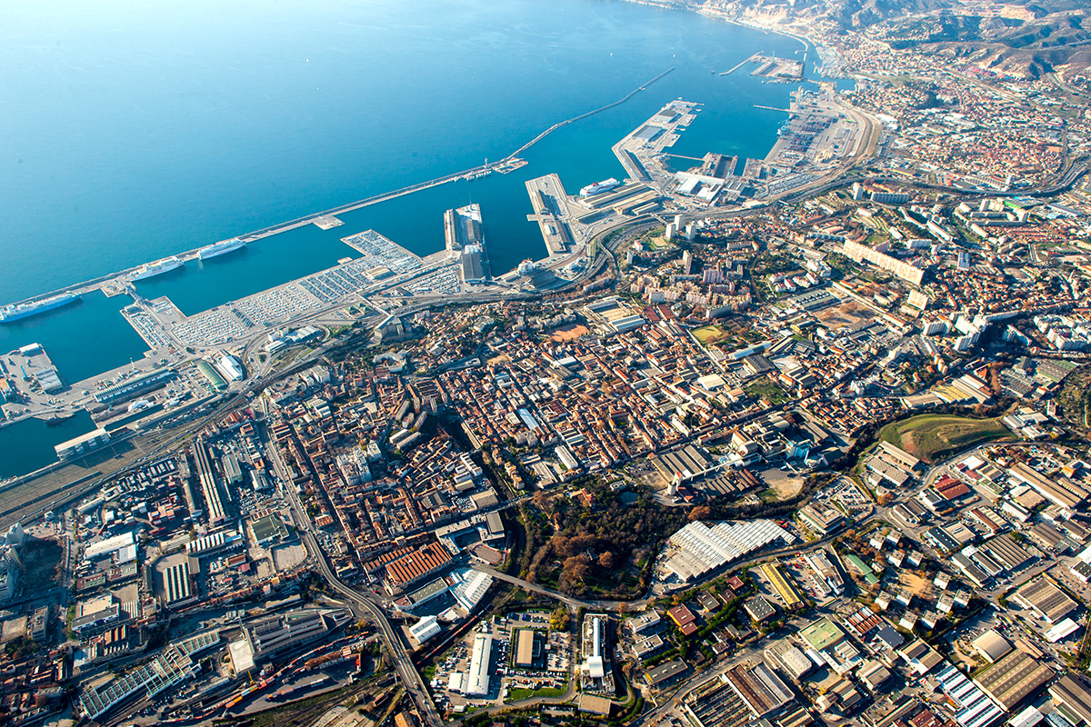
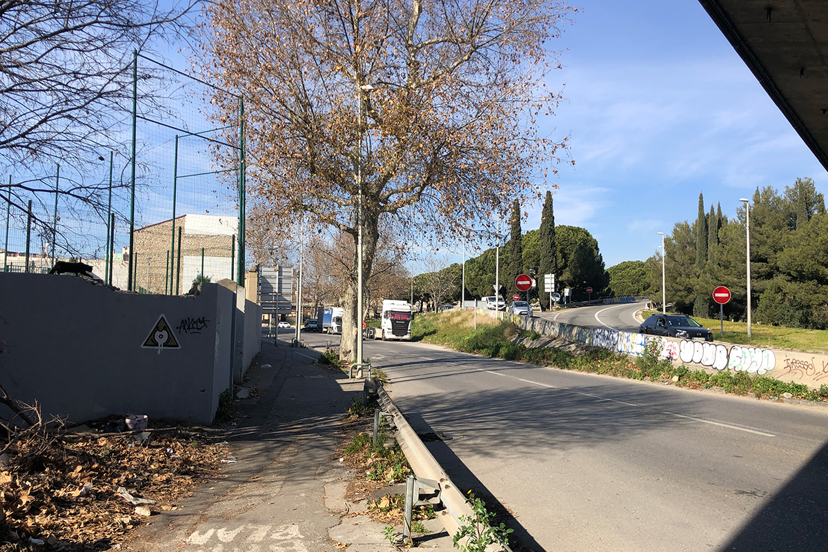
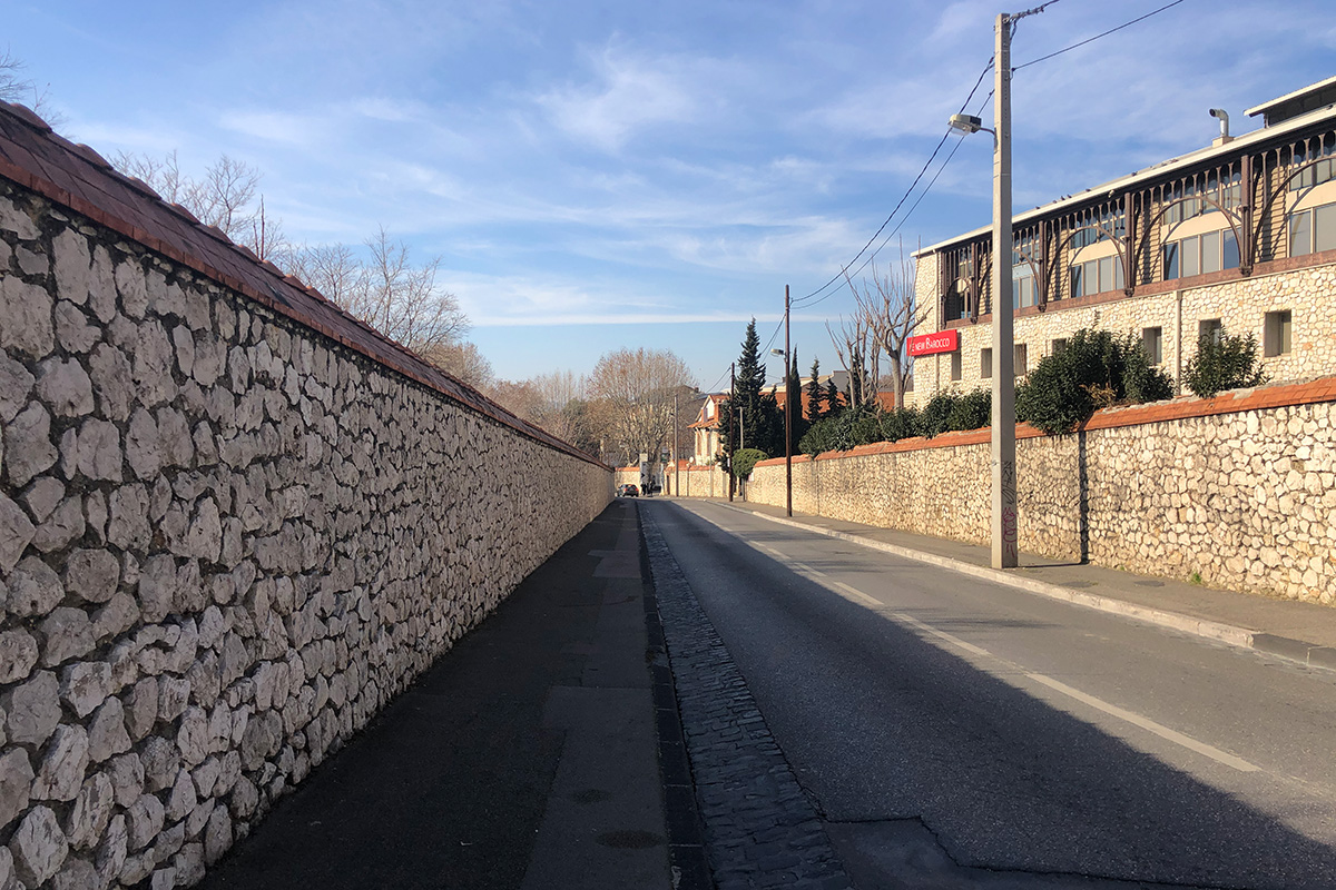
The site is part of a coastal river catchment basin, the Aygalades stream whose source is to the north of Marseille. The area's geography has been disrupted by an urbanization that does not respect the valley sloping down from the hills to the sea: infrastructures cut into this exceptional coastal landscape ignoring natural elements that are essential to the site's identity and functioning. In the middle of this landscape of obstacles, several urban renewal projects coexist.
The Métropole Aix-Marseille-Provence and the City of Marseille are developing projects on an unprecedented scale in a built-up residential area. The "Opération d'Intérêt National" (OIN) Euroméditerranée is developing the second phase of its project, creating a large park and restoring the Aygalades waterway, which currently flows through culverts under the Canet train station. New residential neighbourhoods will be built in this restored landscape, increasing the area's potential for life - both human and non-human - overcoming and transforming divisive borders and infrastructures... Looking anew at the course of the coastal river, it is possible to expose many territorial development issues, to be in tune with the site and nature: ecological and morphological restoration, flood risks and soil permeability, the green and blue networks, global warming and the urban climate, resilience, future local use of the spaces, social inclusion, etc.
Thus, the three project sites tell three different stories of division and disruption that need to be understood. They offer three possibilities to identify, think about and act on transitional areas and need to be urgently developed so that they are able to influence environmentally, economically, socially and spatially fragile areas ... edges for future encounters.
Questions to competitors
The territory needs to be rethought across the divides that define it, going beyond or playing with administrative and physical borders. Candidates are invited to investigate the potential these lines of rupture and the interstices have for becoming fertile and unifying interfaces. It is crucial now to repair the edges of these complex sites, which are the subject of several on-going projects, in order to increase interactions and generate an inclusive vision of the territory.
With a network of parks (Bougainville / Aygalades / Billoux) on the horizon, this landscape pattern could be extended (towards the Massif de l'Etoile? towards the sea? towards the village cores?) through links in a vast chain (existing and to be invented) of landscaped areas. The applicants are asked to bring to light the area's overlooked geography and to develop a sensitive, poetic, local relationship to a territory where scale and landmarks have disappeared.
This territory does not need another strategy study, but a new way of seeing the city. Candidates need to come up with a common story to tell, a narrative of past, current and future projects. The objective is to spotlight forgotten facts and propose coherent projects with informed scenarios.
The three project sites were chosen for their potential (nature, position, resources, etc.) to be catalysts in the development of territorial initiatives. They are areas of confrontation, yet they have the potential to be bridges for cross-public action. Europan is an opportunity to demonstrate the need for "urgent", rapid and efficient interventions on these sites.
Questions on the site
Following the registration of our team at the Marseille site, we have a question concerning the choice of site. Does our proposal have to cover all the proposed sites, or just one of them? By extension, can we choose to deal with, for example, two of the three proposed sites, or all of them, in order to respond to the subject?
As explained during the visit of the 2, you have the possibility of answering all or part of the project sites in coherence with the general purpose that you carry.
Is it possible to send us the project documents for the bougainville park and the aygalades park? In particular, the landscaping project?
You can find the landscaping project designed by d'Ici-là for the Bougainville park at this link: https://ged.euromediterranee.fr/share/s/UeFx62ugTC6S4Yvj_BPN8g
As for the future Aygalades park, no landscaping plans have yet been drawn up, but the objectives of renaturation, uses and connections to the surrounding area are being defined...
What are the plans following the pre-emption of the white house on Lion Creek?
No pre-emption is planned, but UNICIL is committed to an out-of-court acquisition, currently accompanied by the EPF. To date, it is planned to maintain/rehabilitate the entire existing building, without renaturating the Ruisseau des Lions under the residence's right-of-way.
Who owns the halls adjacent to the future Parc des Aygalades at 103 bld Casanova, 13014 Marseille? Are they currently in use?
. OWNER: STORAGE MARSEILLE NORD
. MANAGER: Gérald SEBRIGHT
. USER: Art Emballages
The warehouses are currently used by
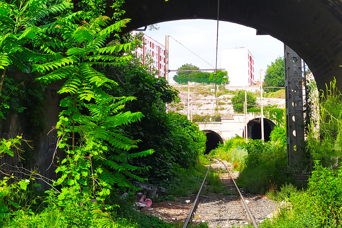
Is it possible to obtain plans of the tunnels and rail tracks at Site 1? Are the tunnels dead-ends? (altimetries...) Do you also have photos?
The tunnels run right through and are still used for train traffic. One bends down to the south, linking the Arenc railway line to the high plateau of the Canet station. The other bends to the north and connects with the coastal railroad line, albeit at a gentler gradient.
What process will be used to reuse track materials (ballast, sleepers, rails) for the redevelopment of Le Canet station? Do we already know the final destination of these materials? Has the SNCF committed to financing the clean-up of the rail site?
Euroméditerranée is currently working on the development of a process to decontaminate the site, in particular the soil, which will be launched as soon as the railway land is acquired in May 2024. Partial on-site treatment is planned for certain non-flood-prone areas. Everything is still to be worked out regarding the treatment and recycling of materials on site, in particular sleepers and rails.
We took part in the site visit day on May 25 for the Marseille sites, and were told that additional documents would be sent to us, including the presentation slides. Do you know when you will be able to send us these documents? As the deadline for questions is approaching, it would be wise to have them as soon as possible to avoid repetition. Thank you for your time.
You can find the presentation shown on the day of the visit at this link: https://ged.euromediterranee.fr/share/s/wxiCZCrfTTeTwzcg1zFwaA
This site is connected to the following theme
LET THE BIRDS SING! Imagine public space as a biodiverse landscape. Imagine public space as the touching ground, the proof that YES, WE CAN –through design– address challenges caused by the crisis due to climate change, in terms of social and environmental issues. Imagine public space as the agent for inclusion of difference both in terms of humans and non-humans, as a mediator between new interdependencies. Imagine soils, water bodies, shores and eco-corridors as the main actors to guide complex transformation processes. On the following sites, public space is seen as the area where the topic of Living Cities is performed.
Reimagining public space as a biodiverse landscape
Questions on the site
You have to be connected –and therefore registered– to be able to ask a question.
Fr. 16 May 2025
Deadline for submitting questions
Fr. 30 May 2025
Deadline for answers
Before submitting a question, make sure it does not already appear in the FAQ.
Please ask questions on sites in the Sites section.
Please ask questions on rules in the Rules section.
If your question does not receive any answer in 10 days, check the FAQ to make sure the answer does not appear under another label or email the secretariat concerned by the question (national secretariat for the sites, European secretariat for the rules).