Skellefteå (SE)
The Synthetic Site Folder and Site Brief are available for free.
Please register and login to access the Complete Site Folder.
- Synthetic site folder EN
- Site Brief EN
- Site on Google Maps
- Back to map
Data
SKELLEFTEÅ (SE)
Scales XL/L
Team representative Architect, urban planner and landscape architect
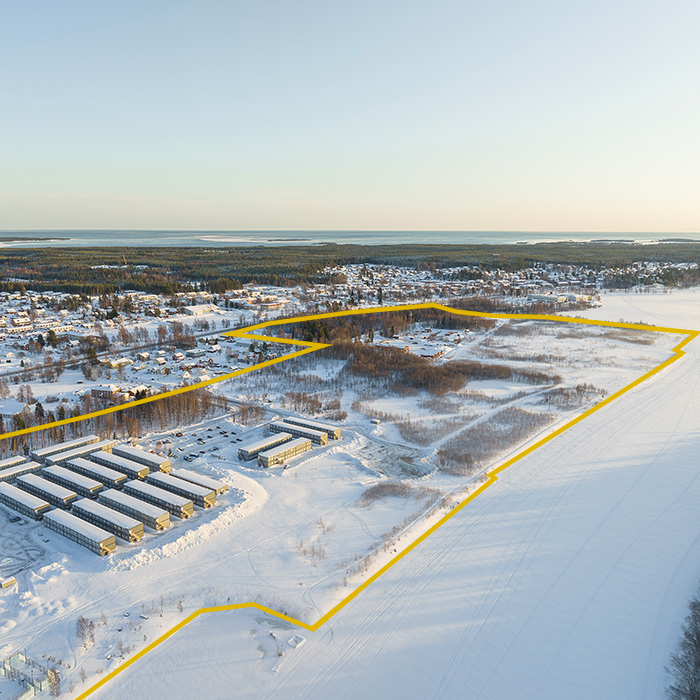
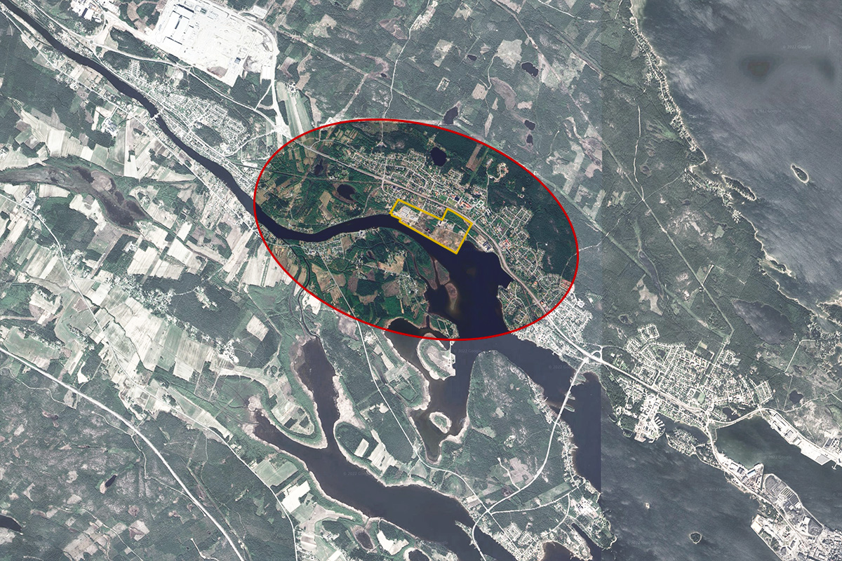
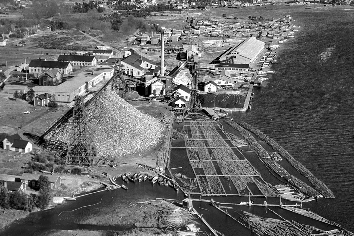
Location Ursviken, Skellefteå
Population 74 000 inhabitants
Reflection site 800 ha - Project site 40 ha
Site proposed by Skellefteå Municipality
Actors involved Skellefteå Municipality
Owner(s) of the site Skellefteå Municipality
Commission after competition The prize winning team(s) will continue the work with the competition assignment in a workshop with the municipality, with an option for further work towards an implementation of the proposal, including workshops, various planning documents, illustrations, drawings and citizen dialogues.
More Information
Inhabited milieu's challenges
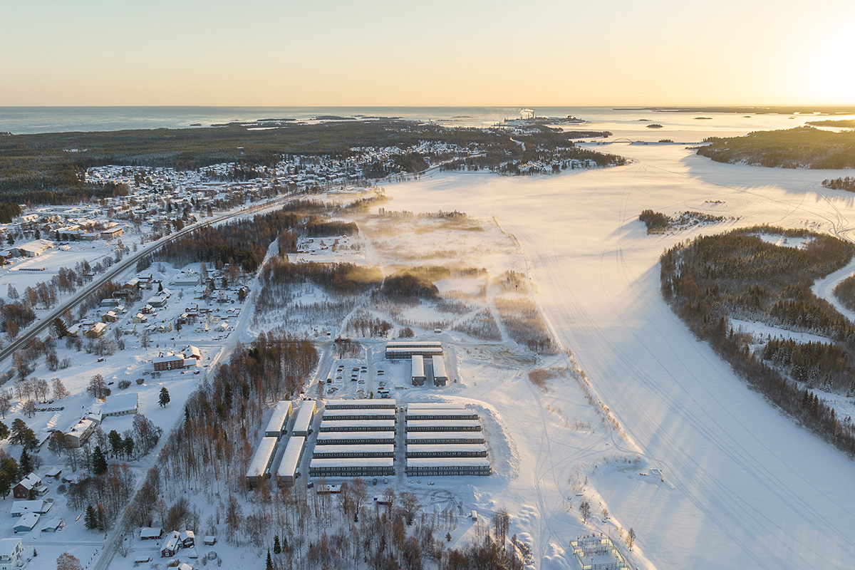
The green industrial transformation is also shifting the direction for Northern Sweden. In recent years, the municipality of Skellefteå has become a Swedish and European symbol of growth, future-proof energy solutions and ground-breaking technology. The largest battery factory in Europe has been established in Skellefteå. Together with the richness of natural resources from forests, rivers and minerals, as well as well-developed renewable energy production, it gives this city in the periphery of Europe, unique conditions for the new green industries from a global perspective. The region that until recently had a long period of low development now attracts multi million industrial investments.
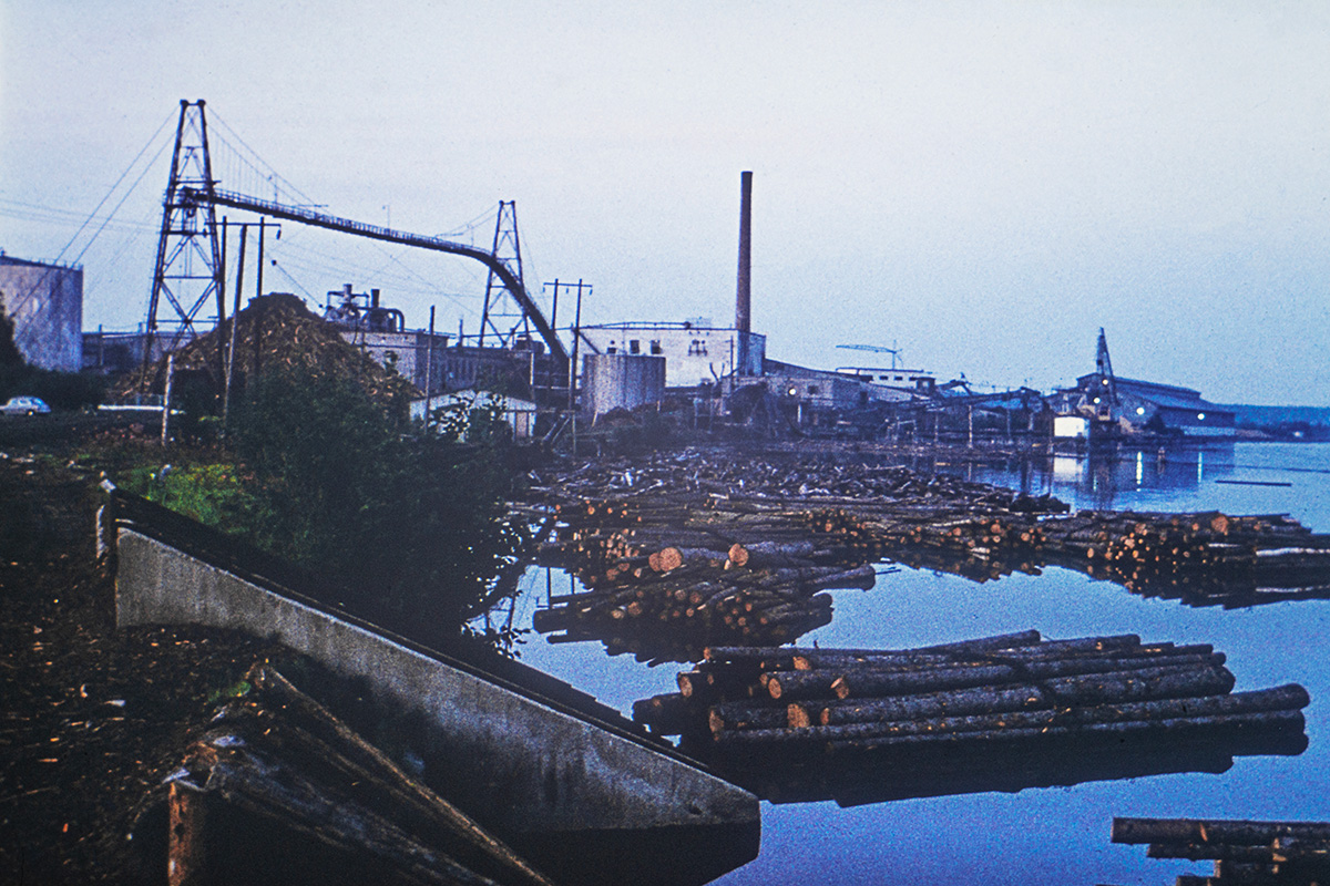
Skellefteå is growing from 74 000 inhabitants to 90 000 in 2030, with the expectation to continue growing even further. Hence, the need for new residences is very high.The project site at stake is a former wood pulp industrial area. Part of the soil is after a decontamination still not reaching the requirements for safe houses. The proposals should present new residences in a living and attractive milieu while taking care of the existing values such as the direct closeness to the river and surrounding nature, offering opportunities to flourish again.
Planning and building the new area of Scharins, gives the opportunity to take care of abandoned industrial land with historical traces, set in a beautiful scenery along the river.Today the site is overgrown with bushes that makes it barely accessible. Treating the soil and creating strategies for a healthy living environment will add values to the area, improving conditions for natural and urban life in co-existence. The abandoned land is not to be seen as a blank paper for development. Beyond handling the soil’s remaining contamination, it will be impor tant to map the site with traces and narratives from history, the landscape, climate conditions, context of building traditions, scales and typologies and the high and extraordinary development rate for Skellefteå.
Questions to the competitors
The vision is to transform Scharins into an exclusive living environment, surrounded by greenery and water. How can new life be given to this barren land that once was a prosperous harbour for global trade and production? The area should offer a mix of housing and businesses as well as areas for recreation and lei- sure activities. The proposals should include 1000–3000 homes. The scale should be relatively low, to fit in with the surroundings, mainly consisting of residential blocks. Proposals should demonstrate:
• A vision of transforming this old industrial site to a vibrant neighbourhood where people, animals and nature may co-exist in a unique place close to the river.
• Innovative and sustainable solutions to build safe residences despite the partly contaminated ground. Are there experiences and lessons from other locations with similar challenges, that can be applied to Scharins?
• Ways to build on the exclusive location next to the river and the creation of recreational opportunities for residents and the public.
• How can the new residential area highlight the history of the location, taking into consideration the previous function as a prosperous global trading port and the wood industries?
• How can accessibility to Scharins increase for residents and visitors?
• How to strengthen the area as a meeting place for a variety of people, encompassing housing, companies and recreational facilities. What functions, businesses and services could be added?
• Ways to enhance biological diversity and climate change adaptation, e.g. through increased and varied vegetation, improvements of the nearby stream, and by taking care of access water.
• How to facilitate social integration through a diversity of residences and forms of tenure.
• The arctic climate must be taken into consideration.
Questions on the site
Will you be adding information under these two (2) (now empty) headlines? PS-e_maps-topography (0) PS-f_maps-characteristic-elements (0)
We will not be adding more information under topography or characteristic elements, as the topographical information is already included in the dxf files under other headlines and we have not considered that other characteristic elements needed further detailed information. This could, of course, change in the case of the competitors needing more specific information.
Hi! In the Skellefteå Brief, there's a map of the contaminated soil at the site, with dots for Metal & Dioxine. Under the map it says: "for further information, see Appendix" In the end of the brief there's Appendix 1 & 2 but with no further info about the contamination of the site, as far as I can see?
For further information (in swedish) on the contaminations please see the links below:
- Map of the contaminated soil: Scharins (arcgis.com)
- Municipality’s website for Scharins decontamination: Saneringsprojekt - Skellefteå kommun (skelleftea.se)
- Final report of the decontamination (2020): Slutrapport för hela scharinsprojektet 2005-2017 20201124.pdf (skelleftea.se)
Will you publish the site visit and where?
Yes, the site visit video will be published in the site area in Europan Europe´s website and in the Europan Sweden youtube channel
This site is connected to the following theme
THINK TABULA NON-RASA! Some nature reserves around the world are deserts –hot or cold–, but they host all kinds of animals and microorganisms hiding in the cracks and crevices, under the rocks. Some of our sites look empty, vacant, but they are not. They are full of life: in the soil, in the air, in the breeze. They are part of a larger balance of natural forces and processes. On these sites, substantial new volumes of programme are required. Think of these sites as the opportunity to multiply the number of life forms, think of the request to build new habitats as an opportunity to design a holistic environment. Think tabula non-rasa!
Designing new habitats as a holistic environment
Specific documents
Questions on the site
You have to be connected –and therefore registered– to be able to ask a question.
Fr. 16 May 2025
Deadline for submitting questions
Fr. 30 May 2025
Deadline for answers
Before submitting a question, make sure it does not already appear in the FAQ.
Please ask questions on sites in the Sites section.
Please ask questions on rules in the Rules section.
If your question does not receive any answer in 10 days, check the FAQ to make sure the answer does not appear under another label or email the secretariat concerned by the question (national secretariat for the sites, European secretariat for the rules).