Clermont-Ferrand (FR)
The Synthetic Site Folder and Site Brief are available for free.
Please register and login to access the Complete Site Folder.
- Synthetic site folder EN | FR
- Site Brief EN | FR
- Site on Google Maps
- Back to map
Data
Clermont-Ferrand (FR)
Scales XL/L
Team composition Architect mandatory
Location Clermont-Ferrand (63)
Population City – 150,000 inhabitants, Metropolitan Area – 300,000 inhabitants
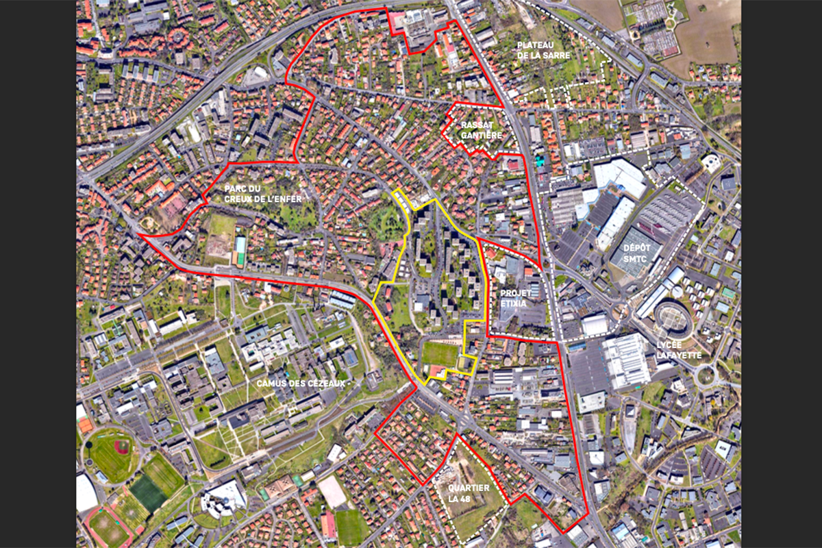
Reflection site 90 ha - Project site 13 ha
Site proposed by Assemblia
Actors involved Assemblia, Clermont Auvergne Métropole, City of Clermont-Ferrand
Owner(s) of the site Assemblia, City of Clermont-Ferrand
Commission after competition Study and project missions for the further development of strategic proposals, feasibility studies on the project site including the prefiguration of uses and/or the reuse of buildings, urban and/or architectural project management mission(s)
More Information
SITE / CONTEXT
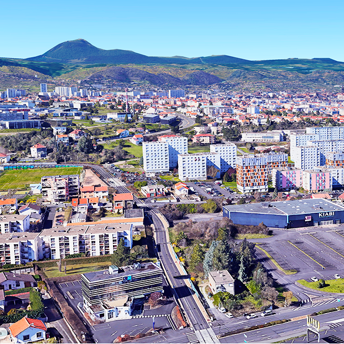
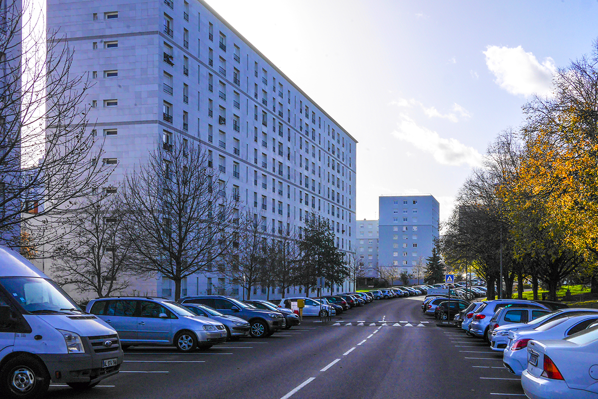
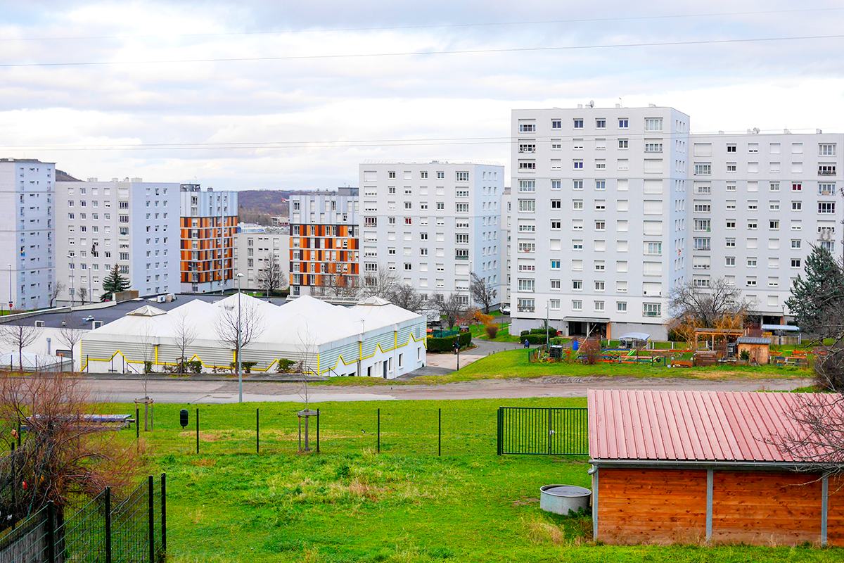
La Fontaine du Bac is a neighborhood located in the southeastern arc of Clermont-Ferrand, near La Pardieu—one of the largest commercial and business districts of the metropolitan area—and just below the Cézeaux university campus. Bounded to the north and south by two major roadways connecting Clermont-Ferrand to the southern and southeastern municipalities of the metropolis, including Cournon, the neighborhood experiences the daily ebb and flow of commuters. Strategically positioned just 10 minutes by car from the Clermont La Pardieu SNCF train station and 5 minutes from the highway interchange between the A71 (linking Orléans to Clermont-Ferrand) and the A75 (connecting Clermont-Ferrand to Béziers), it serves as a regional and national gateway into the city.
Built in the early 1970s on the urban fringe, on former agricultural strip plots, La Fontaine du Bac long retained its status as an entry point into the city. Over time, its surroundings have densified—first with the creation of the Pardieu business district in the early 1980s, bringing the aesthetics of a «franchise city» to this urban gateway, and later with the proliferation of suburban housing developments from the 1990s onward. Today, as one of many fragmented urban entities, La Fontaine du Bac is part of a sprawling, diffuse cityscape that extends almost continuously to the metropolitan limits. The expansion of Clermont-Ferrand’s public transport network, combined with the transformation of adjacent commercial zones, is set to reposition La Fontaine du Bac—once on the city’s periphery—at the heart of the metropolitan area in the near future.
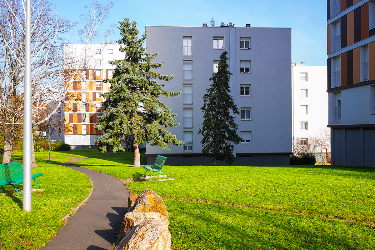
A large-scale housing complex with 909 units distributed across 24 buildings on a 6.4-hectare site, La Fontaine du Bac, like many developments of its era, benefits from generous outdoor spaces weaving between and around the towers—accommodating parking lots, green lawns, and playgrounds. The presence of these green spaces, along with the neighborhood’s accessibility, contributes to the deep attachment of its residents, who affectionately refer to it as «the village.» Among Clermont-Ferrand’s priority neighborhoods (QPV), La Fontaine du Bac has the longest average length of residence, resulting in a significant proportion of elderly social housing tenants.
To address the aging and increasing economic vulnerability of its population, while also embracing ongoing societal and environmental transitions and anticipating the evolution of neighboring districts, La Fontaine du Bac must now embark on a profound transformation.
QUESTIONS FOR THE COMPETITORS
How can the transformation of La Fontaine du Bac be approached in a measured and sensitive way through the revitalization of its landscape spaces? By enhancing and intensifying its outdoor spaces, the neighborhood can become a valuable resource in terms of biodiversity and everyday uses, fostering an endogenous transformation. What spatial reconfigurations and landscape interventions should be implemented to make the neighborhood more adaptable to major future changes—whether urban, social, or climatic?
How can metropolitan dynamics and neighborhood-scale dynamics be reconciled? La Fontaine du Bac is currently an isolated district, seldom frequented by outsiders. Reintegrating it into broader metropolitan transitions requires overcoming both physical and psychological barriers. How can the neighborhood be opened up to adjacent districts while preserving and even strengthening existing social and community dynamics?
What role should residents play in the transformation and management of their neighborhood? The transformation of La Fontaine du Bac cannot be dissociated from a long-term strategy for its governance, led by and for its residents. This transformation offers an opportunity to rethink how social housing is inhabited and, consequently, how it is administered in the 21st century.
Questions on the site
Bonjour, vous mentionnez dans le dossier de présentation du site l'ancienne source de la Fontaine du Bac, avez-vous plus d'informations ou de documentation à propos de cette source ?
All the documents we could gather are on line.
Bonjour, Lors de la visite du site de Clermont-Ferrand, un tableur avec des données "brutes" sur les habitants de la Fontaine du Bac a été évoqué. Peut-il être transmis aux équipes ? Merci d'avance
Two .xls files have been added online in the folder "new docs after launch".
combien de concierges y a-t-il sur le site et où sont-ils situés/ comment les bâtiments sont-ils répartis entre les différents concierges ? le système fonctionne-t-il bien ?
We have a total of six caretakers on site, distributed as follows:
From 8 to 18 Fontaine du Bac
From 2 to 6 Fontaine du Bac and 264/266 Rue de l'Oradou
From 49 to 59 Gantière
15/20/22 Fontaine du Bac and 47 Gantière
1 to 13 Fontaine du Bac
17 to 21 Fontaine du Bac
There is no lodge, but the caretakers share an office at 18 rue de la Fontaine du Bac.
To assign a caretaker, we calculate the number of hours of work to be done and make sure that the buildings are close to each other. We also take into account the difficulty of the sites and how the caretakers live.
We have no difficulties with the general organization.
quel est le budget actuel pour l'entretien de l'espace public (plantations, pelouses, arbres) ? comment l'entretien est-il organisé, à quelle fréquence ?
The annual budget for maintaining green spaces is approximately €31,700 including tax. According to a set schedule, the grass is mowed 12 times and the hedges are trimmed 4 times per year.
nous avons lu dans le dossier du concours, qu'Assemblia avait de bonnes et de mauvaises expériences avec des bâtiments de garage ? auriez vous plus d'info à ce sujet et des éléments à éviter ou à prendre en compte, d'après votre expérience ?
This remains a sensitive issue for the community, as landlords such as Assemblia have experienced difficulties managing multi-storey car parks, most of which date back to the 1970s, for technical and fire safety reasons, compounded by the presence of drug deals, which has led to both physical insecurity and arson attacks. This led to the closure or demolition of these multi-storey car parks. That is why, on page 37 of the site file, we warn against this type of infrastructure without actually prohibiting it.
That said, we would like to point out that if this solution is addressed in the candidates' responses, it must be done with precision in both form and content (management). It should also be noted that this type of parking structure is currently under construction in the metropolitan area in park-and-ride zones as part of the Inspire project.
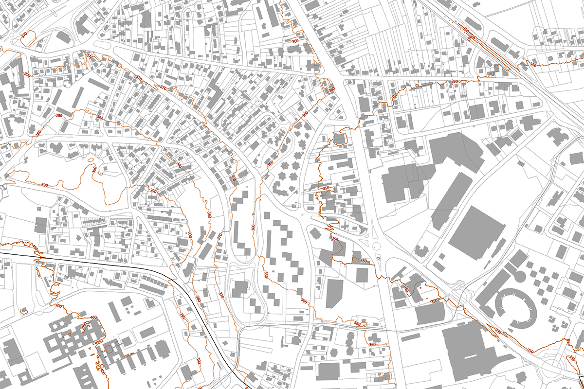
pouvez-vous nous fournir des plans plus détaillés concernant : 1) le système d'évacuation des eaux usées / le système de gestion des eaux de pluie, etc... souterrain sur l'ensemble du site (et bâtiment par bâtiment). l'installation actuelle ou telle qu'elle a été construite 2) les courbes de niveau sur le terrain
Here are more detailed plans concerning:
- the wastewater disposal system / rainwater management system, etc., underground throughout the site (and building by building), current installations or as they were built.
See the appendices provided in the initial site file and added to the “new docs after launch” directory:
FR-CLERMONT-C-M6 pdf Network plan - drinking water
FR-CLERMONT-C-M7 pdf Network plan - rainwater
FR-CLERMONT-C-M8 pdf Network plan - wastewater
A Declaration of Intent to Carry Out Work file completed by the various concessionaires on the “build without destroying” teleservice platform
Plans for connection to the district heating network
- the contour lines on the terrain, as assumed in the following document in the “refexion site > SS-d-e_maps” file:
FR-CLERMONT-SS-M2 jpeg: Site plan for part of the site under consideration
In addition, ypu will find in the "new docs after launch" folder, the topographical plan that we did not provide, even though it is incomplete and focuses heavily on roads:
GTF – Export Topographical Plan
quelle est la composition/le profil actuel des locataires ? combien d'appartements par type y a-t-il sur le site ?
The figures have been uploaded to the “new docs after launch” folder on the server.
des informations sur les efforts d'adaptation climatique de la ville ? (gestion des eaux de pluie, prévention de l'îlot de chaleur urbain, etc.)
Answers were provided in the site brief (see p.23):
"In 2013, Clermont Communauté and the City of Clermont-Ferrand jointly launched a study on the territory's vulnerability to climate change. This study, conducted by the Météo France - Mosaïque Environnement consortium, aimed to analyze climate change, assess future climate conditions, and identify the impacts of climate change on key sectors (health, water resources, the economy, etc.). The study highlighted the great richness of the Clermont region, particularly in terms of biodiversity, both in terms of fauna and flora, but also its high vulnerability to heat waves and natural hazards (floods, forest fires, etc.). Following on from this study, in 2019 the Metropolis adopted an Energy and Ecological Transition Plan with the aim of becoming an energy-positive region by 2050 by halving the region's energy consumption compared to 2012 and covering the remaining needs with renewable energies. This plan is built around three major axes: preserving resources and adapting the territory to future changes (conservation of natural spaces and environments, development of green and blue cities, creation of an agricultural green belt to develop the Metropolis' food autonomy, etc.); promoting local resources by relying on the economic fabric (development of renewable energies, making residents active consumers and actors, perpetuating circular economy initiatives, etc.); focusing on an energy-efficient and energy-saving region (implementing a master plan for housing renovation, promoting alternative modes of transport to private cars, etc.)" (5).
The index “5” refers to the following indication: 5. Summary of the Energy and Ecological Transition Plan available online: https://www.clermontmetropole. eu/fileadmin/user_upload/ preserver_recycler/transition/1_-_ Synthese_2019.pdf
> The energy and ecological transition plan is stored in the “new docs after launch” folder and can be downloaded from the Europan Europe website.
l'ancien pavillon situé entre le terrain de football et le terrain de tennis est-il actuellement utilisé ? pouvez-vous nous communiquer un plan de ce bâtiment ?
I think I understand which building we are talking about. However, there are also modular buildings (bungalows) in the immediate vicinity of the City Stadium Papillaud. I assumed that the question could concern either building (see photos and aerial view in the "new docs after launch" folder under the name "stade-foot-pavillons.pdf"), so we are providing answers for both cases.
The modular buildings are mainly used as changing rooms, offices, and a large activity room for associations.
The old building located near the stadium and tennis courts consists of several association rooms (soccer, pétanque, tennis, etc.), storage rooms, and a refreshment bar. One wing of this building is in very poor condition.
Room No. 8 has just been renovated as part of a “participatory budget” project. It will soon be allocated to the “compli6té” association.
L'espace de stationnement est-il actuellement suffisant ou insuffisant ?
The site currently has around 889 parking spaces. We count approximately 797 above-ground spaces, including 240 on Rue de la Fontaine du Bac and 240 along Rue de la Gantière and Rue de l'Oradou, as well as 92 garage spaces on Rue Fontaine du Bac, 44 near Victor Hugo Elementary School, and 48 across from Parc de la Fontaine du Bac. This represents almost one space per apartment (909 units). see document "parkings.pdf" in the "new docs after launch folder".
Our tenants want (always) more spaces. However, in the midst of an ecological transition and with rising energy costs, we believe that the number of vehicles will inevitably decrease in the future. This is all the more likely with the public transportation options available at the doorsteps of our buildings, including the existing tram line and the BRT line C, which will begin operating at the end of 2025. This should encourage some tenants to give up their cars.
This is a delicate subject because cars are very important to our tenants today, but we also know that the future will likely see a reduction in the number of vehicles. The challenge is therefore to come up with a solution that is viable in the short, medium, and long term... could this solution be scalable?
Y’a t’il un marché hebdomadaire dans le quartier ? Ou quel serait le marché le plus proche ? A quelle fréquence ont-ils lieu ?
Clermont-Ferrand open-air markets or in door market
https://clermont-ferrand.fr/liste-des-marches
https://www.annuaire-mairie.fr/marche-clermont-ferrand.html
Pouvez-vous nous fournir le plan des écoulements d’eau pluvial/stockage par bâtiments ?
We could get to these very technical documents.
Savez vous quel est le système de restauration de l’école primaire ? Y a–t-il des cuisines ?
The Victor Hugo school group does not have its own kitchen.
Meals are prepared in a central kitchen and delivered daily.
https://opendata.clermont-ferrand.fr/pages/menus-municipaux/
Vous mentionnez dans le Dossier de site des annexes au dossier “T-A1” à “T-A4” qui ne sont pas téléchargeables sur la fiche de site du Projet de Clermont Ferrand. Est-il possible de les récupérer ?
The mentionned documents have been added into the folder "new docs after launch".
This site is connected to the following theme
Re-sourcing from social dynamic How to transform urban areas and enclaves into open neighbourhoods? How to constitute the smallest urban entity of proximity, exchange and governance, consisting of humans and more than humans? Open urban neighbourhoods can be enablers of citizenship and accommodators of diverse temporalities of stay. They may be pivotal sites for initiating and implementing social and ecological changes, rippling through the rest of the city, thus being valuable for the European Green Transition.
Promoting open Neighbourhoods
Specific documents
Questions on the site
You have to be connected –and therefore registered– to be able to ask a question.
Fr. 16 May 2025
Deadline for submitting questions
Fr. 30 May 2025
Deadline for answers
Before submitting a question, make sure it does not already appear in the FAQ.
Please ask questions on sites in the Sites section.
Please ask questions on rules in the Rules section.
If your question does not receive any answer in 10 days, check the FAQ to make sure the answer does not appear under another label or email the secretariat concerned by the question (national secretariat for the sites, European secretariat for the rules).