Zagreb (HR)
The Synthetic Site Folder and Site Brief are available for free.
Please register and login to access the Complete Site Folder.
- Synthetic site folder EN
- Site Brief EN | EN
- Site on Google Maps
- Back to map
Data
Zagreb (HR)
Scales L/S
Team composition Architect mandatory
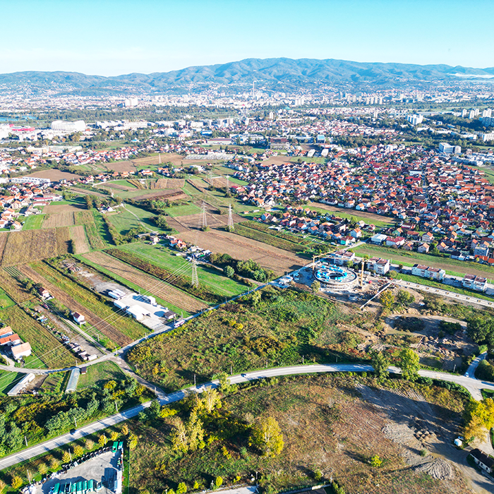
Location Zagreb, Croatia
Population Novi Zagreb 119,815 inhabitants, Zagreb 767,131 inhabitants
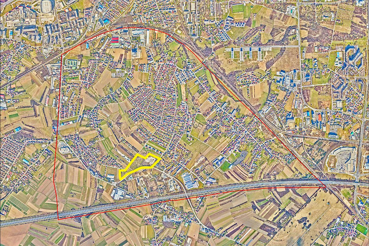
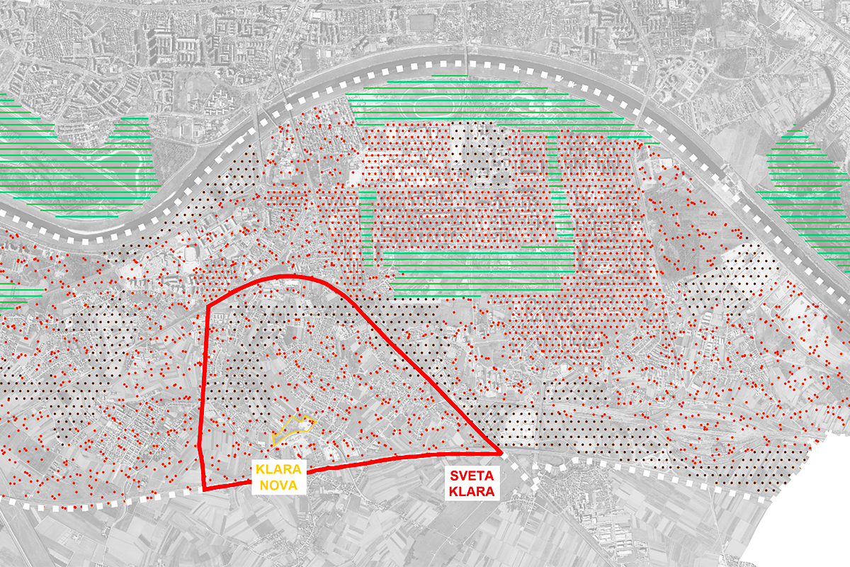
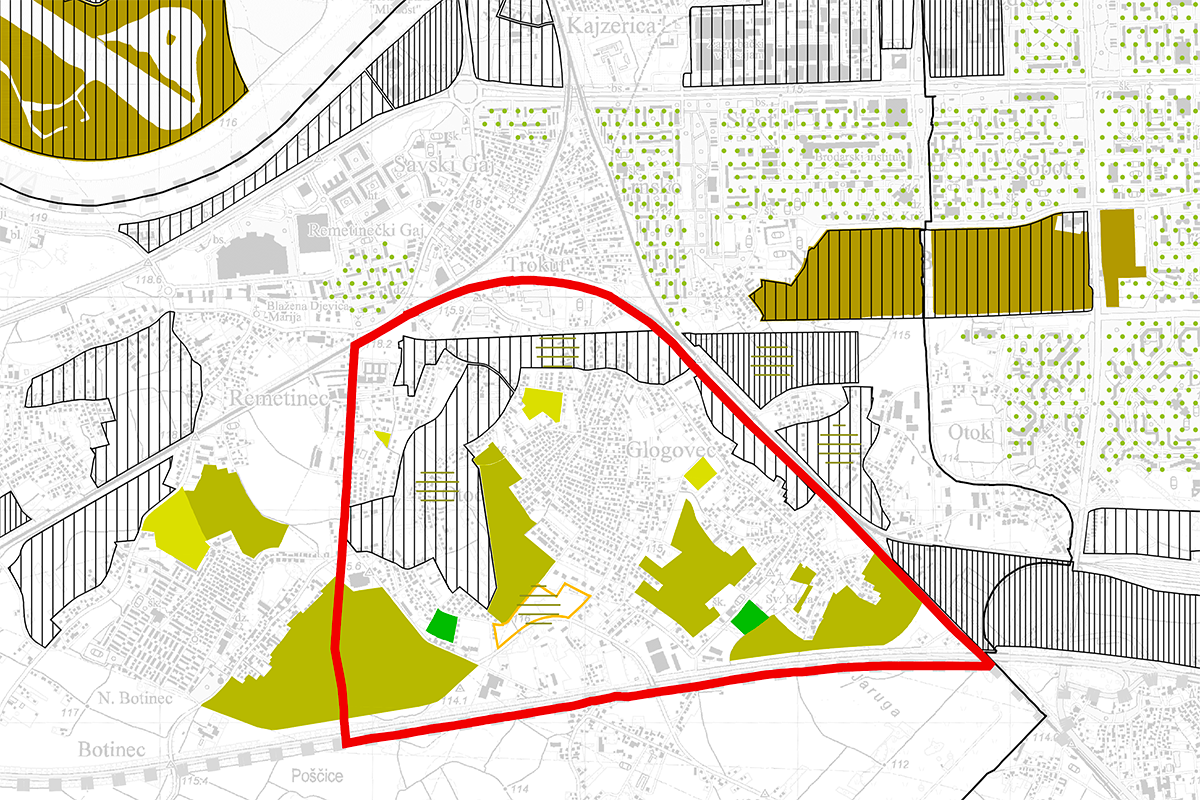
Reflection site 410 ha - Project site 4,62 ha
Site proposed by City of Zagreb
Actors involved City of Zagreb
Owner(s) of the site City of Zagreb
Commission after competition is an URBAN DEVELOPMENT PLAN.
More Information
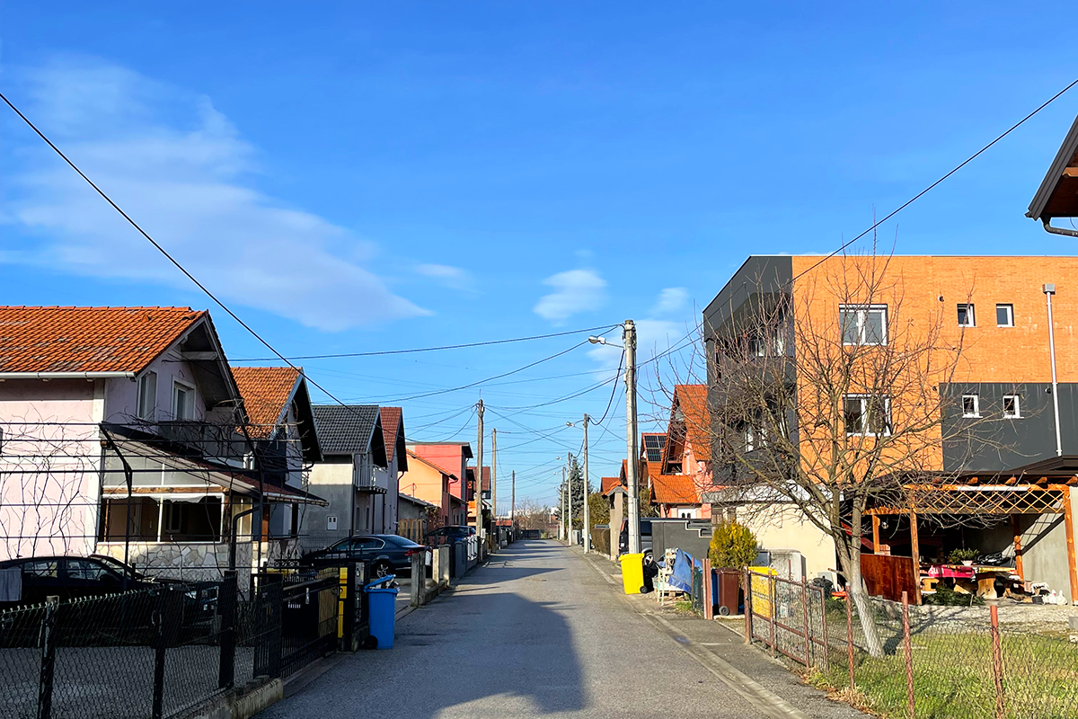
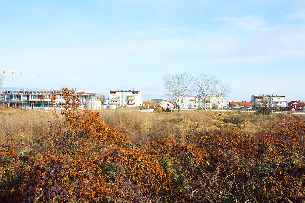
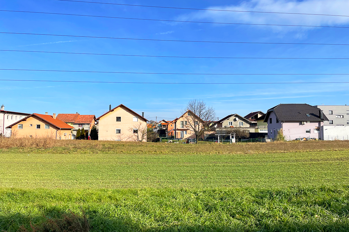
SITE / CONTEXT
Klara Nova is located on the southern edge of Novi Zagreb. Its typology and level of consolidation define it as a suburban periphery of Zagreb. It is developed on a matrix of rural agricultural parceling, separated from its broader context by infrastructure corridors, which clearly mark the boundary between the planned Modernist neighbourhoods of Novi Zagreb and its rural outskirts.
The city’s expansion across the Sava River began in the mid-20th century with the construction of the Zagreb Fair and the bridge along the central urban axis. In the socialist system, new housing estates were developed based on the Athens Charter principles and the functionalist city concept. These estates followed orthogonal matrix, featuring freestanding multi-apartment buildings surrounded by large park areas.
Simultaneously with the planned development of residential neighbourhoods, unplanned self-built housing areas emerged around historical village centers and along roads and pathways. Traditional villages have transformed into sparsely populated suburbs, a substandard urban periphery lacking adequate social and communal infrastructure.
With the transition to a market economy,prioritization of private ownership and investment shifted urban planning focus from integrated spatial development to individual land parcel planning. The reduced investment and organizational capacity of the City led to so-called «microlocation planning». This was reflected in a significant increase in private residential and commercial construction, alongside a decrease in public and social facilities, parks, recreational areas, and infrastructural networks, especially when compared to the Modernist urban plans.
A persistent trend of expensive and unaffordable housing has been aggravated by a limited supply of public housing units, the increase of short-term rentals, and the 2020 earthquake that temporarily rendered a substantial portion of the housing stock unusable.
The implementation of municipal policies and spatial planning documents envision the development of affordable public housing on this brownfield site. This project aims to include public, social, and sports-recreational facilities, as well as green park areas, creating a model for organized, contemporary residential communities through planned housing development.
QUESTIONS TO THE COMPETITORS
At the level of the Reflection site, in accordance with the topic of Re-sourcing, it is necessary to propose scenarios for revitalizing the broader community, where the new neighborhood will become an integrating factor for all undefined levels of urbanity, primarily through urban regeneration and increasing of urban standards.
How can new spatial models be developed to coexist with the existing ones, in order to strengthen the neighborhood of Sveta Klara as a place of interaction and participation for its residents and users? How can the use of sustainable modes of transportation in suburban areas be encouraged while reducing dependence on personal vehicles?
At the level of the Project site, it is necessary to propose urban design for an inclusive and climate-resilient residential neighborhood for affordable living and working, with a comprehensive landscape design. Additionally, the task includes developing a conceptual design for buildings with modular layout, and floor plans providing varying levels of privacy/communal spaces.
How can we create peri-urban residential communities by reinterpreting the tradition of coexistence and cooperation between humans and their environment?
How can we organize facilities of a new community and rethink a spectrum of diverse and dispersed private and communal spaces, at the level of the neighborhood and at the level of individual buildings?
Questions on the site
The project brief (p29) outlines a land use diagram with zones Z1, M1, and R2 assigned within the site.Could you please confirm whether these zones must remain in their indicated positions,or if they can be repositioned within the project boundaries, provided their functions/proportions (M1 60%, R2 25%, Z1 15%), and overall program are maintained?
Yes, it is necessary to maintain the specified land use diagram.
According to the project brief, zone M1 allows for the planning of detached and/or semi-detached buildings. We would like to ask whether proposing additional housing typologies within M1—while still meeting the intended programmatic and spatial goals—would be acceptable, or could such an approach be considered grounds for disqualification?
The proposed housing typologies in the competition brief are determined in accordance with the General Urban Plan of the City of Zagreb, and since the competition is being conducted for the purpose of implementation, it is important that the competition entries comply with spatial planning documents.
The brief states that 5 commercial units and a socio-cultural center must be planned in the residential zone. Does this mean a total of 6 distinct non-residential units (5 commercial + 1 center)? Is it suggested that the 5 commercial units must be integrated within residential buildings, while the cultural center may be located on a separate plot?
This is correct, the commercial units and socio cultural center must be planned as stated in the question.
Regarding the socio-cultural center: the brief states that its area cannot exceed 30% of the gross construction area of a building on the plot, which would be approximately 150 m². If the center is located on a separate plot, does the same 30% limitation apply, or can the total floor area of the socio-cultural center be larger in that case?
In accordance with Chapter 5.2.5 of the competition program as well as Chapter 5.2.2, the socio-cultural center planned on a separate plot may be a maximum of 40% of the plot's floor plan area.
Is the proposed zoning of residential and recreational areas in the ideogram (page 29) mandatory, or can we adapt the zoning to our solution?
The zoning proposed in the competition brief is mandatory.
Is it necessary to follow the proposed cadastral parceling?
The existing cadastral parceling is not mandatory, as stated in the Competition brief.
Is it possible to form zones (residential, recreational, green) in a way that they are not formed as unified areas, as they are shown in the ideogram on page 29? In other words, is it possible to concieve the zones of different uses as divided in a number of smaller areas distributed on the site?
It is necessary to propose a solution in accordance with the zoning from the Competition brief.
On page 30, it is stated that 5 commercial units may be planned. Can they be standalone buildings, or must they be part of residential buildings?
The primary goal is for 5 commercial units to be dispersed throughout the neighborhood.
”Direct access from public traffic areas to parking/garage spaces on the plot is not allowed;” “Each plot must be accessible from a public traffic area, existing or newly planned;” These two sentences are a direct contradiction to each other. Please confirm that the first quoted statement can be ignored?
The above mentioned is not in contradiction, as it refers to the formation of one (common) entrance or exit to an individual plot, given the need to ensure multiple parking and garage spaces for each purpose planned on the plot, according to the norms given in the Competition brief.
Is it permissible to propose scenarios that deviate from the current GUP regulations (e.g., housing typologies, gross construction areas, max. building heights) if these deviations are conceptually justified and contribute to the overall quality of the proposal?
Since the competition is being conducted with the aim of implementation, it is important that the competition entries comply with spatial planning provisions based on the General Urban Plan of the City of Zagreb, in all respects as stated in the Competition brief.
Is it acceptable to propose a collective parking solution—such as a shared garage serving multiple housing units—instead of providing one parking space per unit, if this approach supports a more urban and integrated design?
The General Urban Plan of the City of Zagreb sets out the parameters for stationary traffic in the manner given in the Competition brief. Since the competition is being conducted for the purpose of implementation, it is important that the competition entries comply with spatial planning documents.
Of the 300 new tenants, what percentage or number are young families, large families, and singles? How can we plan the percentage of the apartments by size?
In Chapter 5.2.3. Housing Program of the Competition brief, the structure of housing units is defined as follows:
studios 0-5% of the total number of housing units
one-room apartments 15-30% of the total number of housing units
two-room apartments 35-50% of the total number of housing units
three-room apartments 25-40% of the total number of housing units
four-room apartments and/or apartments for housing communities 0-10% of the total number of housing units
The number of housing units by size are determined according to data on applicants for the allocation of city rental apartments
Is there a way to get existing demographic data on the population in that part of Zagreb (demographic polygon) so that we can have an overview of the population structure today (age, gender, etc.)?
Data from the 2021 population census is available at the link:
https://zagreb.hr/popis-stanovnistva-kucanstava-i-stanova/1043
The data has been processed by city districts – for the competition site, see Novi Zagreb – West, and in the table
https://www.zagreb.hr/userdocsimages/arhiva/statistika/popis 2021 kona%C4%8Dni rezultati/Stanovni%C5%A1tvo prema starosti i spolu po MO GZ, Popis 2021._web.xlsx
is the part of the data for the Sveta Klara Local Council.
At the link: https://zagreb.maps.arcgis.com/apps/MapSeries/index.html?appid=73e33727fad74298a9df9859a2331cd6 , graphical representations of the population structure by city districts are available – for the competition site, select Novi Zagreb – West.
Are there any health facilities in the area today, and can we propose health-type facilities in the competition area, within the non-residential units?
The competition program stipulates that 5 business units with proposed uses such as a small shop, a small craft business, a dental office, a children's playroom or a veterinary clinic be placed within the residential zone. Within the given number of business units, health-related facilities can be proposed.
Considering that work units are also being proposed - is there any information on what people from the area mainly do?
The requested information does not exist. When considering the topic, it is suggested to focus attention on the proposed solutions for new scenarios of life in a specific peri-urban community, in accordance with chapter 5.3, point 1, of the Competition brief.
In the wider scope of the entire neighborhood of Klara, is it necessary to pay attention only to the traffic solution or to something additional?
Chapter 4.2. of the Competition brief defines the expected solutions at the level of the zone of influence of the neighborhood of Sveta Klara. The requested solution must be designed based on the relevant data presented in Chapter 4.1. Current state and planning guidelines, with the possibility of other proposals according to the author's interpretation of the task and the perspective of the competition area.
This site is connected to the following theme
Re-sourcing from social dynamic A missing layer of urbanity is added on a territory with underlying complexities. In all these large sites, the question is how inhabit them, how to relate to them, how to add a human ecosystem while negotiating the pros and cons of the existing complexity. It may be to reconsider an urban interrupted development, to care wounds left or created by old or new infrastructures; to regenerate sub-standard housing or the damage left behind a brownfield, to reconsider a river or former agricultural fields.
Creating New Urban Relationships
Specific documents
Questions on the site
You have to be connected –and therefore registered– to be able to ask a question.
Fr. 16 May 2025
Deadline for submitting questions
Fr. 30 May 2025
Deadline for answers
Before submitting a question, make sure it does not already appear in the FAQ.
Please ask questions on sites in the Sites section.
Please ask questions on rules in the Rules section.
If your question does not receive any answer in 10 days, check the FAQ to make sure the answer does not appear under another label or email the secretariat concerned by the question (national secretariat for the sites, European secretariat for the rules).