Regensburg (DE)
The Synthetic Site Folder and Site Brief are available for free.
Please register and login to access the Complete Site Folder.
- Synthetic site folder EN
- Site Brief EN
- Site on Google Maps
- Back to map
Data
Regensburg (DE)
Scales L/L
Team composition Architect mandatory
Location Regensburg, Bavaria
Population 170,000 inhabitants
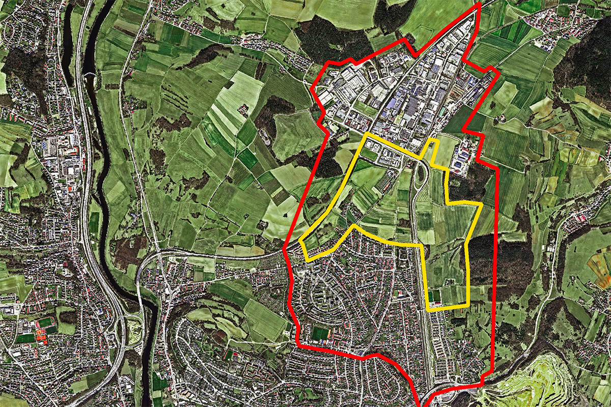
Reflection site 425 ha - Project site 107 ha
Site proposed by Regensburg municipality
Actors involved Regensburg municipality, private partners
Owner(s) of the site Regensburg, private owners
Commission after competition Workshops will be held to discuss and possibly refine the results.The city of Regensburg plans the following steps after presenting the competition results: Specification of the urban-development framework planning; Optionally, beginning at the same time with work on the detailed planning of the first construction section around the mobility point; Transfer of the results for the first construction section to urban land-use planning as well as structural implementation. Depending on the results, commissioning of the selected team is desired, but subject to political and council approval.
More Information
SITE / CONTEXT
For Regensburg, the aim is to develop a mixed- use, low-traffic district that is as climate-neutral as possible. In doing so, it is important to take balanced density, minimal land sealing, and climate resilience into account.
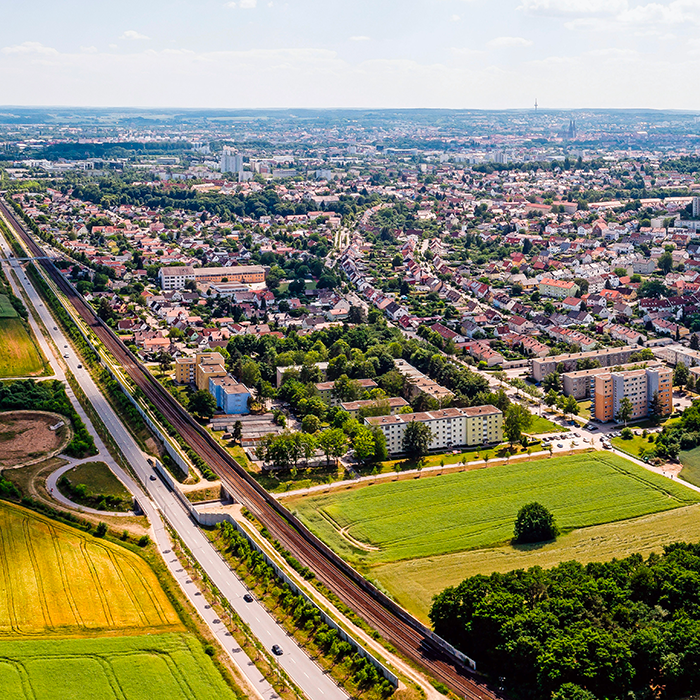
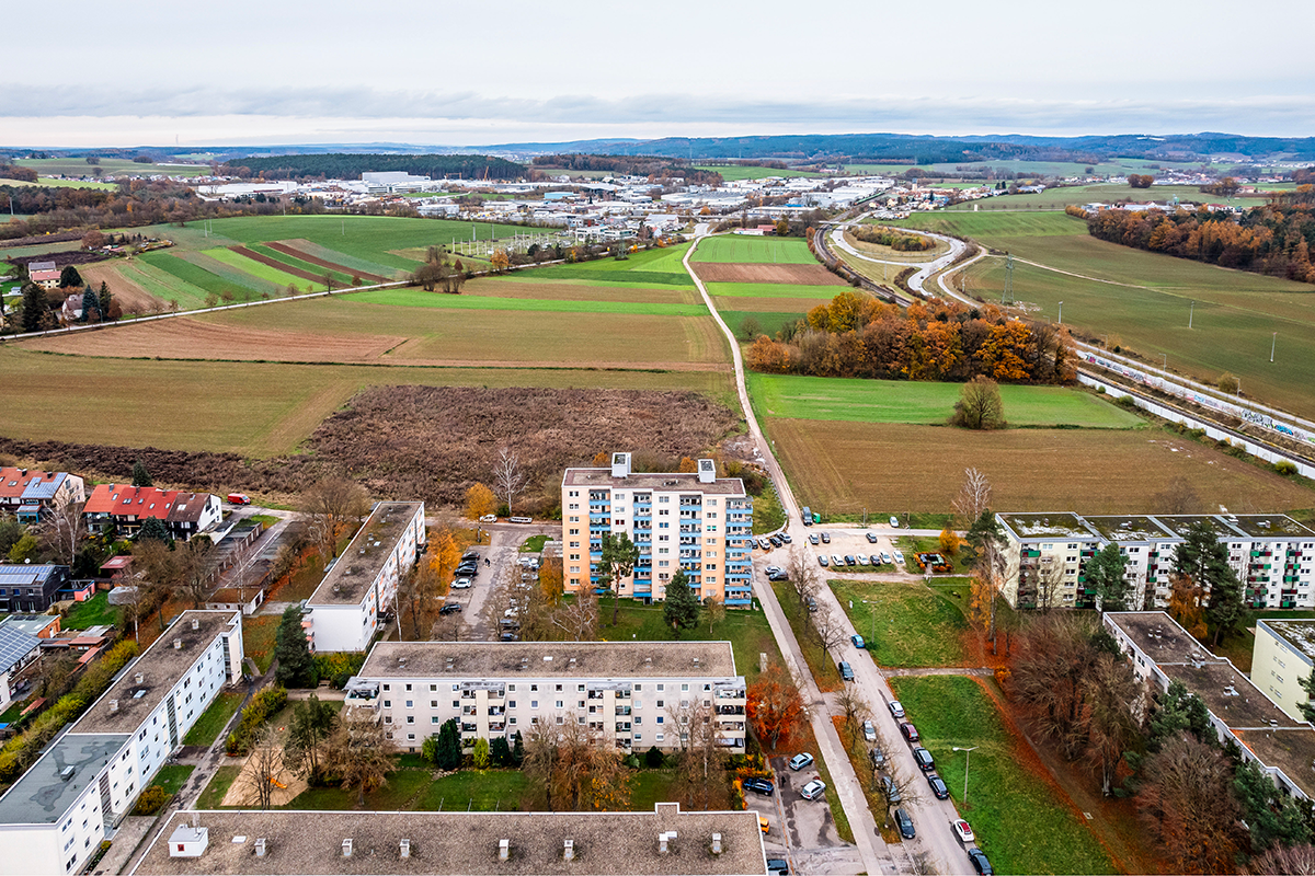
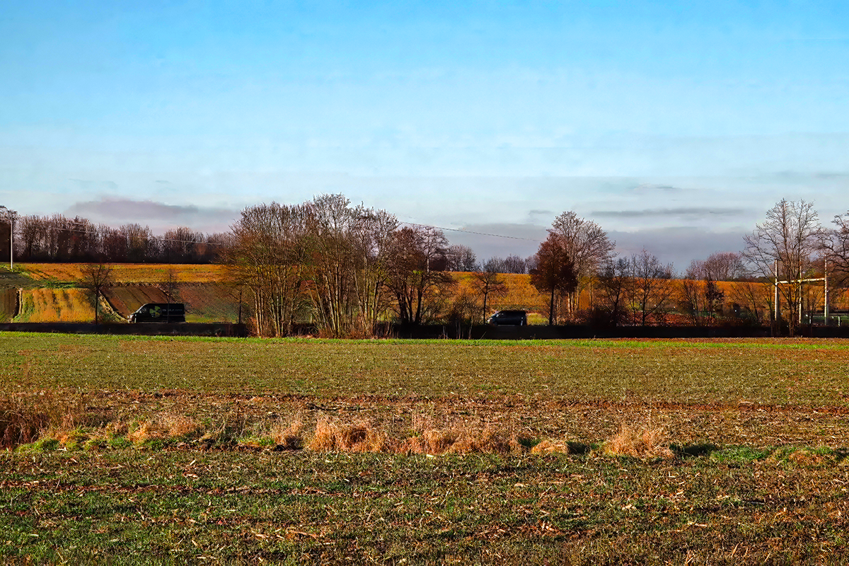
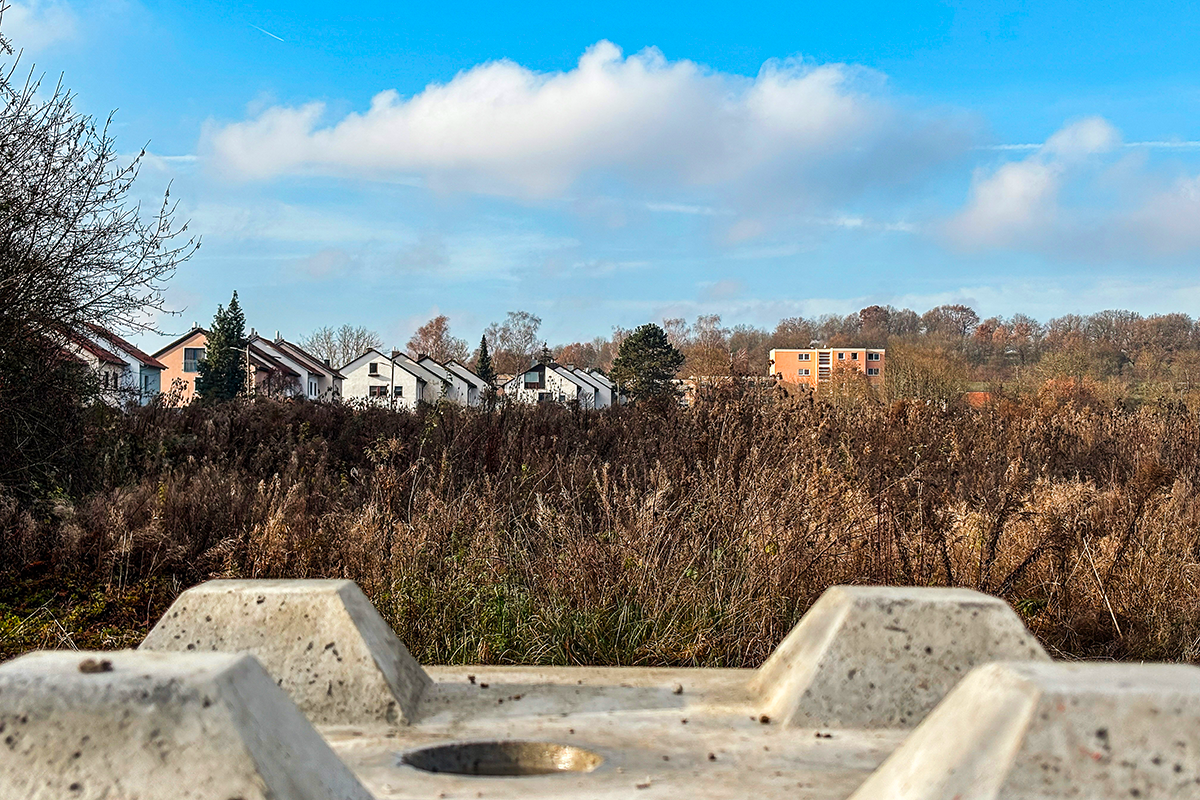
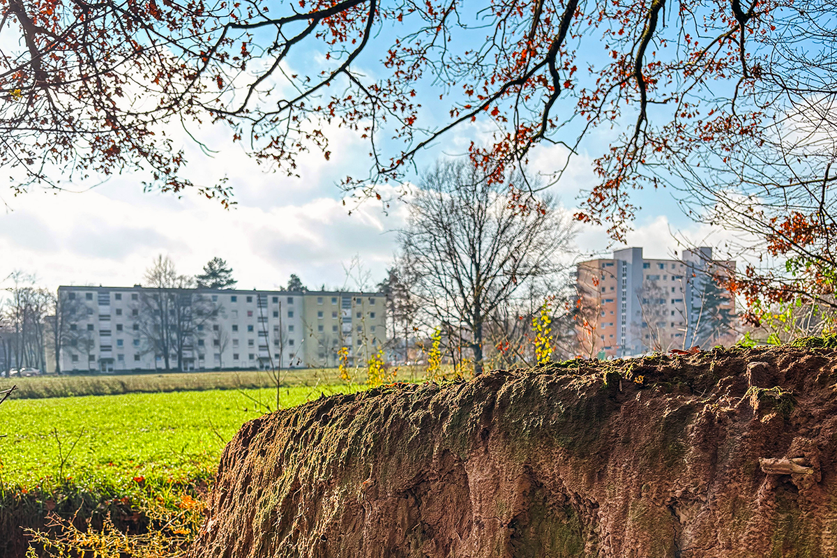
The 107-hectare-large project site in the north of Regensburg represents one of the last large space reserves for the further development of the city and is situated between a commercial area and the existing settlement area.
The new city district is supposed to close the spatial gap and provide affordable living space for at least 5,000 residents. The aim is a city of fifteen minutes: Besides living space with multifaceted, contemporary forms of housing and building typologies, workplaces, commercial premises, and social infrastructures as well as areas for sports and recreation should be created.
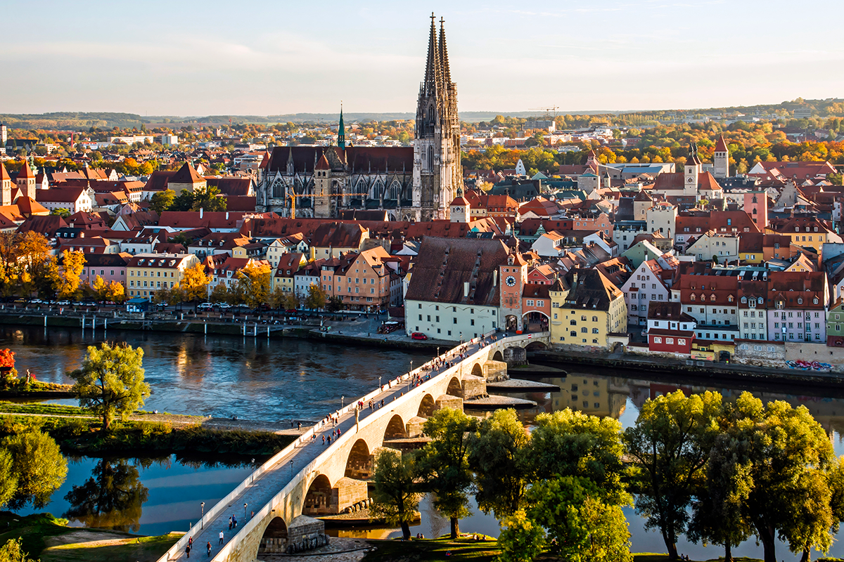
Regensburg, with its roughly 170,000 residents is located in the Free State of Bavaria; in the middle of the landscape of the Danube plain with its river valleys and rolling hills.
What is sought is an urban-development and landscape-planning approach to a solution distin- guished by a future-oriented handling of the high value of unsealed land.This includes careful land usage as well as the integration and transformation of surrounding areas of the city and existing structures as available space resources.
A new sealing of land raises the question of appropriate urban-development density and its distribution.
The expansion of the city is supposed to occur in several development phases – temporally and spatially sensible construction sections should be proposed for this.Work should begin with the detail area 1 at the new railway stop.
QUESTIONS TO THE COMPETITORS
How can an identity-forming, low-traffic city district be created in the sense of a city of fifteen
minutes with a combination of housing, work, and commerce and social infrastructures as well as areas for sports and recreation, and simultaneously distinguished by a future-oriented handling of the value of unsealed land?
In the context of the question of re-sourcing, what is a suitable urban-development and landscape-planning approach to a solution for this task?
How can closing the gap in the urban fabric be designed in harmony with natural processes?
What architectural forms of expression, building methods, and building typologies are oriented towards the future?
Aerial photograph: Stadtverwaltung Regensburg, Amt für Stadtentwicklung; Photo: Hansa Luftbild AG, © Urheber
Other photos: Stadtverwaltung Regensburg; Stefan Effenhauser and Johannes Sporrer
Questions on the site
Are there any 3D geodata available for the site, such as topography or existing buildings?
We received additional documents and uploaded them in the folder 0-New Documents after Launch (name of the folder: DE-Regensburg-Topografy Rahmenplan Nord 1)
Could you please specify the length of the platforms of the planned train station? Is it 170m or 210m?
the approximate location and size of the station can be found in the document (sketch) on the mobility hub, which will be uploaded as soon as possible and can then be found in the New documents after launch folder.
In the framework plan on p.36 - Baufelder Teilgebiet Mitte – It says "Urbanes Gebiet" 50% P+R + 15% Gewerbe + 35% Wohnen / GFZ of 2,5. Therfore a total of 32.700m2 built area is possible 16.375m2 is for P+R? Would this be around 655 car parking spaces (1 parking space =25m2 incl. access)?
The mentioned table in the brief is not intended to calculate car parking spaces, but rather to provide a rough estimate of the population potential. The concept of stationary traffic and a car-free neighbourhood are part of the competition task. The participants should develop their own proposals for this. However, it is not necessary to provide a detailed parking space plan with a specific number of parking spaces in the idea competition.
Should the geometry and outlines of the Baufelder specified in the framework plan be kept as they are, or can they be modified?
The building plots shown are an initial proposal by the City of Regensburg. They can be adapted as part of the new design, provided that the overarching urban planning objectives are taken into account.
When reviewing the data bases, we noticed that the files provided do not contain any data on the existing trees. Does the city have any data on this that could be made available to us?
There is no map with the trees. The existing trees can be seen on the aerial and oblique aerial photographs.
Should the entire area between Chamer Straße and the railway line be shown as the Detail Area 1 (1:1000)?
In the competition brief on page 33, Figure 23, Detail Area 1 is shown graphically. This covers the specific area to be developed between Chamer Straße and the railway line. We would ask you to use this illustration as a guide.
Can both Detail Areas (Detail Area 1: Mobility hub and Detail Area 2: District Center) be located in the area of the initial construction phase (between Chamer Straße and Railway Line)?
In principle, the mobility hub (Detail Area 1) and the district centre (Detail Area 2) can be both located in the same area - for example in the area of the first realisation phase between Chamer Strasse and the railway line - depending on the design. If this is the case, we recommend adding a further area of specialisation in another part of the planning area in order to ensure that two different areas are processed in accordance with the brief.
The 3D data in xyz format doesn't seem to be working and does not have the usual 3 column coordinates. Could you upload the data again please ?
Dear participant, we have been able to open the file without any problems and have not yet been able to detect any technical errors. You also seem to be the only team having problems with the file.
Unfortunately, we are therefore unable to determine where exactly the problem lies and recommend trying a different programme.
The location for the ‘Walhalla’ stop for the regional railway was already specified in the planning documents. Can this point be moved in the course of the urban development concept?
The ‘Walhalla’ railway stop is outside the planning area and its location is fixed. If the question relates to the new ‘Wutzlhofen’ railway stop within the planning area: Its location is also fixed and is already specifically planned by Deutsche Bahn. It is therefore not possible to move it as part of the urban development concept
Can a road run parallel under the high-voltage line in some areas?
Yes
To the north-east of the planning area there is an area of woodland which is still within the city boundary and adjoins the ‘Sonnlandbund e.V. Regensburg Verein für Familiensport’ property. Can this be included in the overall green concept of the project?
The neighbouring forest area to the north-east lies within the city boundary and is designated as a municipal protected forest. Due to its special protected status, it may not be overplanned or utilised. Integration into the overarching green concept can only be envisaged in the form of visual references or open space planning transitions, but not through functional or structural interventions.
Im Bearbeitungsgebiet befinden sich mehrere bestehende Ausgleichsflächen. Inwieweit wäre es im Zuge der geplanten Umgestaltung denkbar, diese Flächen zu verlagern und durch die ökologische Aufwertung anderer Teilbereiche des Areals weiterhin den Anforderungen an Ausgleichsmaßnahmen gerecht zu werden?
There are several existing compensation areas in the planning area. To what extent would it be conceivable to relocate these areas in the course of the planned redesign and to compensate for them through the ecological enhancement of other parts of the site?
Can alternatives to the solar park in the east also be planned? For example, solar systems on the roofs of buildings?
A development plan is currently being drawn up for the areas of the solar park in the east, which stipulates its use as a solar park. Once the development plan comes into force, the land is expected to be used as a solar park for at least 30 years. In the long term, an alternative use of the land may be considered, but it is currently assumed that it will be used as a solar park in the long term. Roof areas can be planned as locations for photovoltaics independently of this.
To what extent must the biotope at the continuation of Sandgasse be restored? Can the bike park remain as it is or does it have to be removed?
The existing biotope at the continuation of Sandgasse must be taken into account in accordance with the applicable nature conservation regulations. Complete restoration is required where interventions are made in protected biotope structures. The existing bike park may remain as long as it does not interfere with the protected biotope areas or their development objectives. A nature conservation assessment and consultation with the relevant authorities will be necessary in the further process.
Can a sports field, running track or playground be located directly under a high-voltage power line?
No. According to the LAI guidelines ‘Notes on the implementation of the Ordinance on Electromagnetic Fields’, the following distances must be maintained around overhead lines, which must be free of relevant immission sites: Width of the strip adjacent to the stationary outer conductor: 110 kV 10 m; 220 kV 15 m. Relevant places of immission are places that are intended to be used by people on a more than temporary basis. These include in particular residential buildings, hospitals, schools, schoolyards, kindergartens, day nurseries, playgrounds and allotment gardens. Restaurants, meeting rooms, churches, market squares, gymnasiums and comparable sports facilities as well as workplaces can also be used for other than temporary residence. Therefore, sports fields, running tracks or playgrounds are not permitted directly under an overhead line.
Does a safety distance have to be maintained around the substation? If so, how many metres?
According to the LAI guideline ‘Notes on the implementation of the Ordinance on Electromagnetic Fields’, a strip of 5 metres in width around transformer substations must be free of relevant immission points.
Relevant places of immission are places where people are not only temporarily present. These include in particular residential buildings, hospitals, schools, schoolyards, kindergartens, day nurseries, playgrounds and allotment gardens. Restaurants, meeting rooms, churches, market squares, gymnasiums and comparable sports facilities as well as workplaces can also be used for other than temporary residence.
The competition brief describes a non-buildable area of 10 metres from the canal route in the continuation of Sandgasse. Do a road, square design, private garden structure or public green space count as overbuilding or are these uses permitted?
No buildings are permitted in the 10 m wide protection strip along the canal route. Buildings of any kind (including ancillary facilities such as garages or carports) and private gardens are excluded. Surface uses such as roads, paths, simple square designs (e.g. paved areas) and public green spaces are permitted - but without tree planting. Deep foundations or elaborate furnishings that require corresponding foundations are not permitted. Permanent accessibility for maintenance and repair must be guaranteed without restriction.
This site is connected to the following theme
Re-sourcing from natural elements In this family of sites, the potential of soils could guide the evolution of a site in a process of space’s regeneration, intensification or addition. The biological dimension of available land could trigger new ecological and social relations, and interactions between organisms for a mutual benefit. From the horizon to the scale of the microorganism: which is the capacity of soils to infiltrate biodiversity provide ecosystem services and give continuity to the territory?
Reactivating Soils
Specific documents
Questions on the site
You have to be connected –and therefore registered– to be able to ask a question.
Fr. 16 May 2025
Deadline for submitting questions
Fr. 30 May 2025
Deadline for answers
Before submitting a question, make sure it does not already appear in the FAQ.
Please ask questions on sites in the Sites section.
Please ask questions on rules in the Rules section.
If your question does not receive any answer in 10 days, check the FAQ to make sure the answer does not appear under another label or email the secretariat concerned by the question (national secretariat for the sites, European secretariat for the rules).