E15 Sites - Saint-Omer (FR)
Making water productive
Site Location Communities of Salperwick, Saint-Martin lez Tatinghem, Longuenesse, Arques and Saint-Omer
Project Scales XL/S - territory / architecture + context
Site Family IMPLANTING - Productive milieus
Post-competition phase Feasibility study and/or project management
See the site page here
See here the map of the different sites
How Can the Site Contribute to the Productive City?
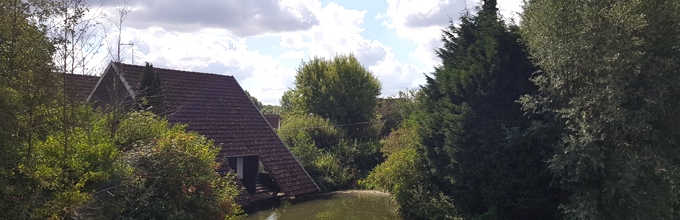
The study site spreads over five municipalities of the intercommunal region (Saint-Martin lez Tatinghem, Saint-Omer, Longuenesse, Salperwick and Arques), a terrain that runs from urban centre to Audomarois marshlands. The site is bordered to the west by a by-pass highway built over a period from 1980 and 2000 and to the east by a simple road along the riverbank. Isolated, often mono-functional areas and neighbourhoods punctuate the site. Local connections, sharing and productive connections need to be developed.
What connections and productive interfaces can be created around the notion of productive water (water and tourism, agriculture, industry, innovation, recreation, sports, etc.): marshland / city interface, sports facilities / educational facilities, Arques city centre / marshlands, Arques city centre /train station area. The reclassification of unused and existing or future abandoned sites needs to be reconsidered and set in motion in order to favour urban diversity, create continuity and urban and natural connections that are in harmony with these districts (at issue are city entrances, landscaping, reclassification of unused and existing or future wastelands).