Grenoble (FR)
The Synthetic Site Folder and Site Brief are available for free.
Please register and login to access the Complete Site Folder.
- Synthetic site folder EN | FR
- Site Brief EN | FR
- Site on Google Maps
- Back to map
Data
/ ©
Grenoble (FR)
Scale XL/L
Team representative architect/urbanist/ landscape architect
Location Grenoble - Isères (38)
Population city 158,454 inhabitants; Grenoble-Alpes Metropolis 443,123 inhabitants
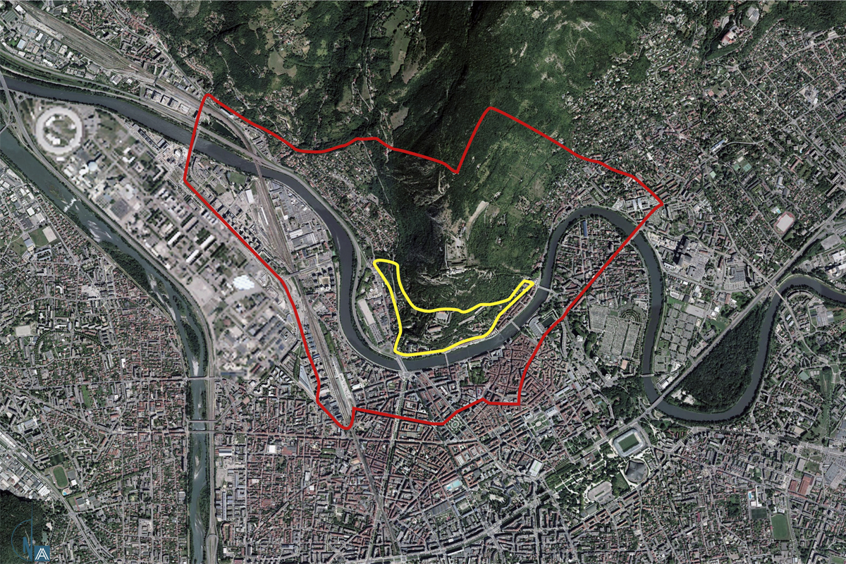
Relfection site 1650 ha - Project site (1) 9,8 ha, (2) 0,7 ha
Site proposed by ville de Grenoble
Actors involved ville de Grenoble, ville de La Tronche, ville de Saint-Martin-le-Vinoux, Grenoble-Alpes Métropole, Conseil Départemental de l’Isère, CROUS, Région Auvergne Rhône-Alpes, Parc Naturel Régional de Chartreuse et l’Agence d’Urbanisme de la Région Grenobloise
Owner(s) of the site ville de Grenoble and the French State
Commission after competition study and project missions on one or more mutable sites. Operational implementations may be initiated with partners
More Information
Urban City Strategy
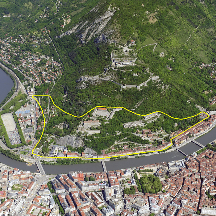
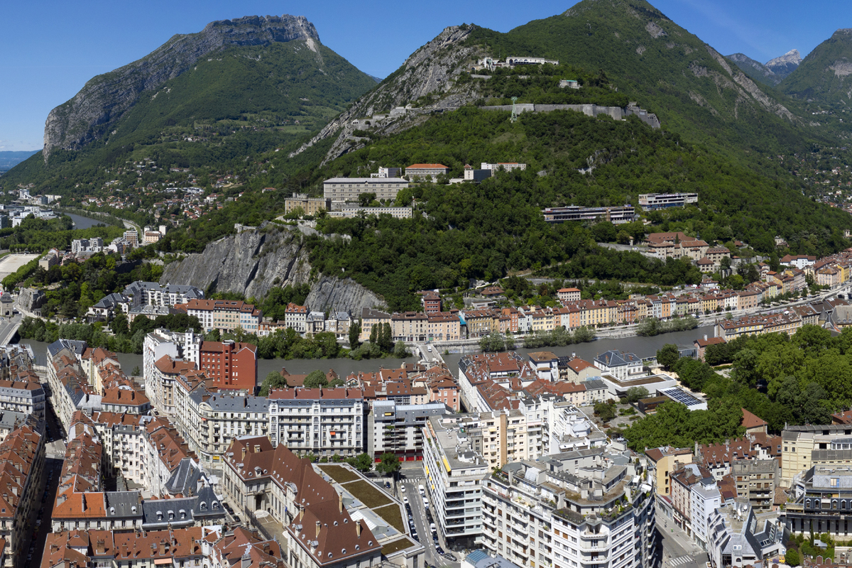
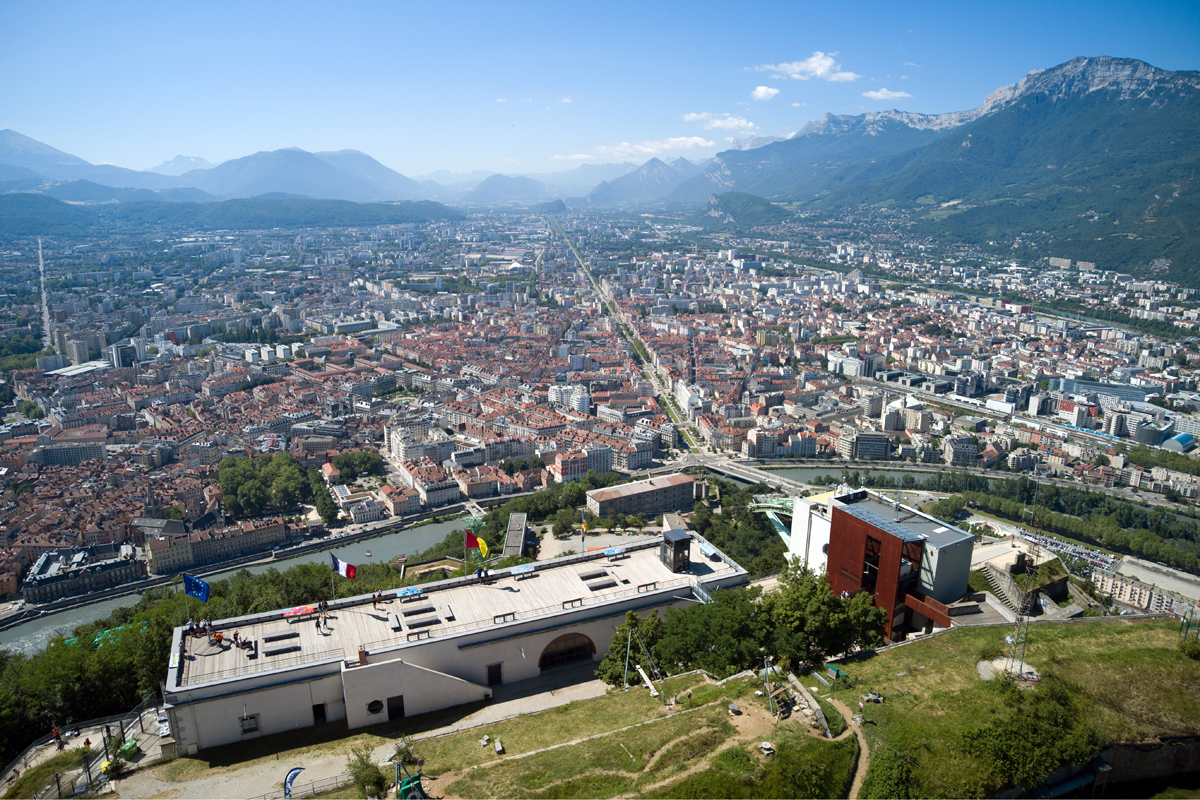
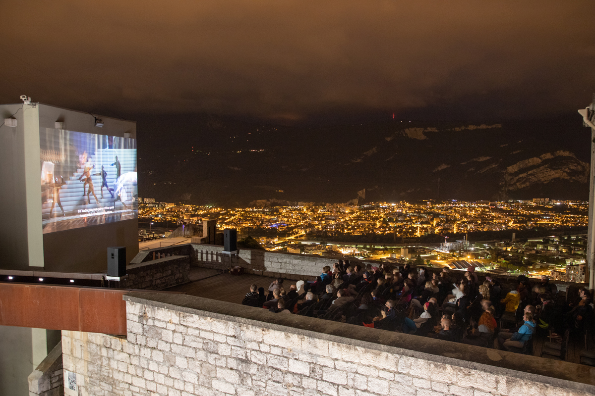
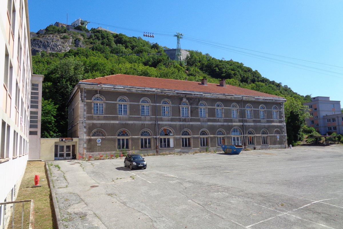
Often described as a rocky spur perfectly aligned with the historic centre of Grenoble, the Bastille, an urban mountain fragment that forms connections between the river (Isère), the massif (Chartreuse) and the buildings of the plain (Grenoble urban area), nevertheless remains a space that is psychologically remote from the entities it overlooks. A place of culture and heritage, a place of tourism and sports activities, but also an inhabited place, the Bastille is simultaneously a sanctuary, a totem and a living space. However, this ignores the fact that even today the site remains hard to access, that it is punctuated with large derelict spaces and that, more globally, it suffers from the absence of a project with the capacity to showcase its built heritage, to initiate new ways of inhabiting, to practise and imagine the slope, while cultivating the richness of its natural heritage and its biodiversity. This is more particularly the case of its intermediate stratum, composed of the Cité universitaire du Rabot, whose imminent departure (2023) constitutes the opportunity for a real transformation combining urban and ecological issues.
Site Definition
This intermediate stratum consists of three strata with public spaces, roads and built elements with a strong heritage character. A privileged site for contemplating the Grenoble basin, its pronounced perch and its geography make it difficult to access, all the more so since the monofunctionality that characterized it until then (housing and student life) has largely contributed to isolating this urban fragment from the rest of the city. In addition, the floor space offered by the existing buildings make it a privileged space for urban renewal and one of the few living spaces in the Bastille. Thus, putting this site into project means articulating three major issues: its accessibility (what alternatives to motorized travel?), its habitability (what program options?), and its degree of openness to the city (what kind of public?)
How Must Metabolism and Inclusivity Be Developed and Connected?
Despite its multiple qualities, the presence of exceptional natural and heritage resources, and beyond the variety of uses to which it is put by the people of Grenoble and visitors today, the Bastille suffers from the absence of a unifying narrative about its future. Under these conditions, how can a project be developed that contributes to a renewal of its image and practices, while preserving its singularity? What are the elements available to be mobilized to establish a narrative of the development and management of a common good such as the Bastille?
Among the main expectations of this competition, the question of the future identity of the Bastille site in general and its intermediate stratum of the Rabot in particular seems central. Thus, the formulated projects will ensure to find original ways to reconcile, articulate or take part between the dualities that characterize this site: protected space / frequented space, inhabited space / visited space, natural space / anthropized space, sanctuary space / experimentation space, learning space / edutainment space, strolling space / sports space, alternative space / institutional space, accessible space / forbidden space, intimate space / collective space, local space / global space... And finally urban space / mountain space?
Through these questions, the Bastille offers itself as a unique place to experience our relationship with the living, but also to observe and study global changes. Can it not be seen as a watchtower for contemporary climatic and environmental issues, where perception by the sensible, understanding by measurement, action by experimentation, questioning by creativity and sharing by discussion would invite us to think together and not separately about the architectural, urban and territorial project and the design of a more inclusive ecological society?
Questions on the site
Is it possible to have dwg funds of the study site? (Cadastre, surveyor)
The documents are available for download in the file 0-New_Docs_After_Launch, of the complete site folder :
- Bastille, topography, networks : FR-GRENOBLE-SS-M5
These files require the signature of an agreement between the City of Grenoble and the candidates. To draw up the agreement, please contact Laura HOURY, laura.houry@grenoble.fr, tel: +33 (0)4 76 76 33 54.
- Plans and maps of the Bastille site: FR-GRENOBLE-SS-M6 to M11
Is there a diagnosis of the existing buildings on site? Is it possible to have the plans of the existing buildings?
Plans, sections, facades and networks of most of the buildings on the site (Cité Rabot), are available for download in the folder 0-New_Docs_After_Lauch, of the complete site folder :
. FR-GRENOBLE-PS-M3 to M21
. Plan Rabot Gymnasium : FR-GRENOBLE-PS-M11 TO M21
Is it possible to have access to the different sources used for the study conducted by the urban planning agency (studies and data)?
You will find some of the data mobilized in the Urban Planning Agency's studies in the various answers to the candidates' questions.
We add three elements, available for download in the 0-New_Docs_After_Launch file, of the complete site folder:
- Historic_Sites_Files (PDF): FR-GRENOBLE-T3
- Fortifs_bastille_final_report_2009-06-11 (PDF) : FR-GRENOBLE-T4
- Esplanade_HDZ_ESP_OAP (PDF): FR-GRENOBLE-T5 & T6
Is there a map of the environment and a census of the fauna and flora?
Three pdf documents are available for download in the file 0-New_Docs_After_Launch, complete site folder: FR-GRENOBLE-T7, T8 ,T9.
A fauna and flora survey was conducted by Gentiana (for flora) and FNE and LPO (for fauna) and Flavia association (butterflies) on the site of the bastille between 2006 and 2015.
A survey of the fauna and flora on the site of Rabot is underway and should be completed in November.
Why were some places on the site closed? Were they closed for security or management reasons?
Regarding the Rabot site: some places and buildings on the site have been closed for reasons of uselessness and/or safety, especially fire.
Can you give us more precise data on the geological context, on landslides, rockslides, runoff?
This type of event occurs regularly (on average every two years) despite the regular maintenance of the site and the work undertaken. It was noticed that these events took place mostly in spring, during heavy rains and the results of winter frost damage. For example, in spring 2018, landslides occurred on the cliffs of the via ferrata, involving the closure of the site and the realization of emergency safety work (purges and passive anchors in particular). At the same time, 3 other collapses occurred at various locations on the site. There was also a case of torrential lava one year, cutting the road to Lyon.
See the map of the "cliffs" (FR-GRENOBLE-SS-M6, available for download in the file 0-New_Docs_After_Launch, of the complete site folder), takes into account these different geological hazards in the risk assessment.
On the other hand, the Bastille mountain is a "gruyère" underneath, and has many galleries (Vicat cement factory exploitation) likely to make the land collapse in places. This does not concern the intermediate terrace.
Can you provide us with more specific data on the risks associated with the cliff?
For the risks related to the cliffs, we rely on the diagnosis made in 2015 by an engineering firm that classified the risks according to the nature of the rock and the frequentation of the place in particular. The main risk concerns the dislodging of stones or blocks of stone, which can roll and fall on the paths they overhang. For that, we have to carry out works in a regular way. It is a question of installing block screens, setting up plated screens, anchoring, or even purging non-adherent stone blocks. The maintenance of these works is also to be taken into account in the management of the site.
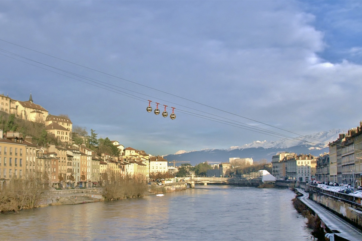
Is it possible to have details on the project of the second cable car? What is the route and what are the planned stops?
The route of the metro cable is available for download in the 0-New_Docs_After_Launch file of the complete site folder: FR-GRENOBLE-SS-M12
The Metro cable is planned to cross the two rivers (the Drac and the Isère) at the level of the scientific polygon, linking Fontaine to Saint-Martin le Vinoux. The closest station to the Bastille site is the terminus stop at the Saint-Martin le Vinoux town hall.
What is the status of future projects: bivouac area, ecopatterning, installation of a wine grower, mikado project, etc.: are the projects completed and in progress?
- Bivouac area: for spring 2022 (test on the summit site within the framework of Green Capital).
- Eco-pasture is an action which exists and continues on the bastille, eastern flank (Cf docs FR-GRENOBLE-PS-M3 to M21, available for download in the file 0-New_Docs_After_Launch, of the complete site folder).
- No installation of a grape grower to date and no immediate plans. Beware, as vineyards can accentuate landslides or mudslides.
- The Mikado project is underway: development of the confluence point and the green corridor at the level of Saint-Martin le Vinoux, lower part. The park does not continue to this day on the western slope of the bastille.
The drinking water supply for the Rabot and the IGA is managed by the CROUS via a water tower: in the context of the "Babel Community" project, how was this problem solved?
To date, the CROUS has given Babel Community permission to connect to their network. Within the framework of the partnership work in progress, there is a possibility that the Metropolis will take over the ownership and management of Maurice Gignoux Street (currently still owned by the State) and resurface the street and its networks.
Could we have a vector map of the ramparts?
The documents are available for download in the file 0-New_Docs_After_Launch, of the complete site folder :
- Bastille, topography, networks : FR-GRENOBLE-SS-M5
These files require the signature of an agreement between the City of Grenoble and the candidates. To draw up the agreement, please contact Laura HOURY, laura.houry@grenoble.fr, tel: +33 (0)4 76 76 33 54.
- Plans and maps of the Bastille site: FR-GRENOBLE-SS-M6 to M11
Could we have more elements concerning the topography? (Surveyor's plan, vectorial level curve...)
The documents are available for download in the file 0-New_Docs_After_Launch, of the complete site folder :
- Bastille, topography, networks : FR-GRENOBLE-SS-M5
These files require the signature of an agreement between the City of Grenoble and the candidates. To draw up the agreement, please contact Laura HOURY, laura.houry@grenoble.fr, tel: +33 (0)4 76 76 33 54.
- Plans and maps of the Bastille site: FR-GRENOBLE-SS-M6 to M11
Are there any plans of the existing buildings in the Rabot area?
Plans, sections, facades and networks of most of the buildings on the site (Cité Rabot), are available for download in the folder 0-New_Docs_After_Lauch, of the complete site folder :
. FR-GRENOBLE-PS-M3 to M21
. Plan Rabot Gymnasium : FR-GRENOBLE-PS-M11 TO M21
Can we know the precise program of the Babel Community?
The document "Presentation Babel Community" is available for download in the file 0-New_Docs_After_Launch, of the complete site folder : FR-GRENOBLE-T10
Transformation and rehabilitation of the Dolomieu Institute into a business and tourism residence "The Babel Community":
- 137 accommodation units
- coworking spaces
- a bar-restaurant
- a fitness area
- meeting rooms
- ancillary premises (technical premises, two-wheelers, household waste, etc.)
Finished surfaces: 6005 m² of hotel accommodation + 481 m² of offices
Building on 6 levels. Creation of roof extensions
Can we have DWG documents and building plans? As well as a topographic survey?
Plans, sections, facades and networks of most of the buildings on the site (Cité Rabot), are available for download in the folder 0-New_Docs_After_Lauch, of the complete site folder :
. FR-GRENOBLE-PS-M3 to M21
. Plan Rabot Gymnasium : FR-GRENOBLE-PS-M11 TO M21
Why is the door to the passage between Promenade des Remparts and the Rabot site closed? (door N°91 : access to the Remparts terrace)
The Cité du Rabot is currently private property of the State, managed by the CROUS. For the tranquility of its occupants, the site is closed. Therefore, door 91 is closed for ease of management of the site to date and for the tranquility of the residents.
Is it unthinkable to keep CROUS housing despite the move? How will the transition to the next CROUS work?
Although this is not the institution's request, there is nothing to prevent a project proposing to maintain Crous housing at Le Rabot.
The 500 places will be reconstituted within the Saint-Martin d'Hères campus and, in fact, the volume taken away will be covered by another location.
History of the second IGA building / what happened there? Was it always privately managed? Why didn't the private project work out?
After the University was defunded, the State sold the property to a private developer to carry out his project. This elderly promoter is now passed away and his descendants wish to sell. Various offers to purchase have been made, but none has resulted in the signing of a sales contract, as there is no agreement on the resale price. The steps are underway and we hope that they will be completed soon.
Is there a diagnosis of the sanitary and structural state of the CROUS buildings?
No current diagnosis of the sanitary or structural condition of the buildings to be transmitted.
A heritage study is expected to be launched this fall for an April 2022 delivery.
Is there a more precise program for the Vicat site? (Esplanade project)
No. Initial discussions took place at the beginning of the Esplanade New Generation project (2015) but then stopped without any concrete results. Vicat does not see this site as a priority at this time. Discussions need to be relaunched.
Can we have elements such as "archive images" concerning the periods before the Rabot Cité Universitaire? Is there an iconography of the site? Information on the materials of the period? (Place d'Armes)
We suggest you explore the photographic collection of the Musée Dauphinois, in particular the images taken by the geographer Raoul Blanchard: https://collections.isere.fr/fr/museum/page/photographies/0627651b-1c93-47c7-b229-84ad9f160035
This site is connected to the following theme
Recovery New energy has to be found for these sites through a treatment that respects the existing environment introducing specific elements and actions able to develop a resilient city.
Dynamizing Landscapes
These sites present a potential to develop a landscape that strongly animates new developments, granting them qualities in the sense of creating a living milieu, integrating rich biodiversity in the realm of public spaces.
Specific documents
/ ©
Questions on the site
You have to be connected –and therefore registered– to be able to ask a question.
Fr. 2 June 2023
Deadline for submitting questions
Fr. 16 June 2023
Deadline for answers
Before submitting a question, make sure it does not already appear in the FAQ.
Please ask questions on sites in the Sites section.
Please ask questions on rules in the Rules section.
If your question does not receive any answer in 10 days, check the FAQ to make sure the answer does not appear under another label or email the secretariat concerned by the question (national secretariat for the sites, European secretariat for the rules).